![]()
![]()
![]()
![]()
![]()
![]()
|
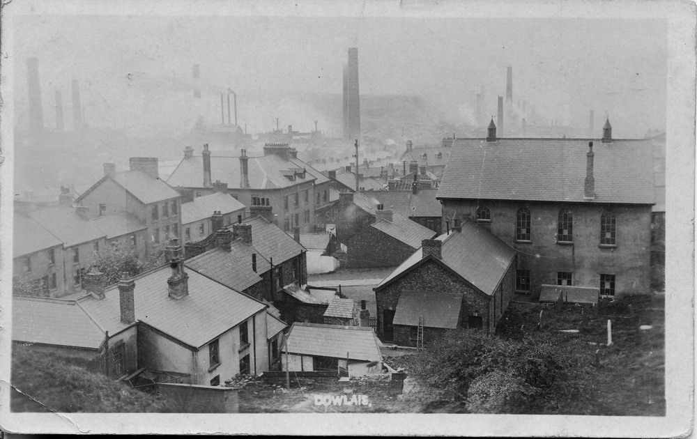
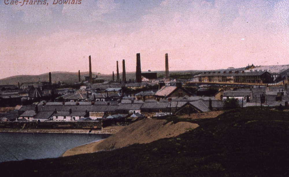
Dowlais |
|||||||||||||||||
|
Merthyr Tydfil |
|||||||||||||||||
|
<Click on the photograph to see a larger version> |
|||||||||||||||||
|
|||||||||||||||||
|
|||||||||||||||||
|
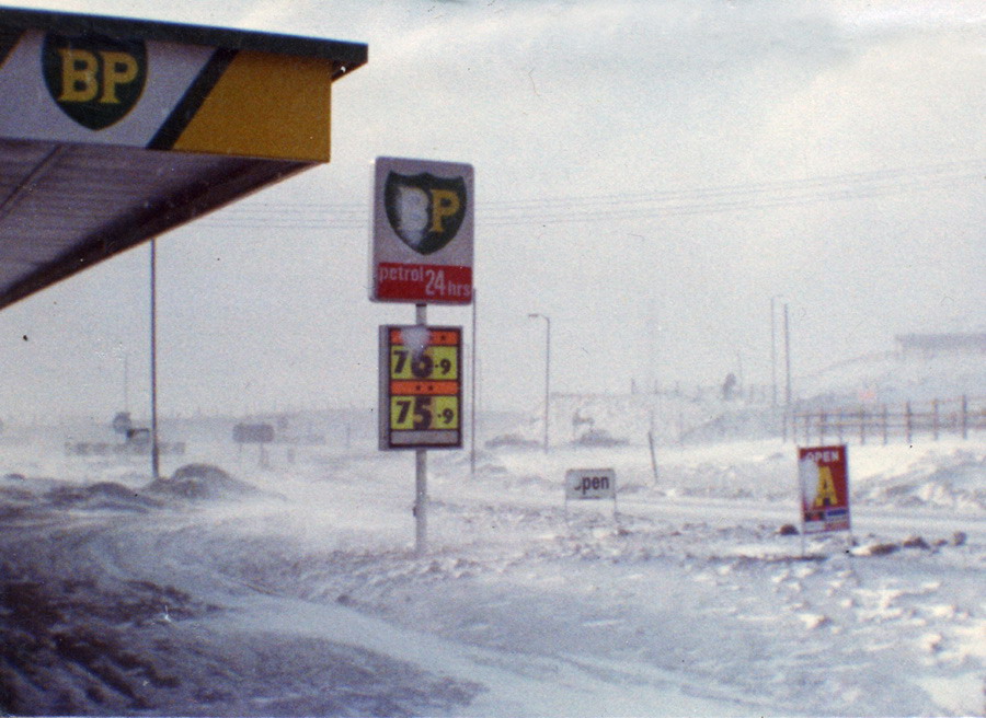
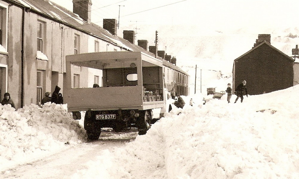
Dowlais Top - B.P. Petrol Station in the Snow - 1970's |
|||||||||||||||||
|
|
|||||||||||||||||
|
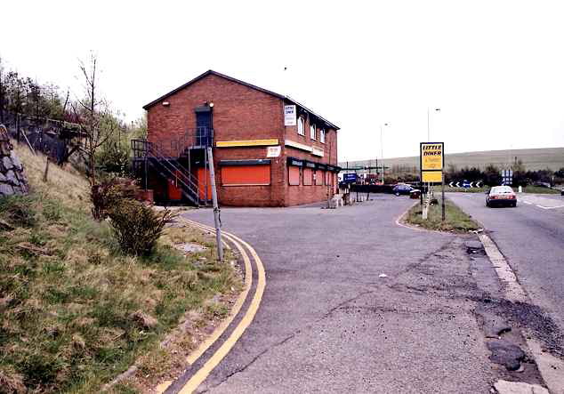
Little Diner - April 2002 Demolished to make way for A465 dualling. |
|||||||||||||||||
|
|
|||||||||||||||||
|
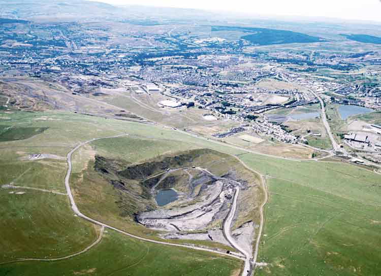
The biggest hole in Europe? This is a picture of the huge NCB 'Royal Arms' opencast coal site operated by Taylor Woodrow. It was taken in the second half of the 1970's. A century earlier the Dowlais Iron Company removed coal for their furnaces from the very same area. New engineering technology made it feasible to reach much lower seams than the Victorians could. This is not the same hole that has been used to dump hazardous materials in recent years. That location is at the top of the picture, yet to be developed by Taylor Woodrow. (Photograph Courtesy of Tom Hier) |
|||||||||||||||||
|
|
|||||||||||||||||
|
|
|||||||||||||||||
|
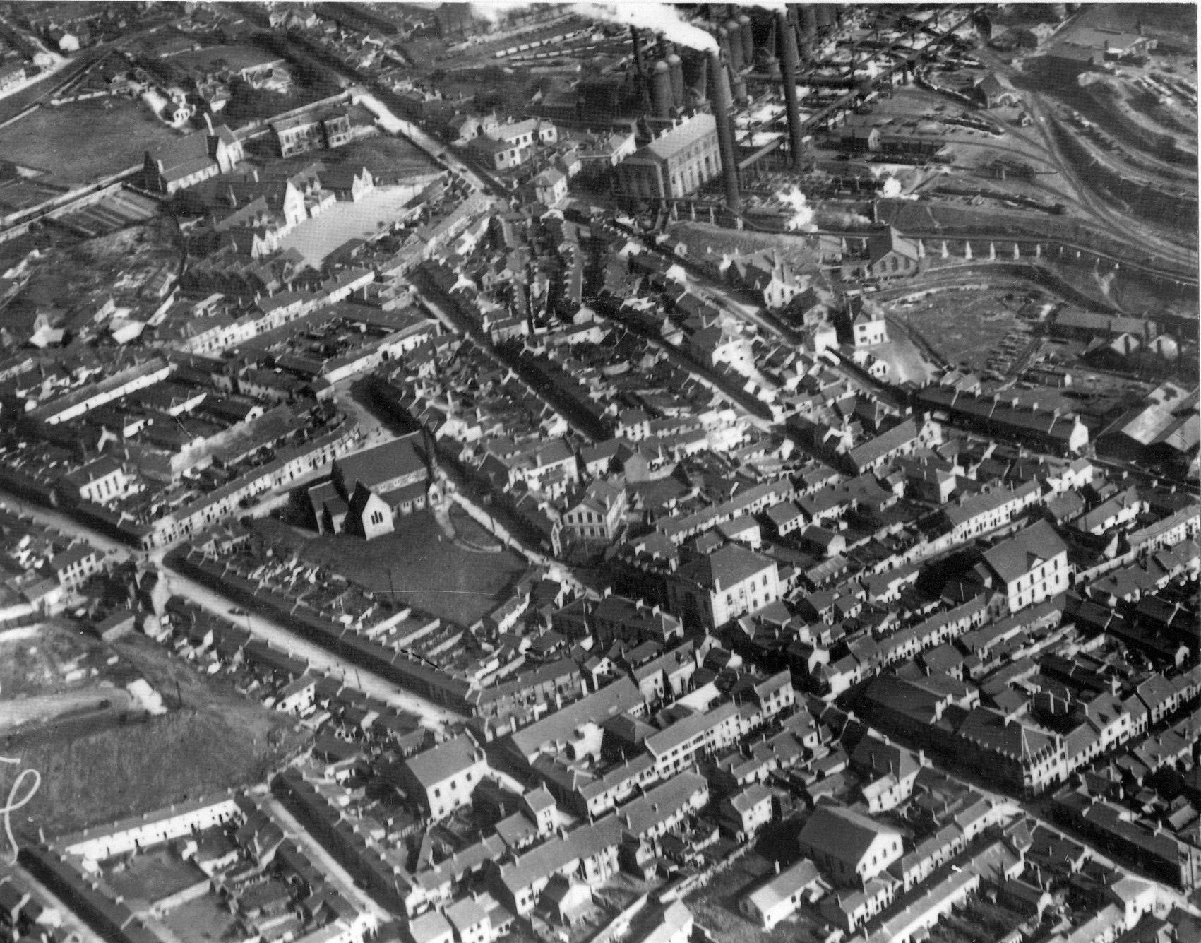
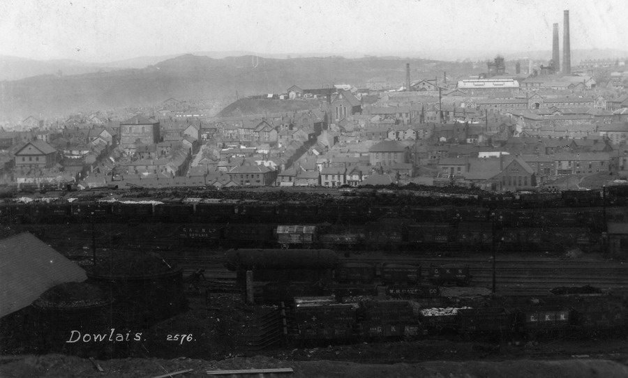
Aerial View Of Dowlais. (Photograph courtesy of Viv Bayliss of South Woodham Ferrers in Essex) |
|||||||||||||||||
|
|||||||||||||||||
|
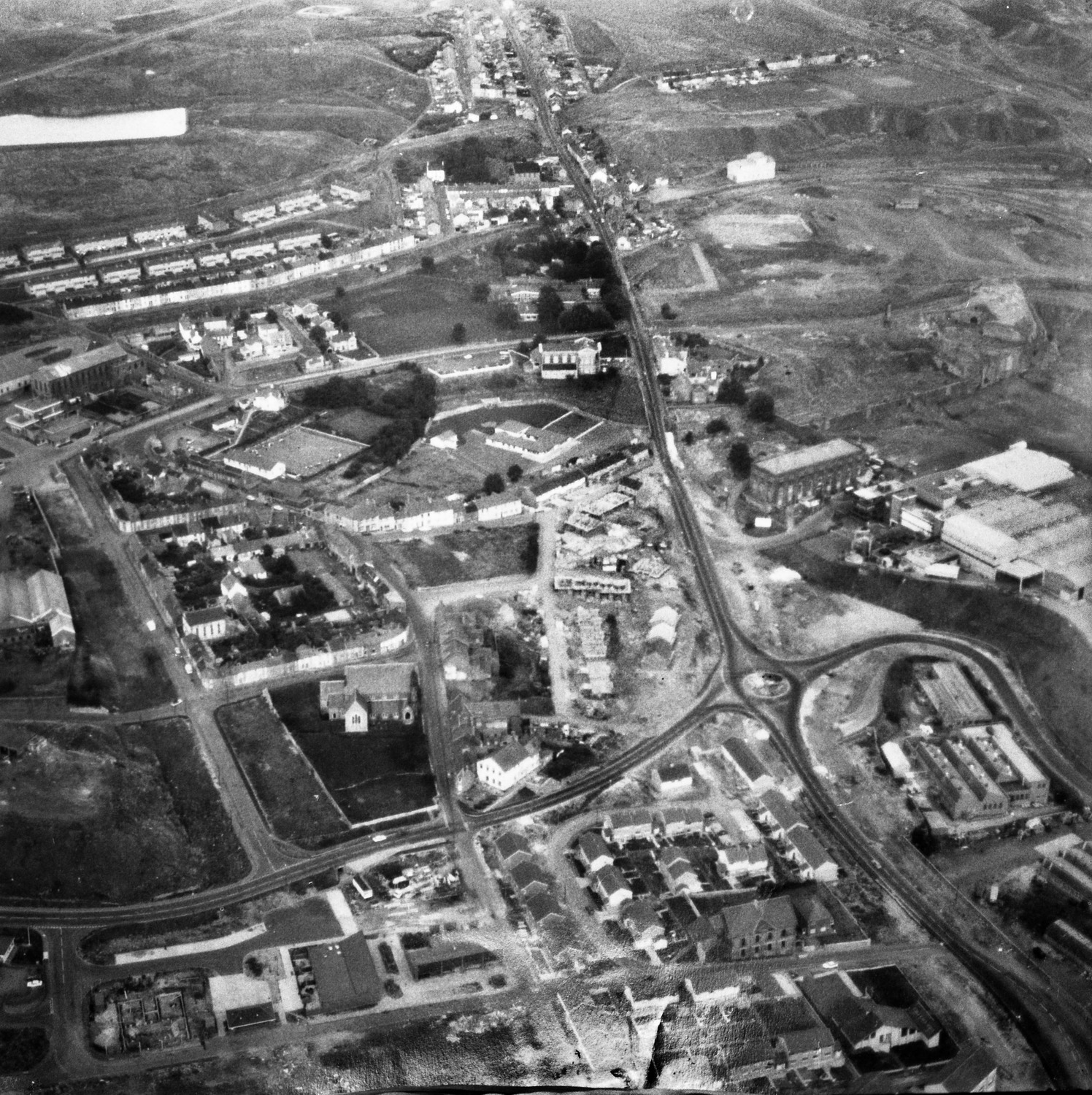
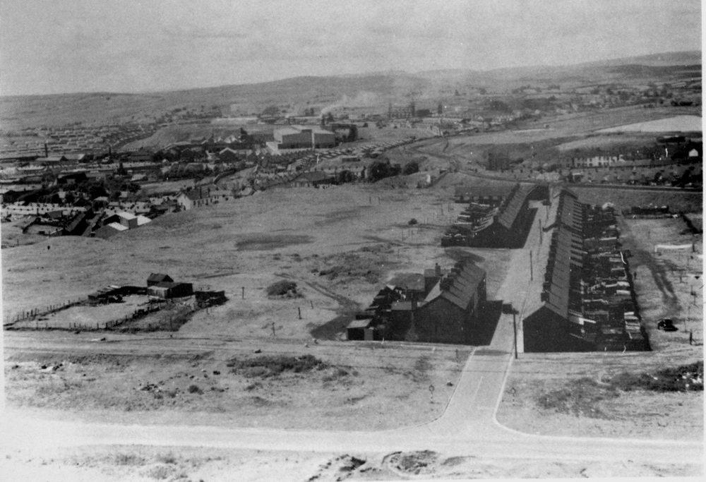
Dowlais - Aerial View During Redevelopment - Late 1970's |
|||||||||||||||||
|
|
|||||||||||||||||
|
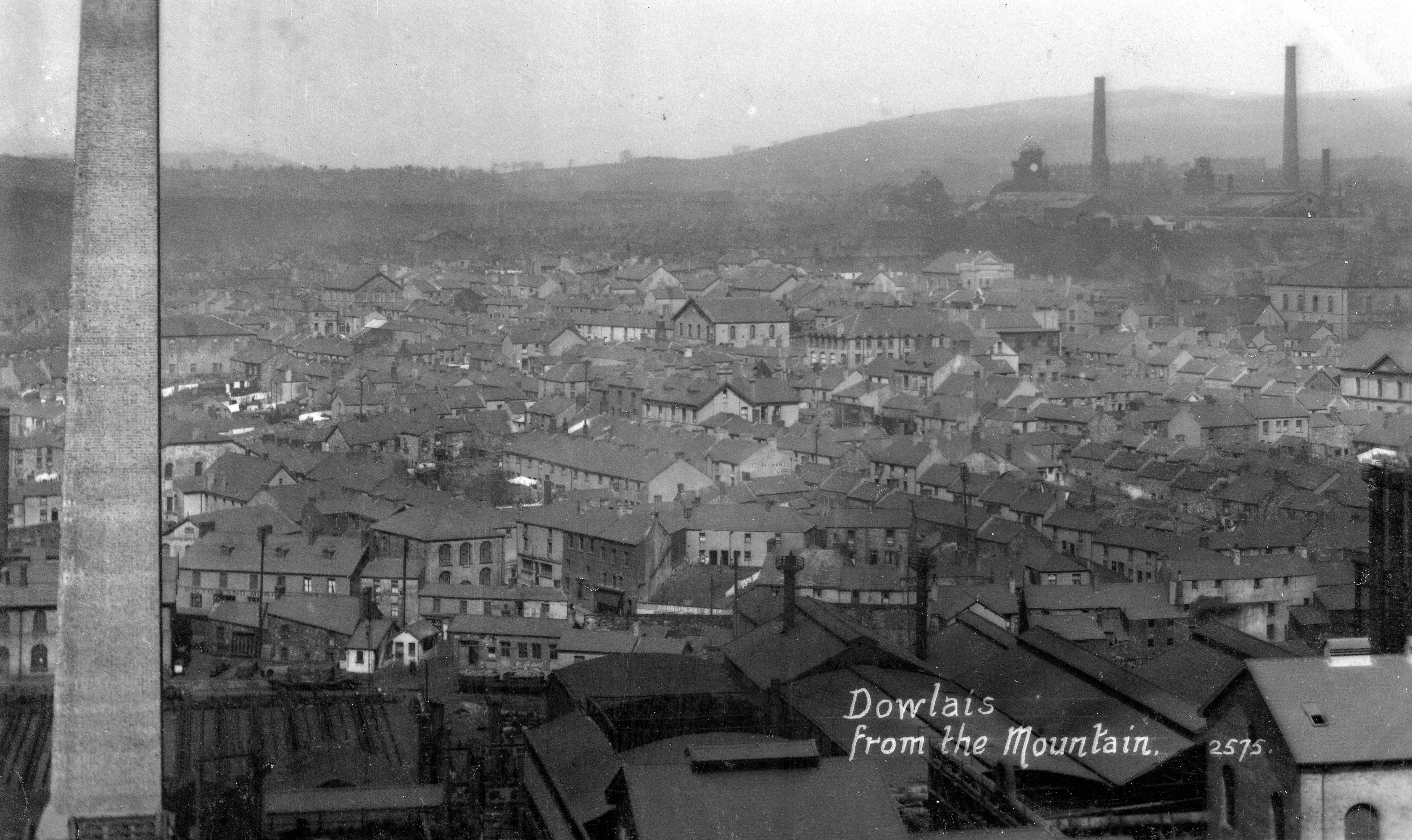
Dowlais from the Mountain |
|||||||||||||||||
|
|
|||||||||||||||||
|
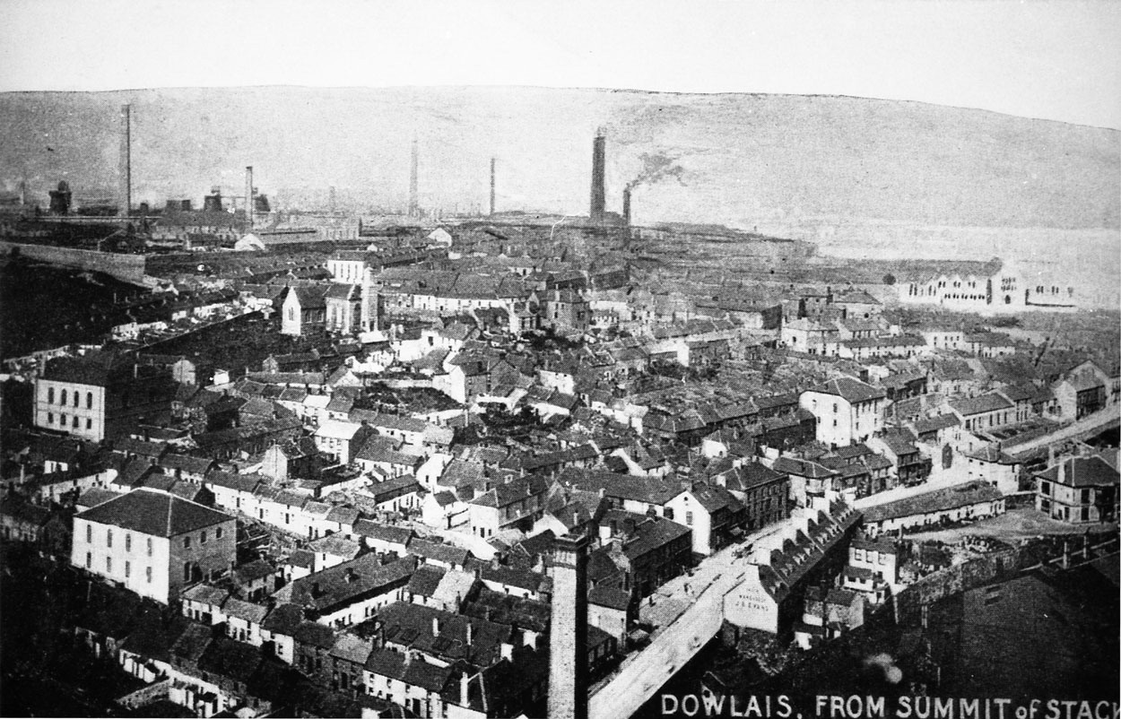
Dowlais From The Summit of the Stack This photograph from the late 1800's shows a early view of Dowlais, the library has yet to be built and you can see the original St. John's Church before it was rebuilt (see different spire). |
|||||||||||||||||
|
|
|||||||||||||||||
|
General View of Dowlais (Photograph Courtesy of Dave Lewis) |
|||||||||||||||||
|
|
|||||||||||||||||
|
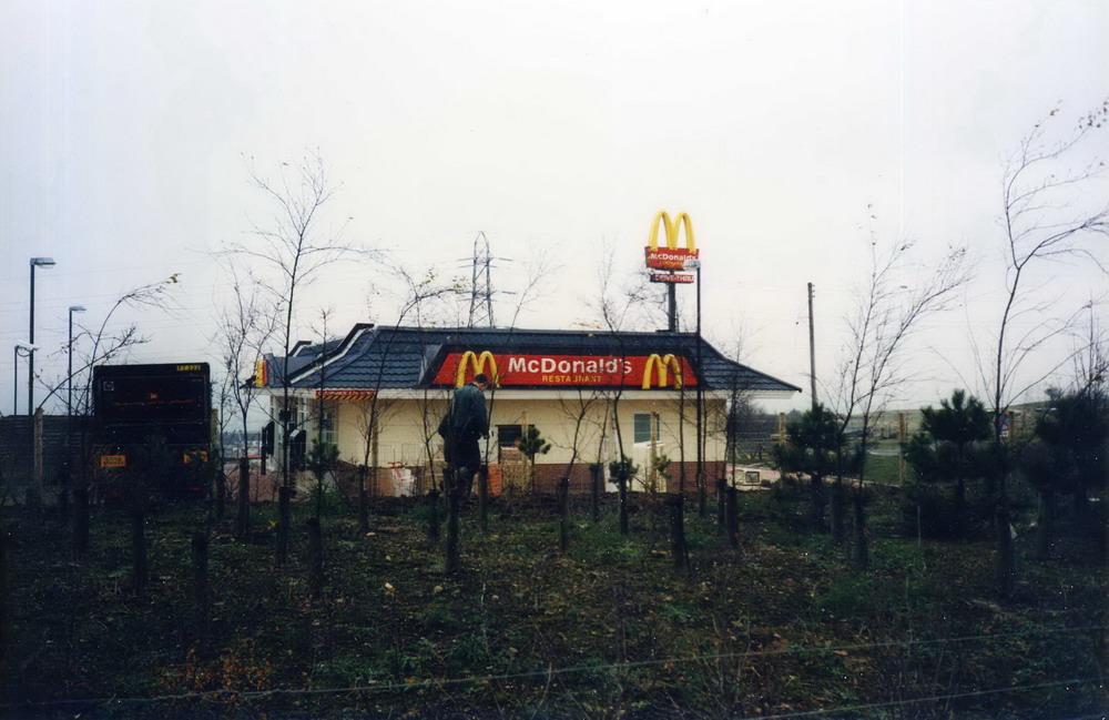
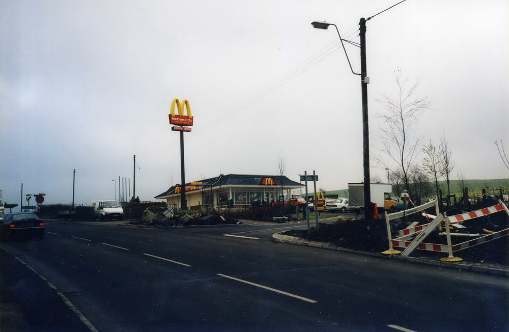
The Plas - Dowlais Top This is approximately the site of the former Dowlais Top McDonalds (See pic below). (Photographs Courtesy of Phillip Owens) |
|||||||||||||||||
|
|
|
||||||||||||||||
|
McDonalds Dowlais Top 1993 (Photographs Courtesy of the John Owen Collection) |
|||||||||||||||||
|
|||||||||||||||||
|
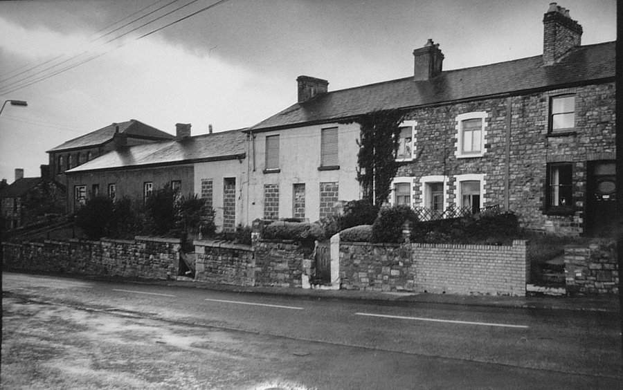
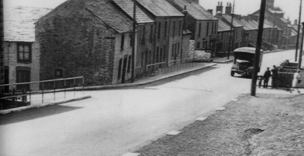
Dowlais Top 1953 |
|||||||||||||||||
|
|
|||||||||||||||||
|
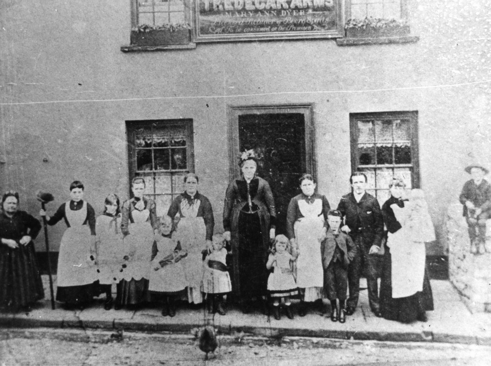
L-R: Unknown Maid, Unknown Maid, Beatrice James, Mary Ann Williams, Rachel Victoria Williams, Hephzibah Williams, Alfred James Williams, Mary Ann Dyer (Landlady), Rose James, Rebekah Matilda James, Berkley James, Kate Matthews, Baby - Harry Matthews & Gwilym Williams. (Photograph Courtesy of Gethyn Rees) |
|||||||||||||||||
|
|
|||||||||||||||||
|
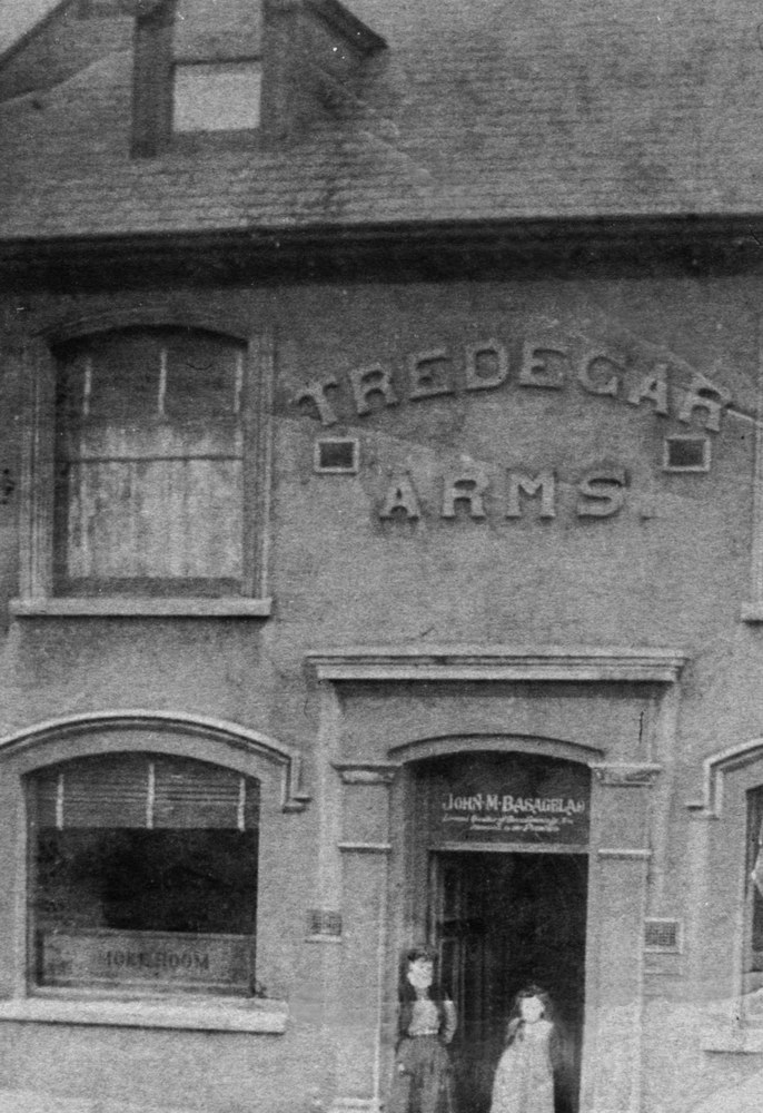
The Tredegar Arms, Dowlais Top The Tredegar Arms was being run by John Bassagaeleo at this time. L-R: Mary Ann Williams and Beatrice. (Information Courtesy of Gethyn Rees) |
|||||||||||||||||
|
|
|||||||||||||||||
|
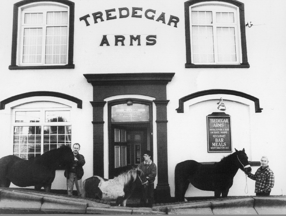
The Tredegar Arms in the 1990's on the Day of the Waun Fair Shown are licensee Steve Evans (now of the Rhymney Brewery, Dowlais), Paul Collins of Penywern and Another. |
|||||||||||||||||
|
|
|||||||||||||||||
|
Blaen Dowlais and the Works. |
|||||||||||||||||
|
|
Wintry Scenes in Blaen Dowlais - Mid 1960s (Courtesy of David Robins) |
||||||||||||||||
|
|
|||||||||||||||||
|
|
|||||||||||||||||
|
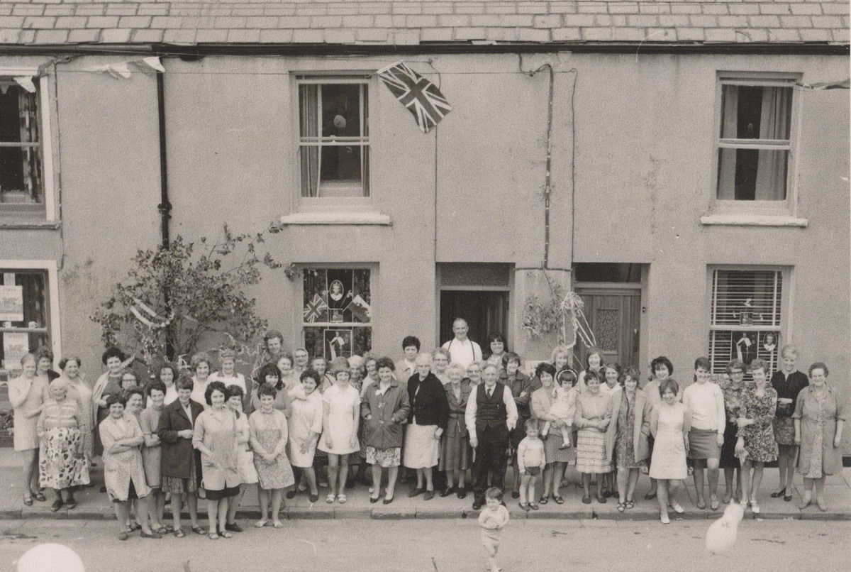
50 Residents of Blaen Dowlais hold a meeting to discuss the Prince Charles Investiture Party .The gentleman in the middle of the photo, standing outside his house, with a waistcoat is David Williams (Mayor of Merthyr around this time) together with members of his family.
L-R :- Brenda Harris, Mrs Harris, Mrs Rachel Owens, Mrs Davies, ?, ?, ?, ?, ?, ?, ?, ?, ?, ?, Cynthia Davies, ?, Janice ?, ?, ?, ?, ?, ?, Maureen Foley, Mrs Mary Jane Robins, ?, Mrs Betty Foley, ?, Mrs Betty Huws, ?, Mrs Powell, Mr Thomas (Father of Raymond Thomas - Merthyr Mayor c1995), Mrs Harris, Mr David J Williams (Mayor of Merthyr c1970), ?, Mairwen, ?, ?, ?, ?, ?, ?, ?, ?, Mrs Nancy Davenport, Nesta Davenport, ?, ?, ?, Carol Sinnet, Rene Sinnet
(Photograph Courtesy of David Robins) |
|||||||||||||||||
|
|
|||||||||||||||||
|
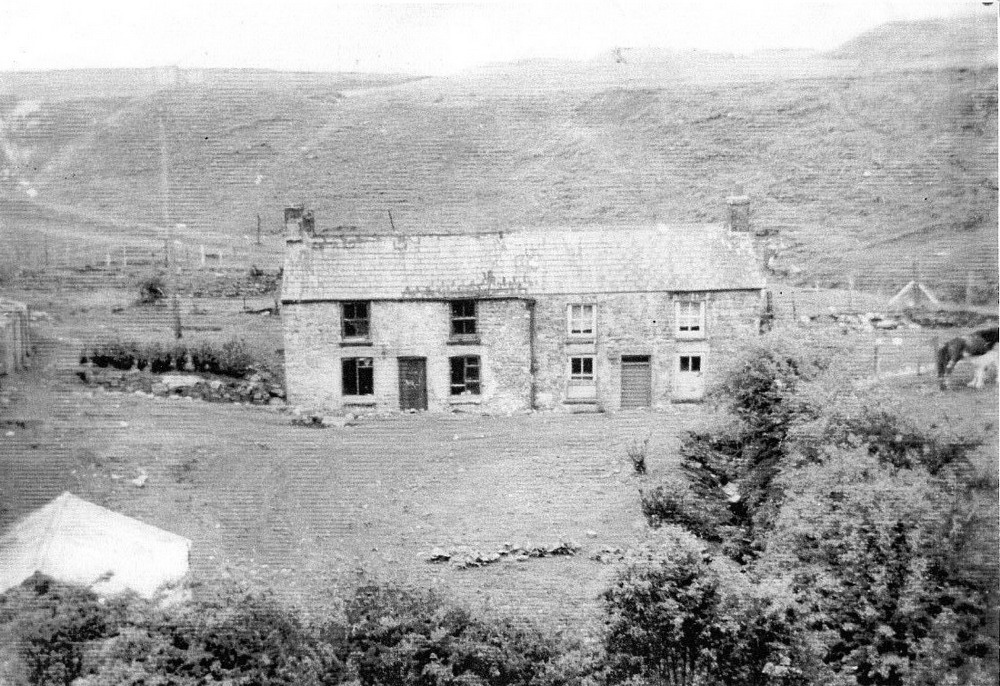
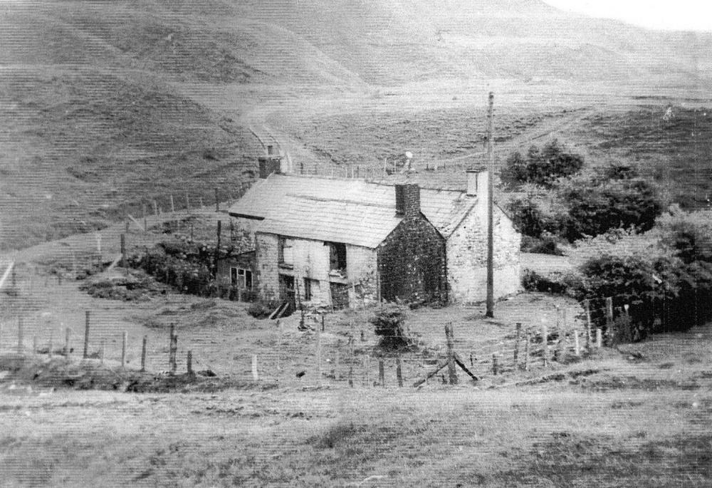
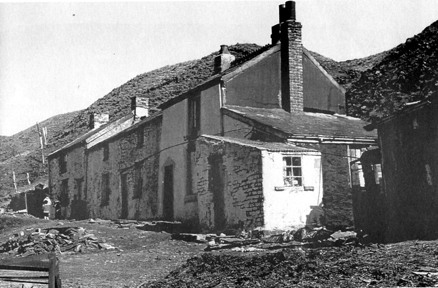
Trecatti. Just a row of cottages up on the mountain overlooking Blaen Dowlais. No services or amenities, very inhospitable but home some families up to the 1970's. |
|||||||||||||||||
|
|||||||||||||||||
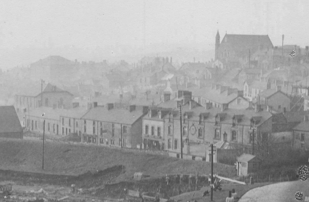
|
View of Dowlais from the Dowlais High Street Station |
|||||||||||||||||
|
|
|||||||||||||||||
|
Taken from the parapet of the LNWR Bridge on 20th June 1970 (Photograph Courtesy of David Beilby) |
|||||||||||||||||
|
|
|||||||||||||||||
|
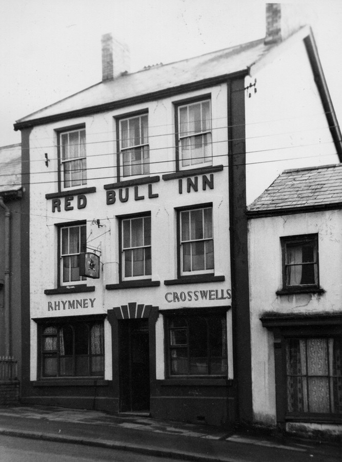
Caeharris, taken from High Street Station On the right is Hebron Chapel. In the middle of the picture is The Antelope Hotel and to the left is the Red Bull Inn. |
|||||||||||||||||
|
|
|||||||||||||||||
|
Train entering Dowlais High Street Station, 1948 (Photograph Courtesy of the John Owen Collection) |
|||||||||||||||||
|
|
|||||||||||||||||
|
|
|||||||||||||||||
|
Red Bull Inn |
|||||||||||||||||
|
|
|||||||||||||||||
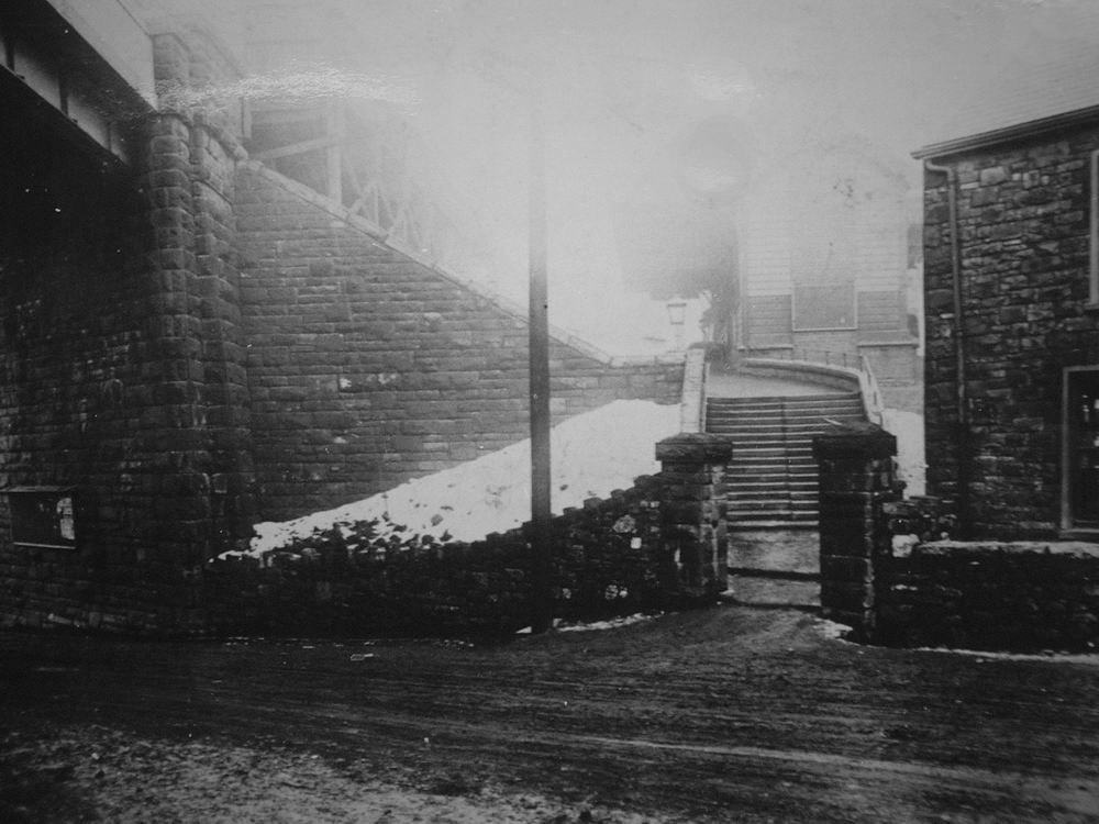
|
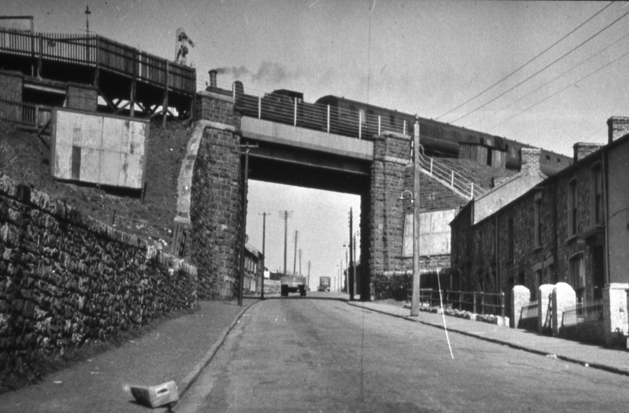
The Entrance to Dowlais High Street Station (LNWR) |
|||||||||||||||||
|
|
Go to Dowlais High St Station.
|
||||||||||||||||
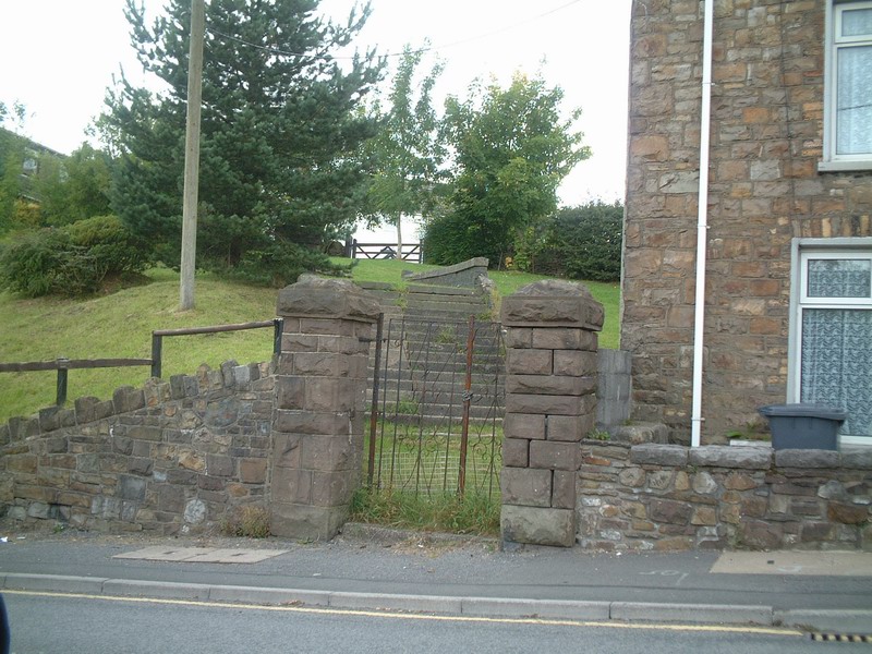
|
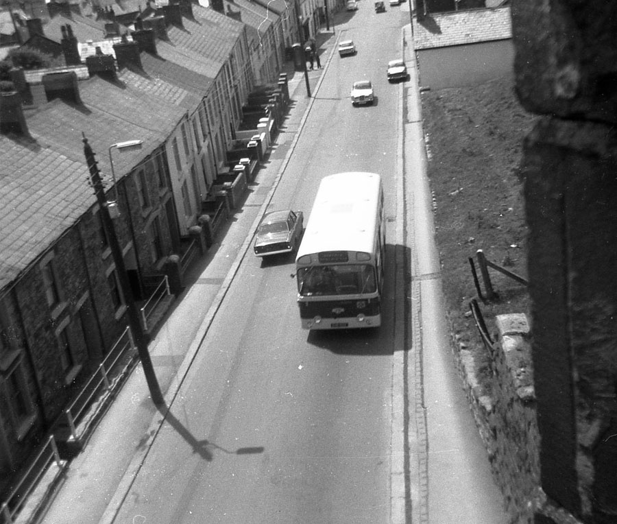
The same scene in 2002 |
|||||||||||||||||
|
|
|||||||||||||||||
|
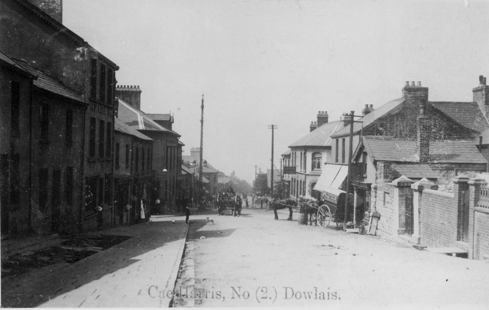
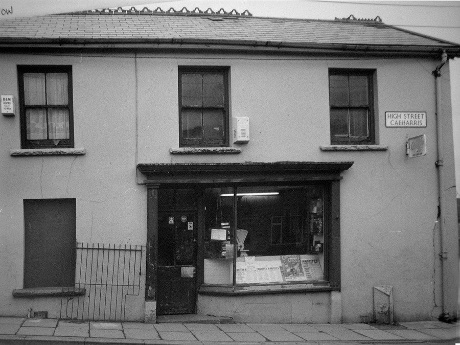
Caeharris High Street |
|||||||||||||||||
|
|
|||||||||||||||||
Caeharris, High Street showing The Antelope on the right hand, and in the distance the bridge to the Dowlais High Street LNWR Station. |
|||||||||||||||||
|
|
|||||||||||||||||
|
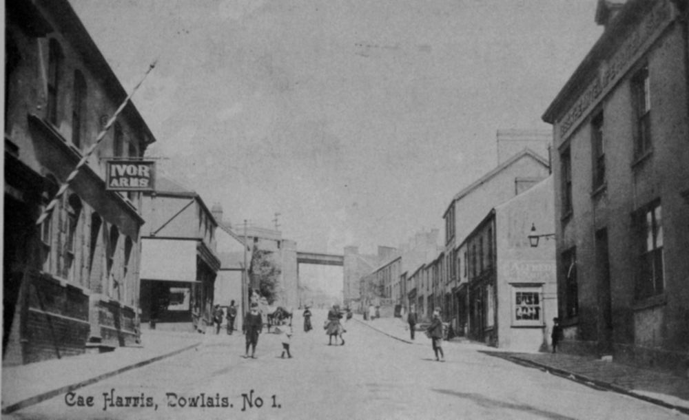
Cae Harris - A similar view as above, only a few years earlier (Photograph courtesy of Pete Noyce) |
|||||||||||||||||
|
|
|||||||||||||||||
|
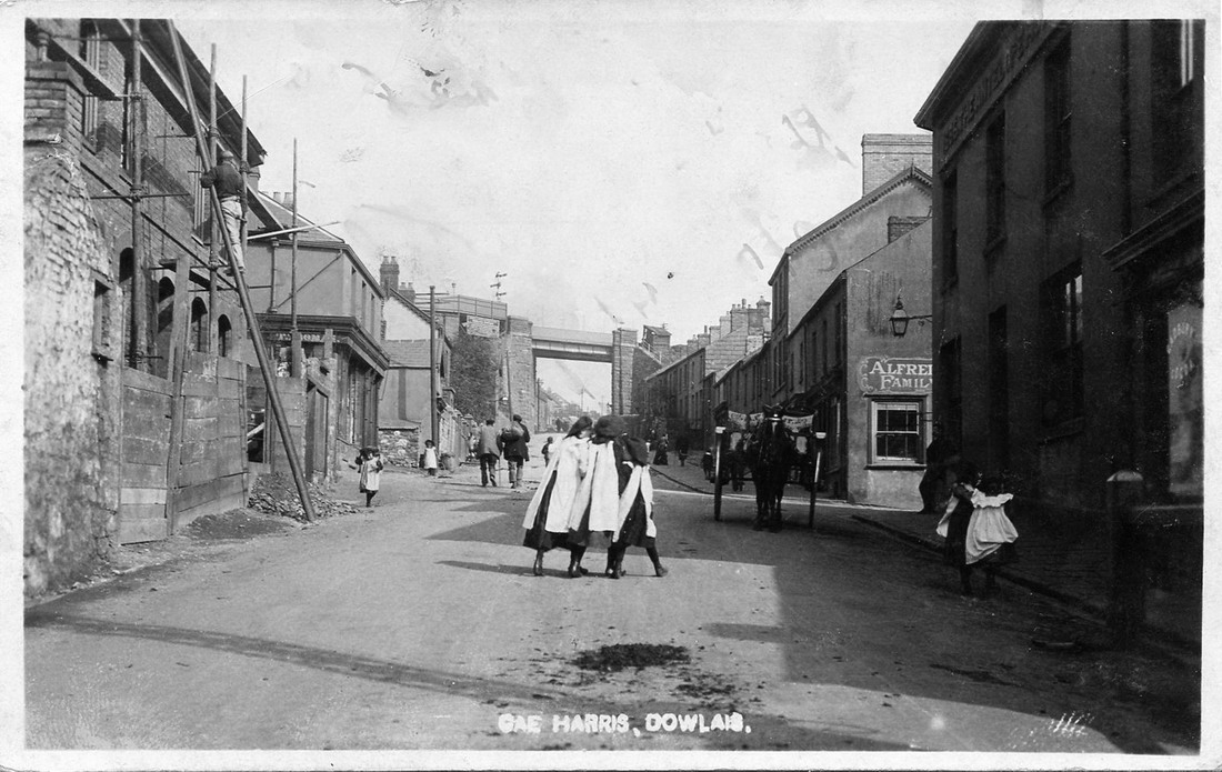
Caeharris - Again, similar to the above two photographs, only taken in the 1960's |
|||||||||||||||||
|
|
|||||||||||||||||
|
Caeharris Pond Situated just above Dowlais House. The water was used for the iron making process. The Ifor Works is in the distance, with Muriel Terrace to the right of it. |
|||||||||||||||||
|
|
|||||||||||||||||
|
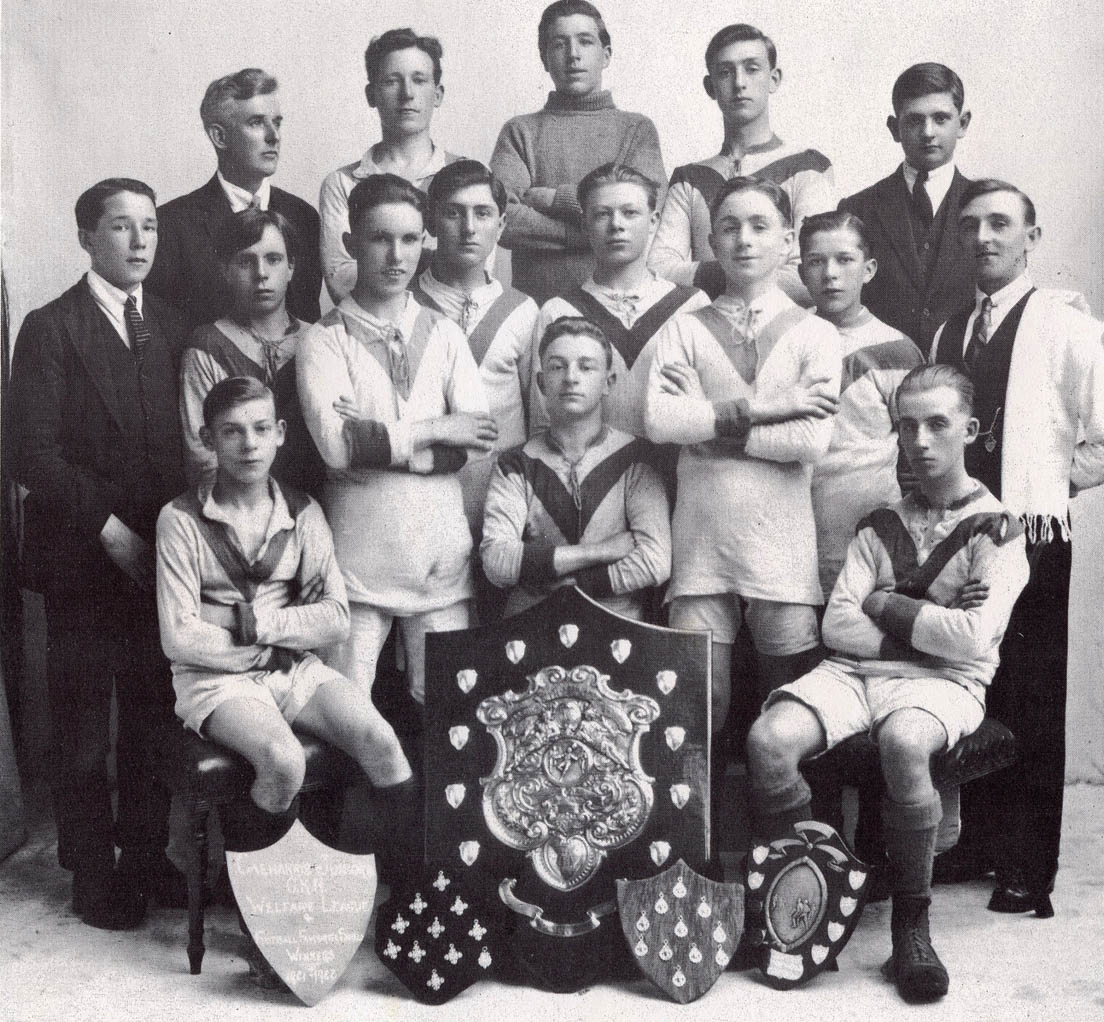
Dowlais Caeharris Juniors Football Team - 1921-22 |
|||||||||||||||||
|
|
|||||||||||||||||
|
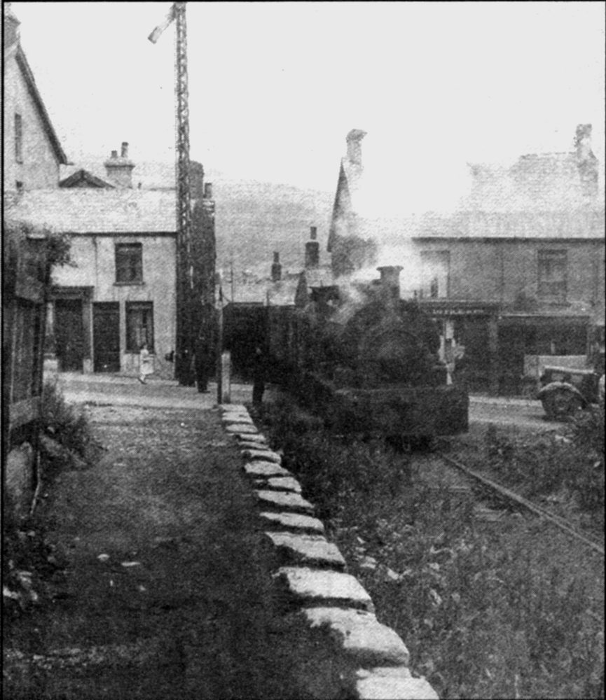
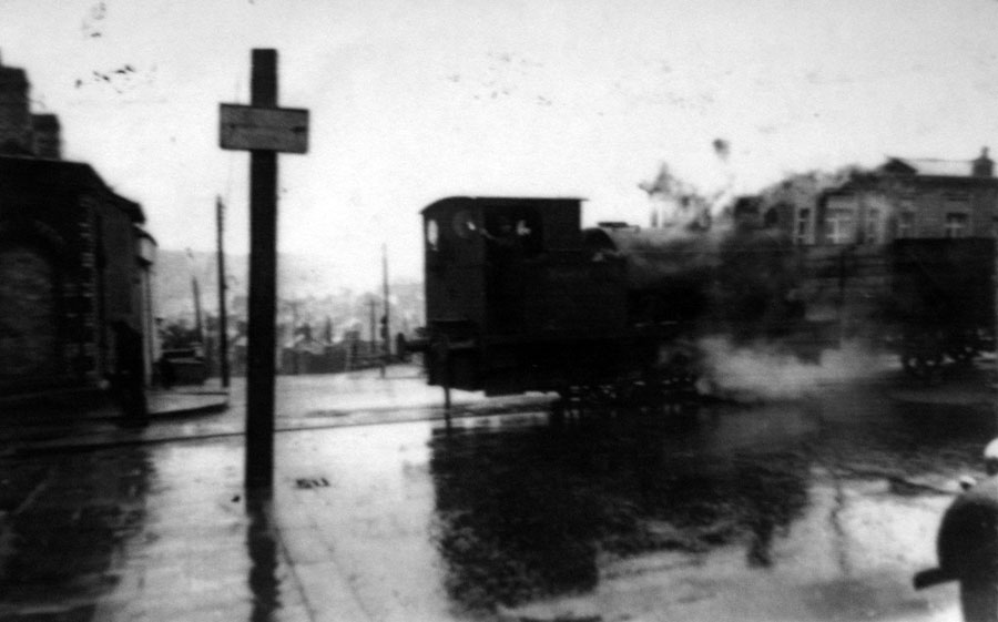
G.K.N. Train pulled by engine 'Gower' crossing the High Street |
|||||||||||||||||
|
|||||||||||||||||
|
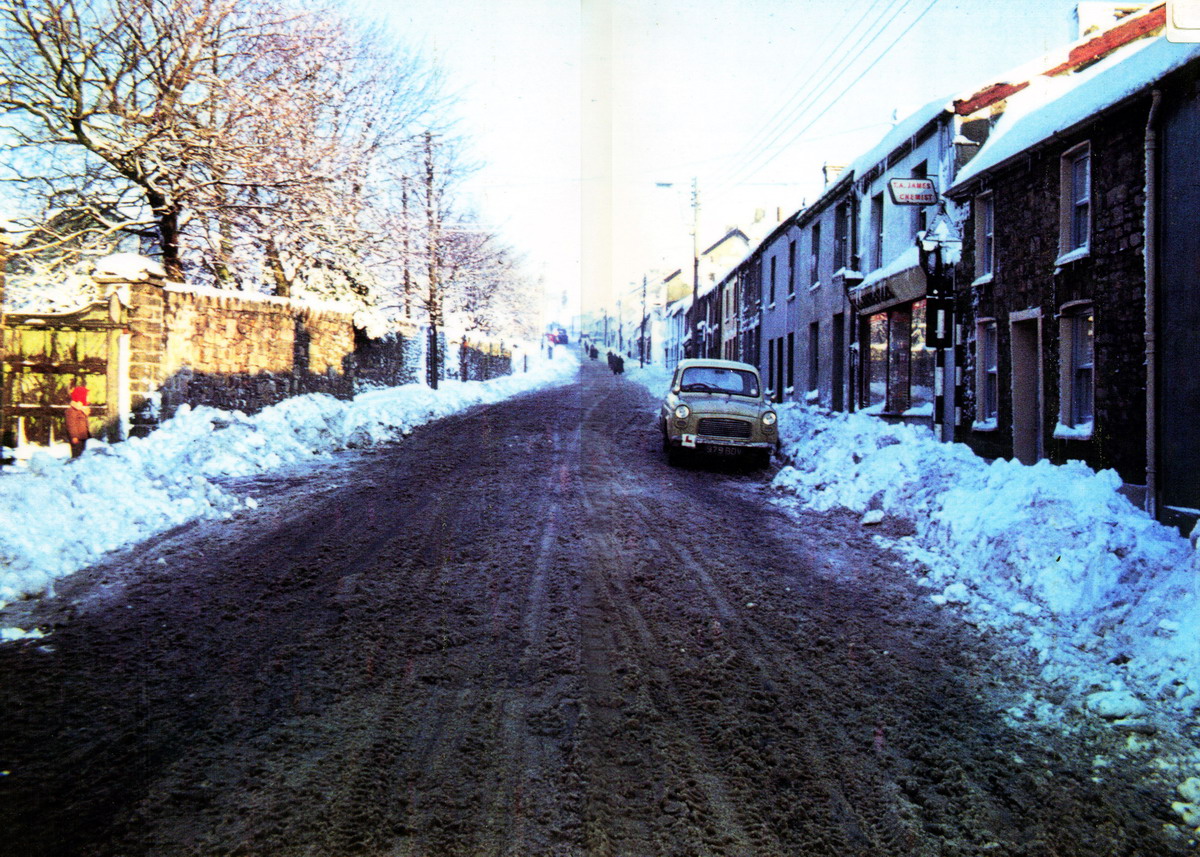
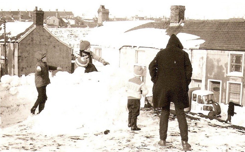
Caeharris, Dowlais in the Snow - 1964 (Photograph Courtesy of the John Owen Collection) |
|||||||||||||||||
|
|
|||||||||||||||||
|
|
|||||||||||||||||
|
Gwernllwyn House |
|||||||||||||||||
|
|
|||||||||||||||||
|
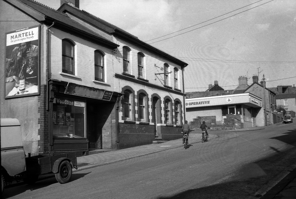
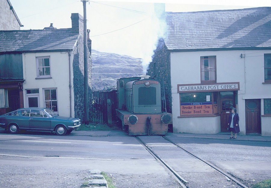
Caeharris Post Office - 1970's c. |
|||||||||||||||||
|
|
|||||||||||||||||
|
|
|||||||||||||||||
|
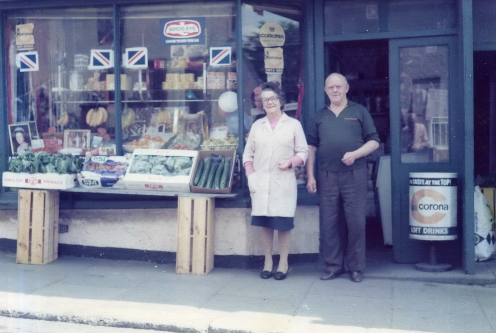
High Street, Caeharris_'Nelliies' shop, with Nellie & Dai Evans on the doorstep. (Photograph courtesy of Wendy & Colin Evans) |
|||||||||||||||||
|
|
|||||||||||||||||
|
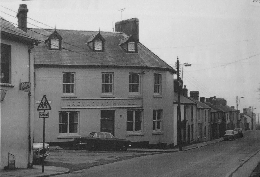
The Greyhound Hotel, Dowlais |
|||||||||||||||||
|
|||||||||||||||||
|
|
|||||||||||||||||
|
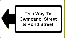
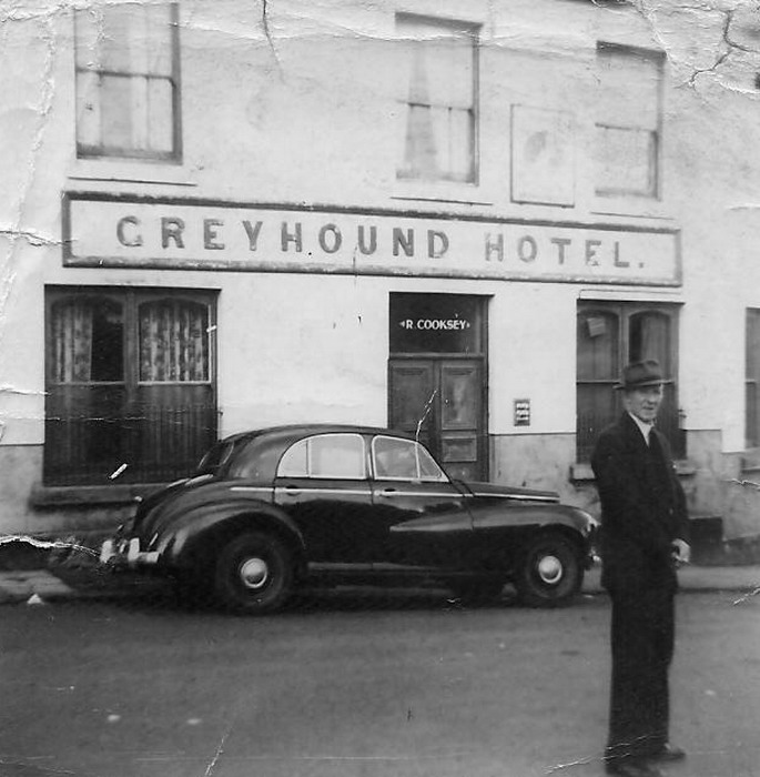
The Greyhound Hotel - Cwm Canol Street, Dowlais (Photograph Courtesy of Huw Williams) |
|||||||||||||||||
|
|
|||||||||||||||||
|
GKN Train crossing the High Street at the top of Doctor's Pitch. |
|||||||||||||||||
|
|||||||||||||||||
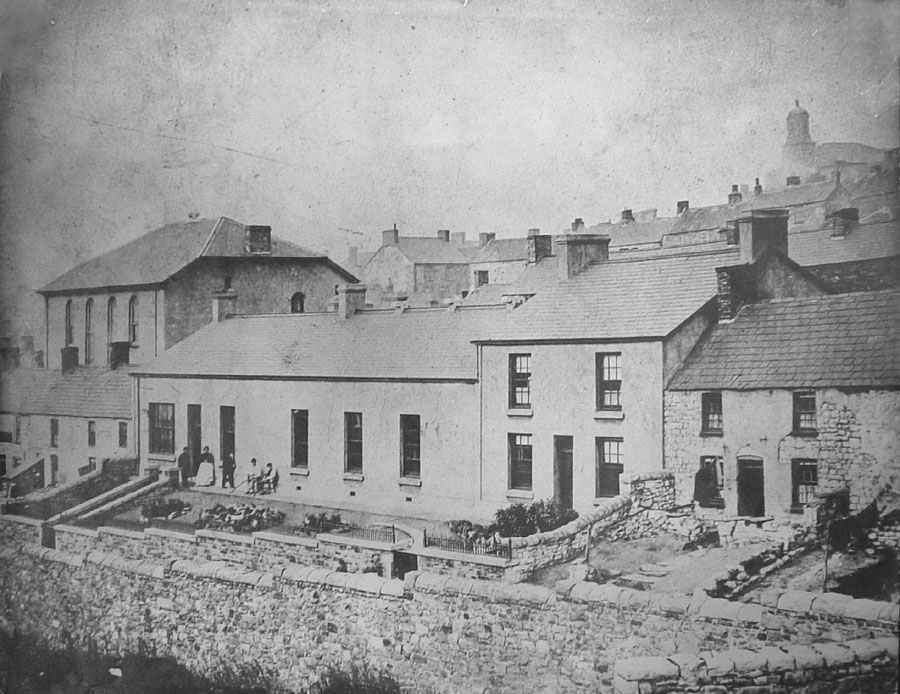
|
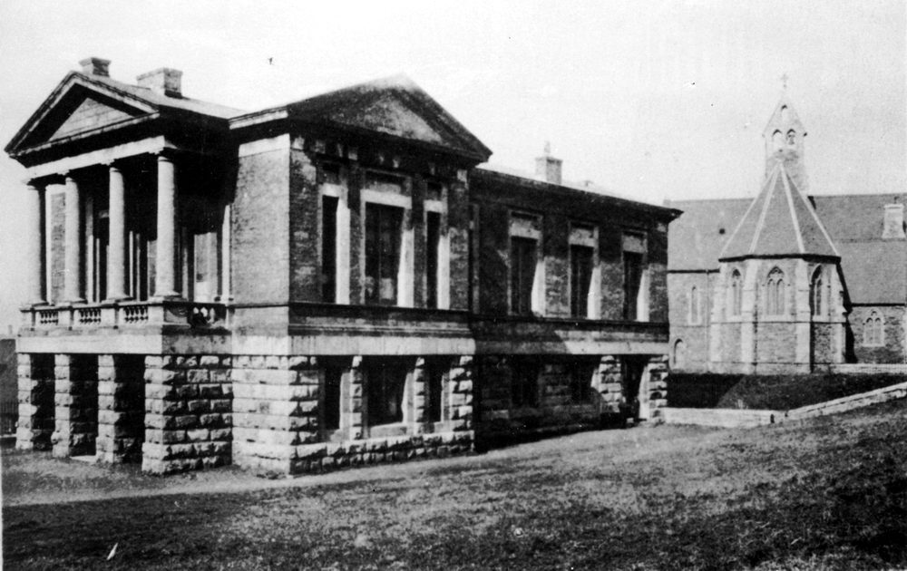
Originally The Library, built by Lady Charlotte Guest, later to become the Guest Club, and in the background St Mair's Church. |
|||||||||||||||||
|
|||||||||||||||||
|
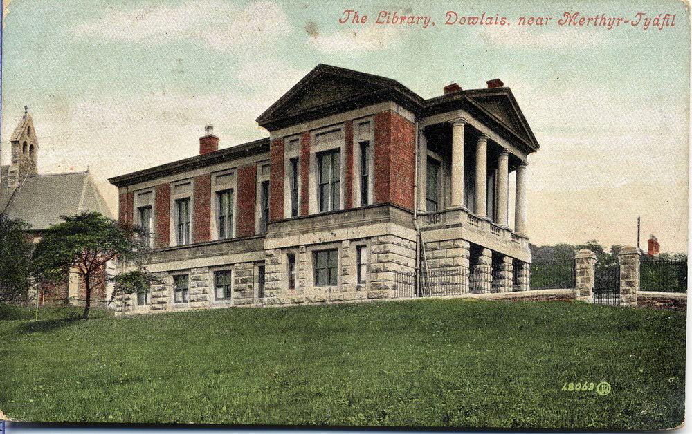
The Library |
|||||||||||||||||
|
|
|||||||||||||||||
|
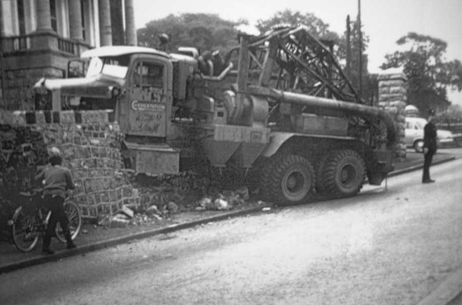
An Accident involving a Cementation Drilling Rig, probably used during the construction of the 'Heads of the Valley' road, outside the Guest Club in the 1960's. |
|||||||||||||||||
|
|
|||||||||||||||||
|
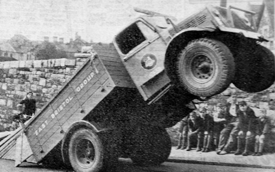
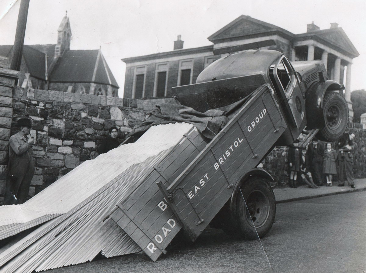
Another Nasty Accident - A British Road Services (Probably Ex-Dowlais Motor Services) Lorry's , load slid back, during a gear changedown to first, causing it to tip back, on Doctor's pitch |
|||||||||||||||||
|
|
|||||||||||||||||
|
The Same Dramatic 'Tip-Up' as Above - 1950's (Photograph Courtesy of David Evans) |
|||||||||||||||||
|
|
|||||||||||||||||
|
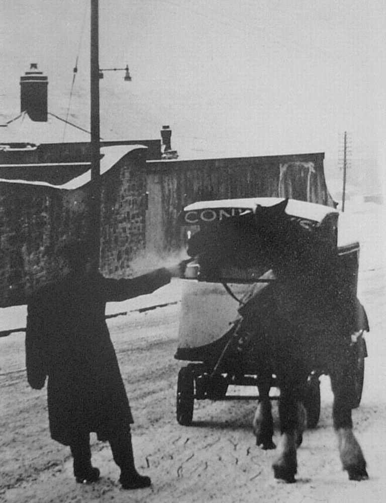
Doctors Pitch. Conways horse being revived with a nice cup of hot tea |
|||||||||||||||||
|
|
|||||||||||||||||
|
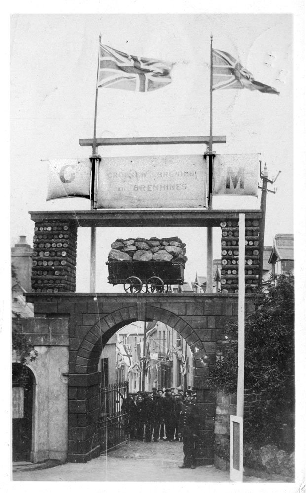
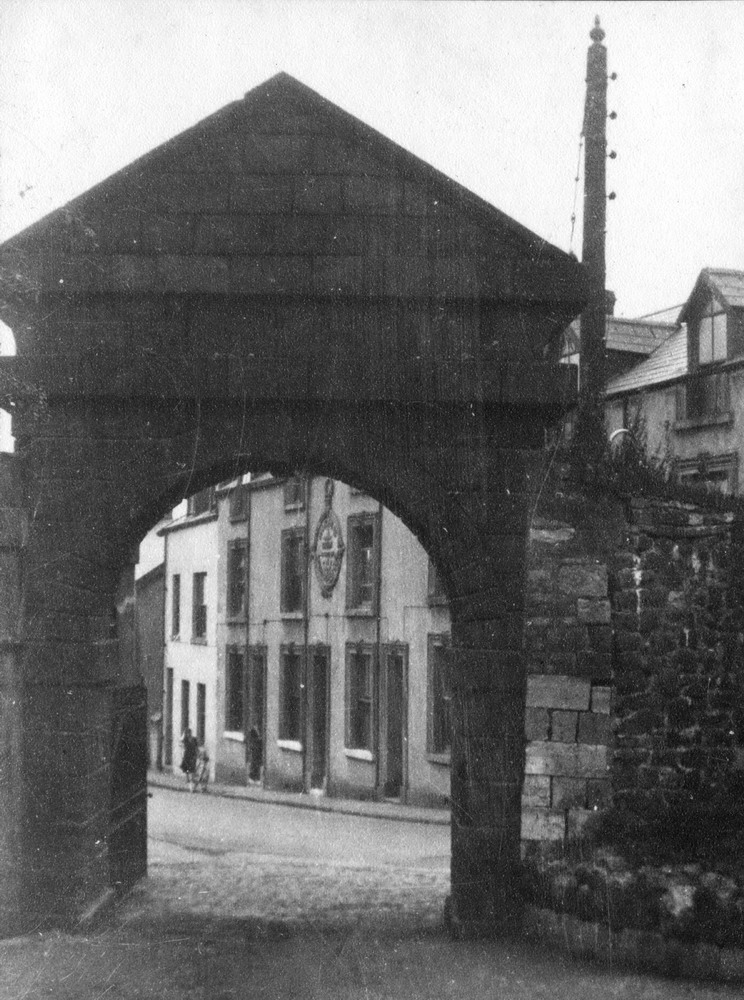
The Coal Arch Built at the Entrance to Dowlais House in 1912 for the Royal Visit
|
|||||||||||||||||
|
|
|
||||||||||||||||
|
|
|||||||||||||||||
|
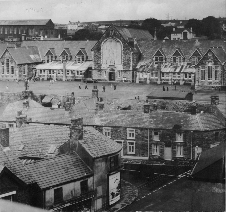
Dowlais Central School. |
|||||||||||||||||
|
|||||||||||||||||
|
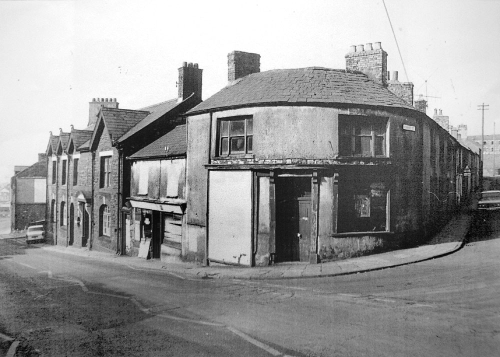
High Street at the junction with Market Street, in the 1960's |
|||||||||||||||||
|
|||||||||||||||||
|
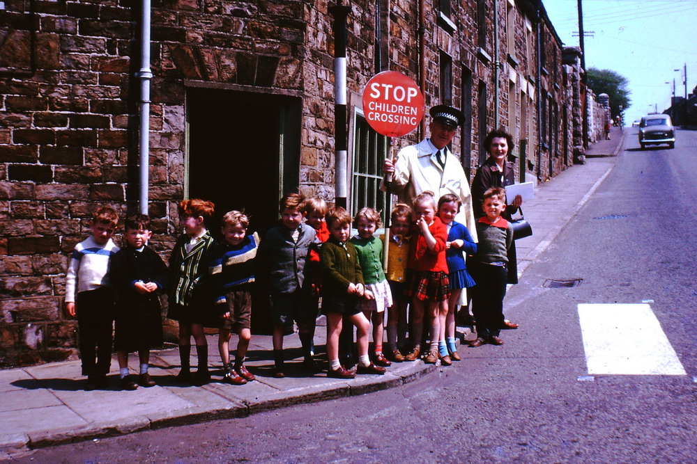
Doctor's Pitch, the Zebra Crossing at the junction with Market Street - early 1960s. Caeharris and Dowlais Top children on their way home from Dowlais Junior School wait at the Zebra crossing. Mrs Gene Robins, extreme right with her son David Robins in front of her, photograph taken by Ceinfryn Robins. (courtesy of David Robins) |
|||||||||||||||||
|
|
|||||||||||||||||
|
High Street, The Patriot Inn. - 1972 |
|||||||||||||||||
|
|
|||||||||||||||||
|
|
|||||||||||||||||
|
|||||||||||||||||
|
|
|||||||||||||||||
|
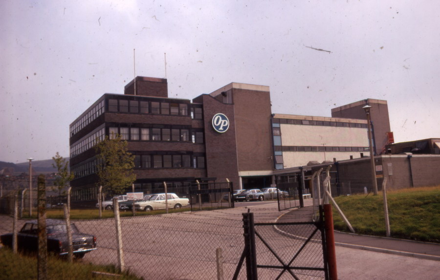
O.P. Chocolate Factory - 1970's. |
|||||||||||||||||
|
|
|||||||||||||||||
|
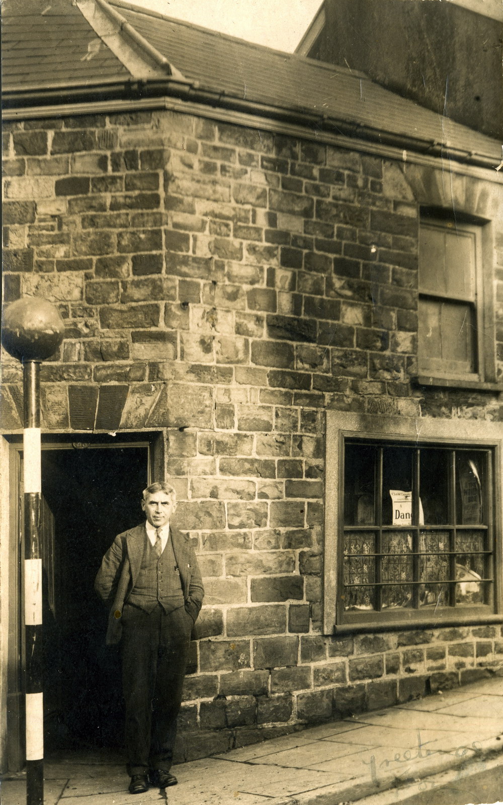
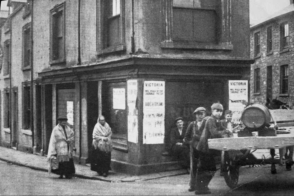
High Street, junction to Well Street. c1930s. "A pint of vinegar please!" Is this a picture of the good old days? |
|||||||||||||||||
|
|
|||||||||||||||||
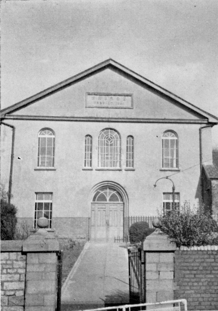
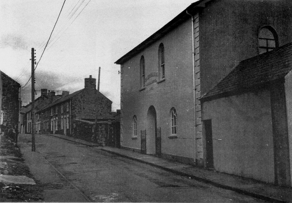
|
Wells Street - 1972, and Caersalem Chapel. |
|||||||||||||||||
|
|
|||||||||||||||||
|
|
|||||||||||||||||
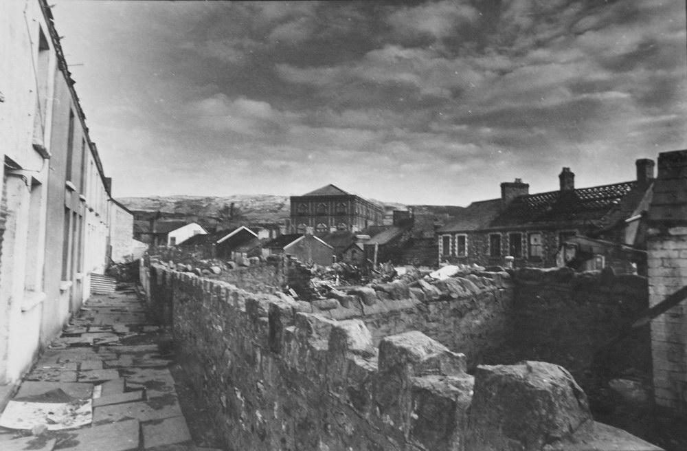
|
Garden Row, with Wells Street to the right and the Blast Engine House in the distance. |
|||||||||||||||||
|
|
|||||||||||||||||
|
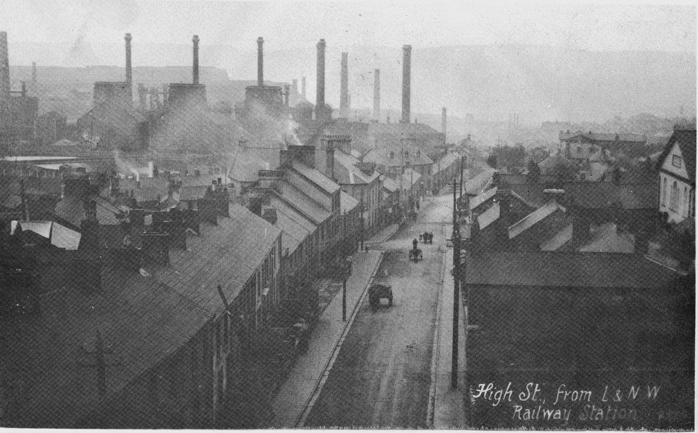
Dowlais High Street 15th November 1905. (Photograph courtesy of the John Owen Collection) |
|||||||||||||||||
|
|
|||||||||||||||||
|
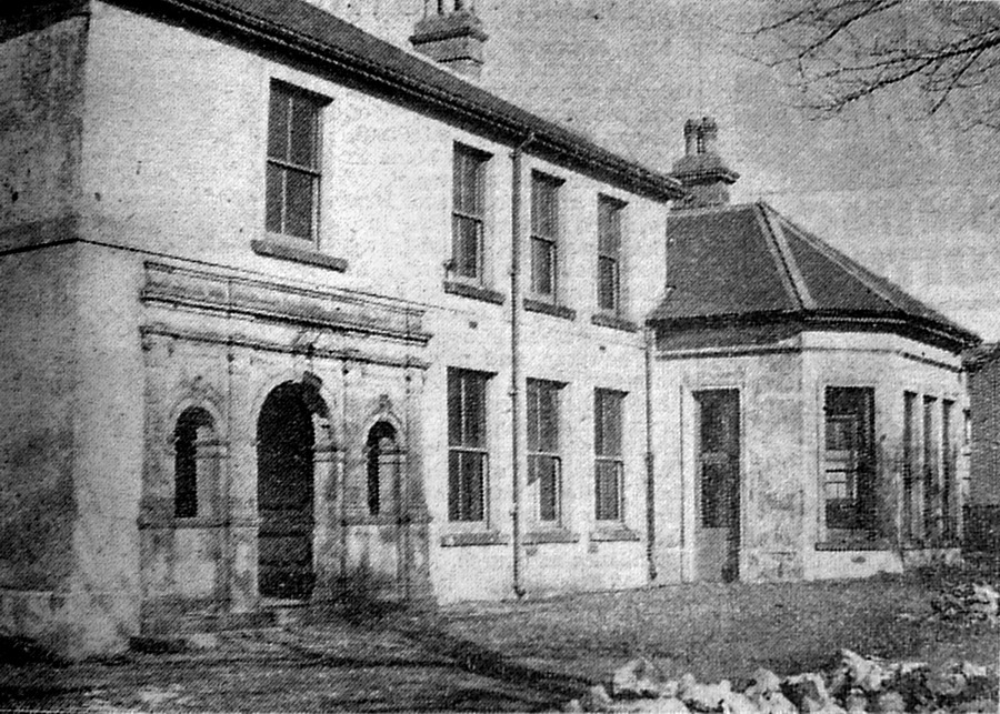
Mrs Ann Clark's Hospital, High Street, Late 1800s. |
|||||||||||||||||
|
|||||||||||||||||
|
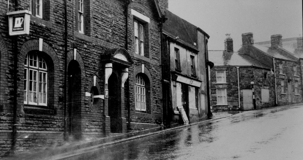
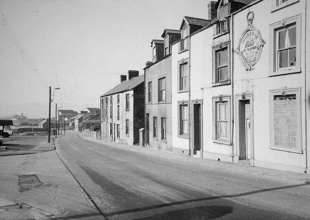
High Street - 1970's. Awaiting demolishment, Caersalem Chapel in the background. |
|||||||||||||||||
|
|
|||||||||||||||||
|
|
|||||||||||||||||
|
|
|||||||||||||||||
|
|||||||||||||||||
|
Do you have any photographs or information relating to Dowlais, Merthyr Tydfil? If so, please contact us, by clicking the 'Contact Us' button. |
|||||||||||||||||
|
|||||||||||||||||
_ADj.jpg)
_Done_2.jpg)