|
Georgetown |
|
Merthyr Tydfil |
|
|
|
|
|
|
|
<Click
on the photograph to enlarge it> |
| |
|
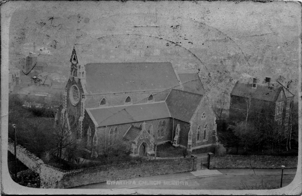
Christchurch, Cyfarthfa Church.
(Postcards courtesy of Clive Bevan)
|
|
| |
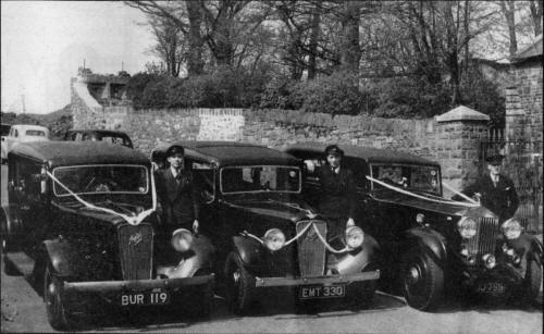
| Wedding Cars at the Cyfarthfa
Church, Early 1950s |
|
 |
|
|
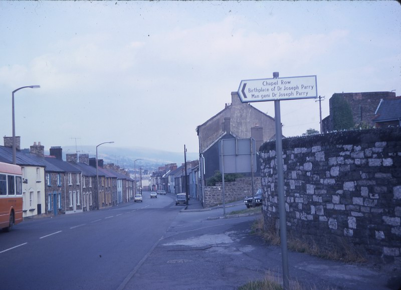
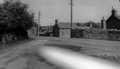
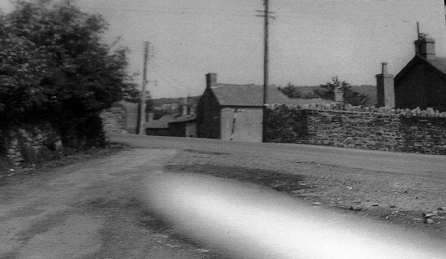
| Five Ways, looking from Cwm Pant
Lane, 1965. |
|
|
|
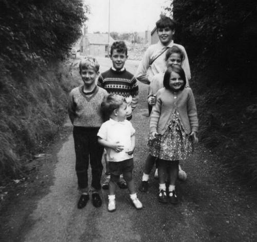
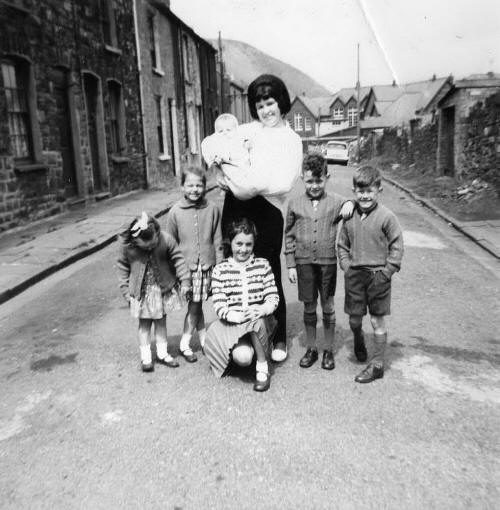
Georgetown, Cwm Pant Lane,
looking towards Five ways (See Photograph above)
Back Row:-
Gary Matthews, David Poulter on holiday from London with his cousins.
Middle
Row:- Carl Protheroe, Jeanette Campbell.
Front Row:-
Steven Peters, Jacqueline Campbell.
(Photograph
courtesy of Idwal Peters) |
|
 |
|
|
|
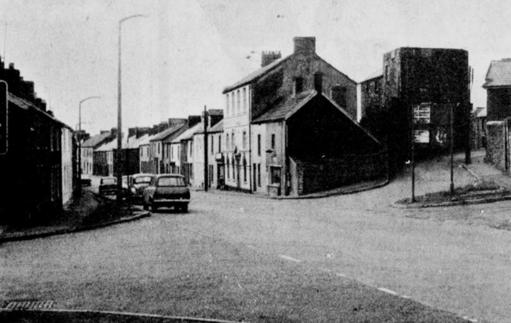
George Street and
Nantygwenith Lane. |
|
|
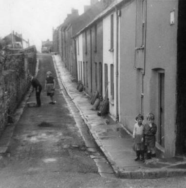
Cyfarthfa
Lane April 1971
|
|
|
|
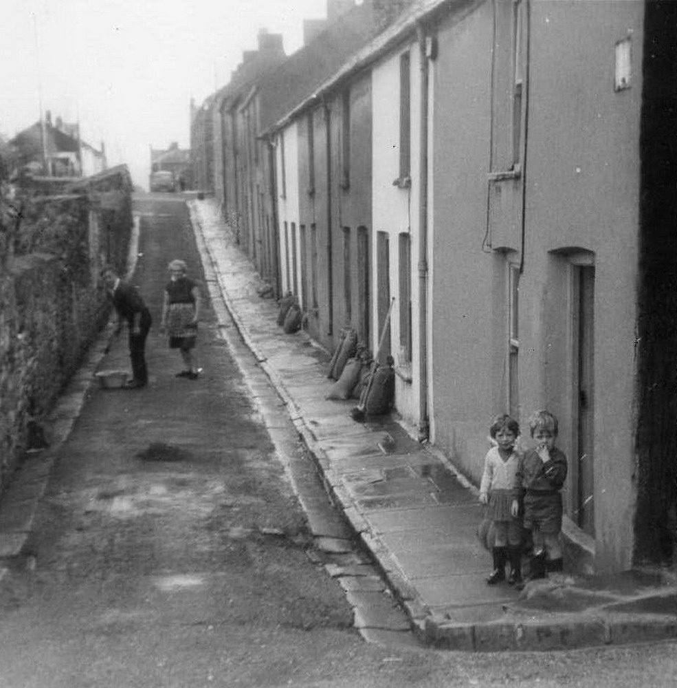
Cyfarthfa Lane, Olwyn and
Islwyn Thomas cleaning up after a flood of water came down from Heolgerrig.
Children Julie Harris and Steven
Peters stand waiting on the pavement.
(Photograph
courtesy of Idwal Peters) |
|
 |
| |
|
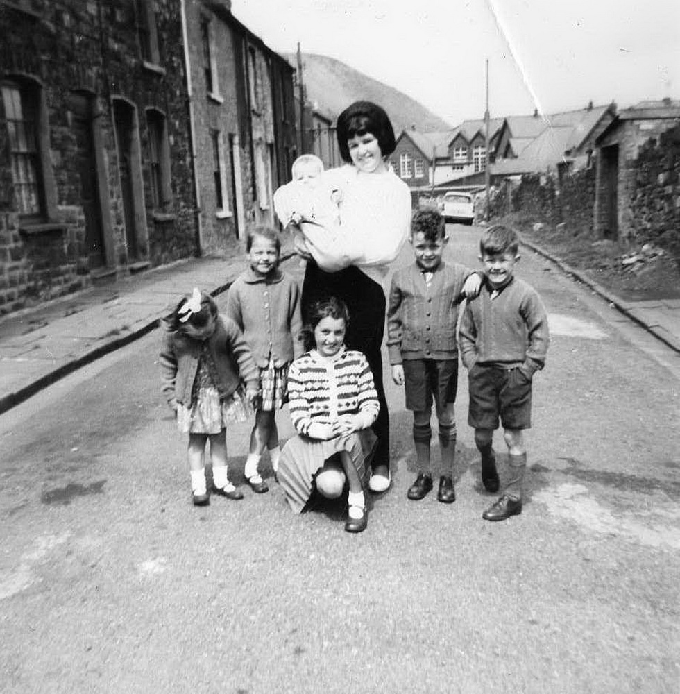
Cyfarthfa Lane.
Irene Leary, with her cousins.
Boys, Gary & Brian Matthews. Baby Steven Peters, Girls, Linda Matthews,
Jeanette Campbell, Jacqueline Campbell.
(Photograph
courtesy of Idwal Peters) |
|
 |
| |
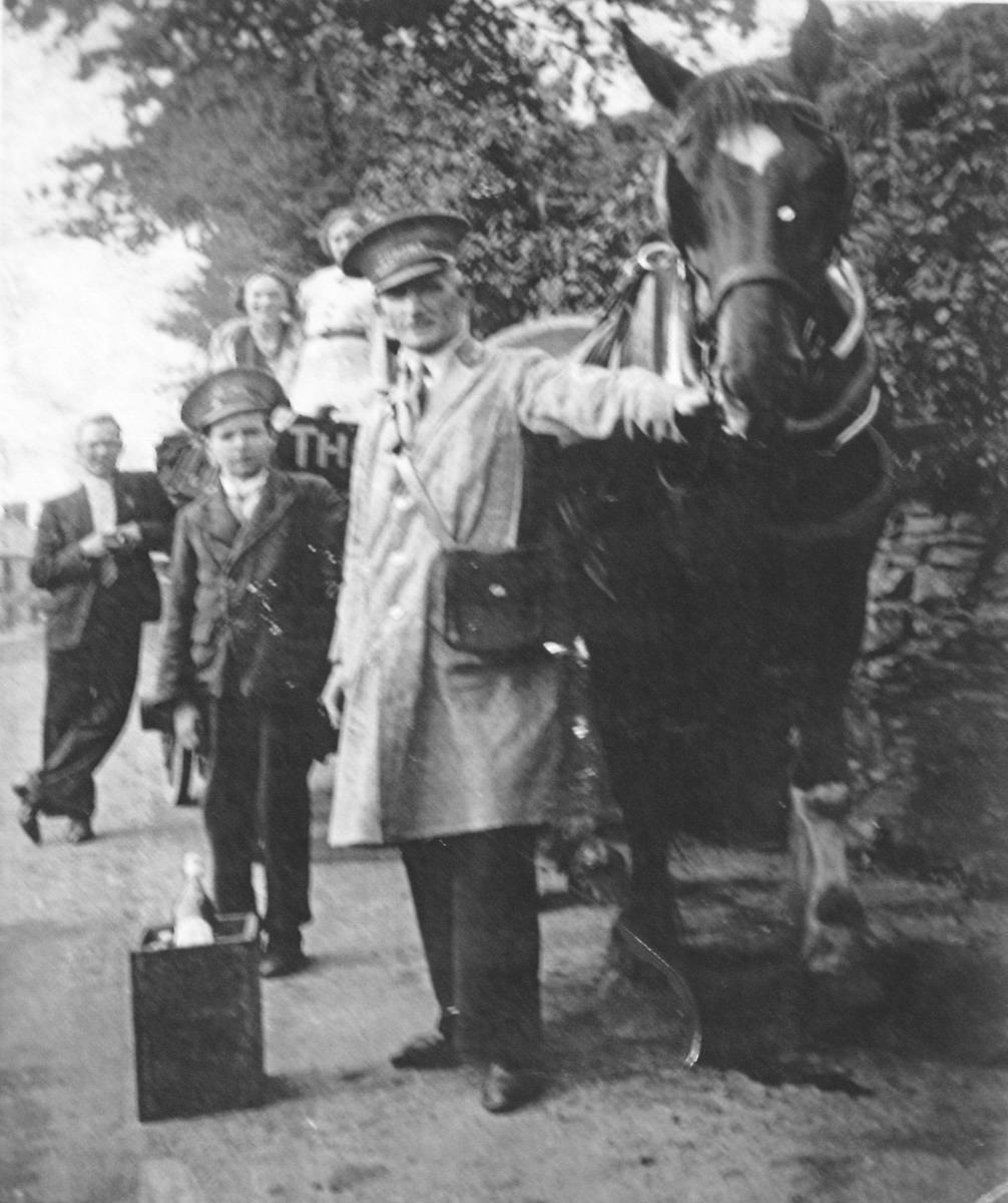
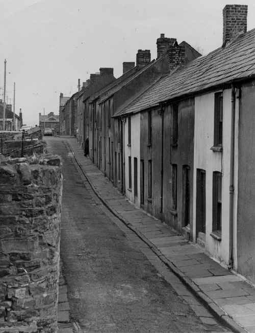
Cyfarthfa
Lane.
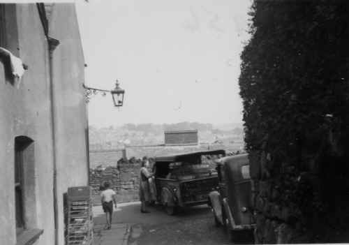
Milk being delivered to a resident of Cyfarthfa Lane. Over the
wall are
the houses of
John Street.
(Photograph courtesy of Mike Donovan.)
|
|
 |
| |
|
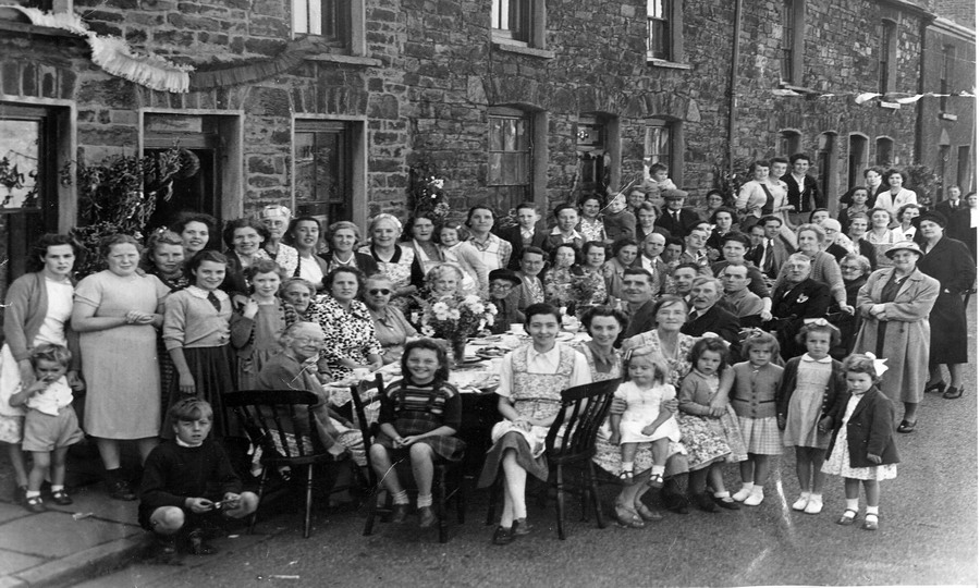
Cyfarthfa Lane, Coronation
Street Party - June 1953.
|
|
 |
|
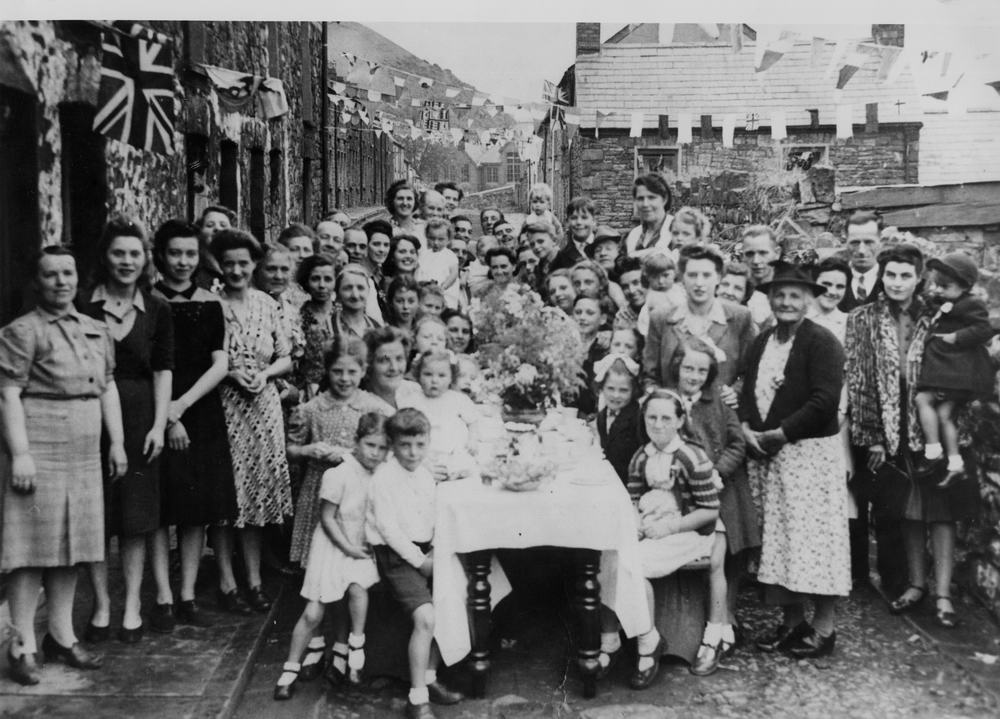
| White Row Street Party |
|
 |
|
|
|
Iron Lane
(Georgetown School at the end of the street.), Mrs Twoose on the right.
|
|
 |
| |
|
| |
|
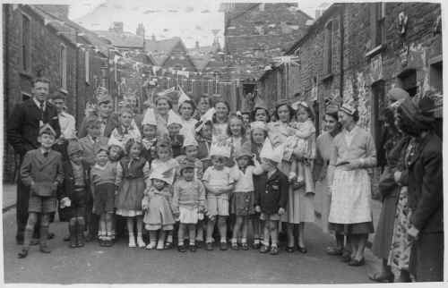
Iron Lane Coronation Street
Party - 1953.
(Photographs
courtesy of Tudor Jones) |
|
_TudorJones_small.jpg) |
| |
|
Iron Lane Coronation Street
Party - 1953.
(Photographs
courtesy of Tudor Jones) |
|
 |
|
|
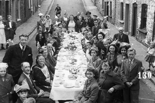
Iron Lane Coronation Street
Party - 1953.
Alice Haines nee Dunscombe is
pictured at the back, slightly covered by a boys hat (first woman from the
left). Colin Haines, Alice's son is pictured slightly to her right in front
of her.
(Photograph
Courtesy of Mike Lewis, Canada) |
|
 |
|
|
Iron Lane
Coronation Street Party - 1953. Taken at the bottom of Chandlers Court
(Photograph Courtesy of Mike Lewis, Canada) |
|
 |
| |
|
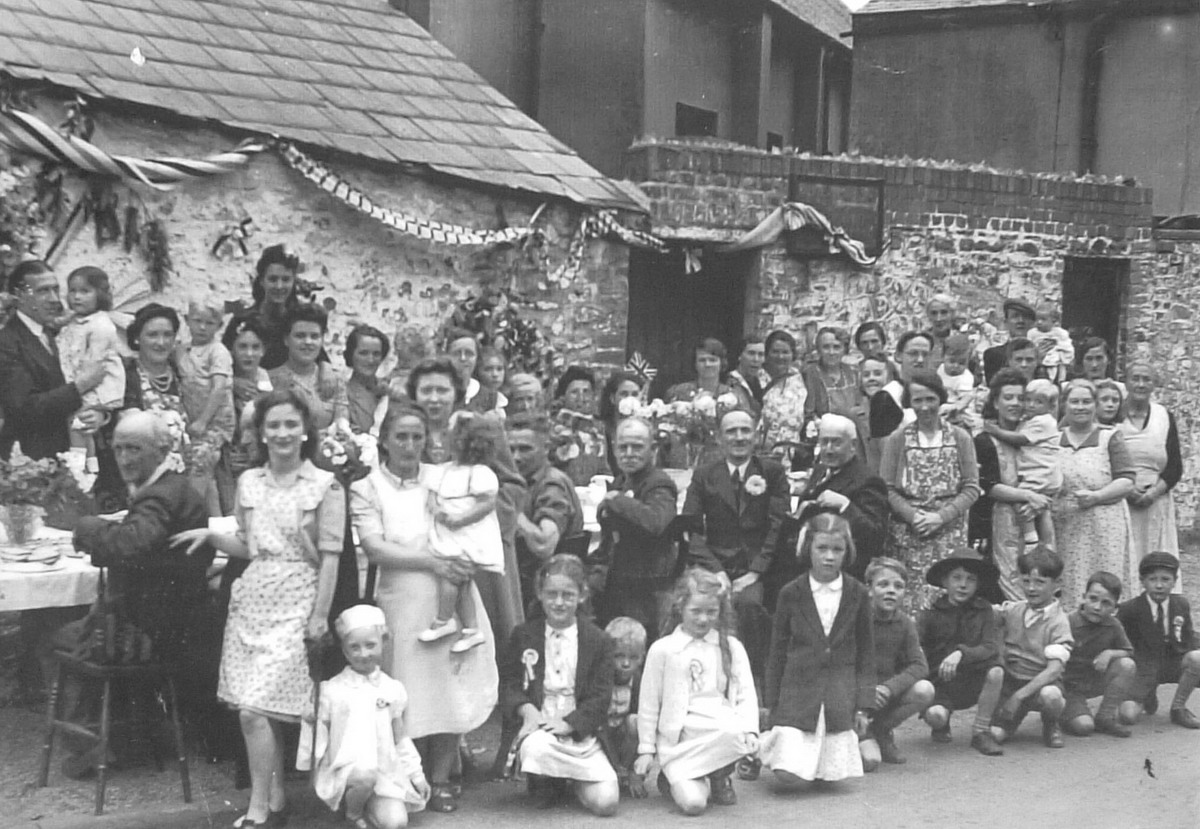
Tramroad, Georgetown Street Party
(Rear of the Kirkhouse) |
|
 |
|
|
|
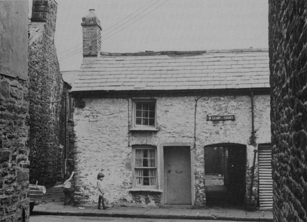
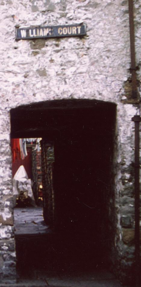
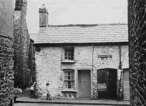
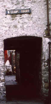
Williams Court
(off Iron Lane). Stuckey's bakehouse down the gully, and under the
arch into Williams Court.
|
|
 |
Williams Court.
|
|
 |
|
|
|
|
|
|
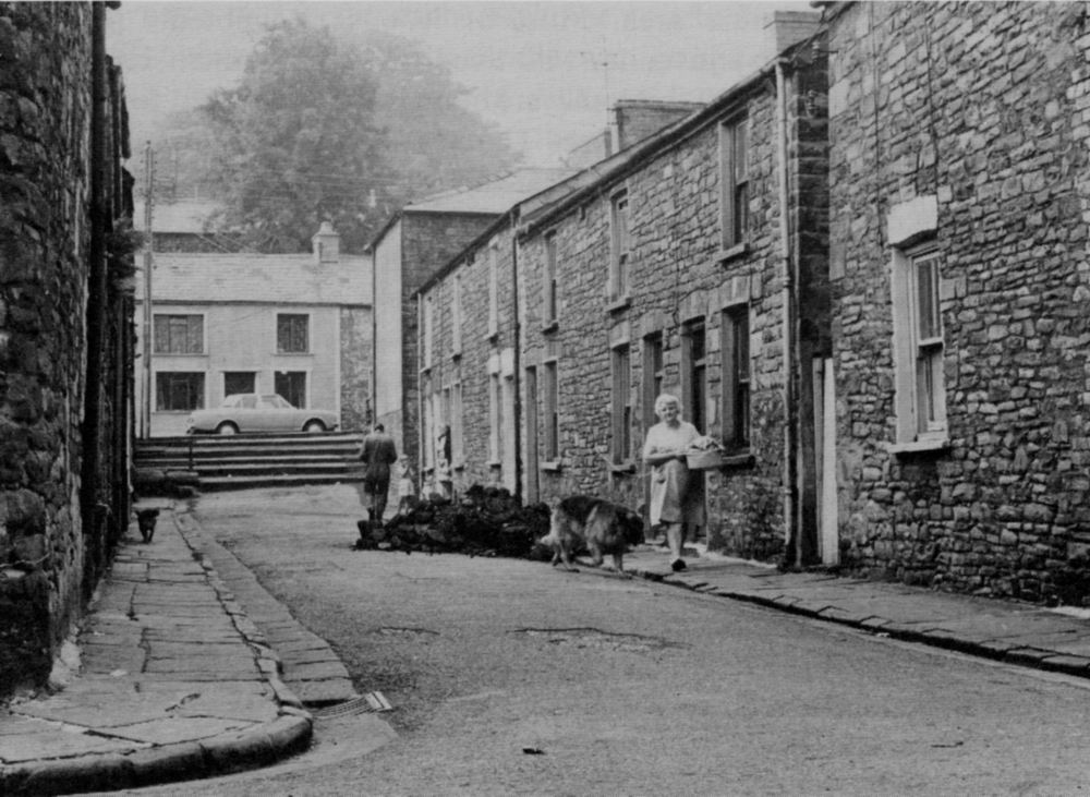
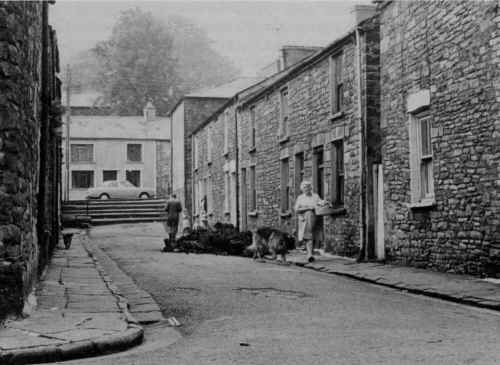
Howell Street.
A Miners coal allowance just delivered.
On the right hand side just before the steps
is the entance to
West Lane. Mary Coleman (known by
everyone as Nana Coleman) is seen leaving her daughter's house, with
her Alsatian "Duke".
(Thanks to Paul Coleman for the information about his
grandmother)
|
|
 |
| |
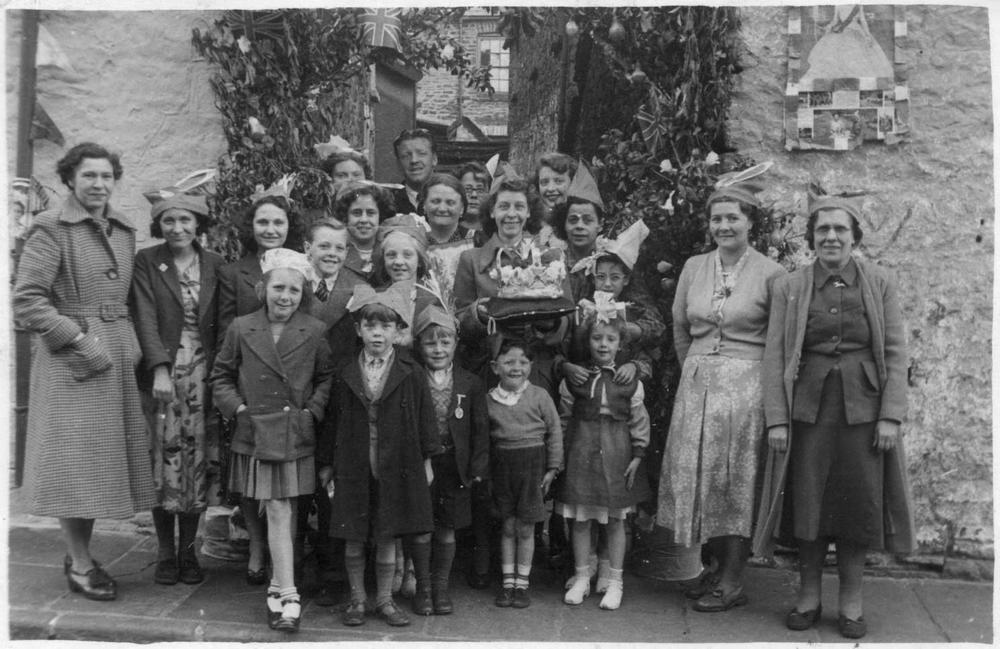
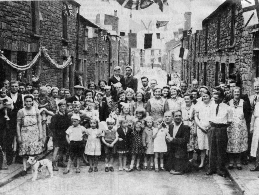
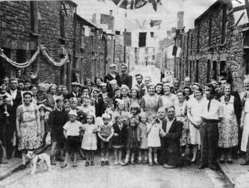
| Howell Street - V.E. Day Tea
Party |
|
 |
|
|
|
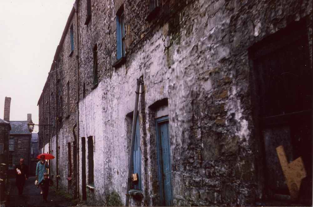
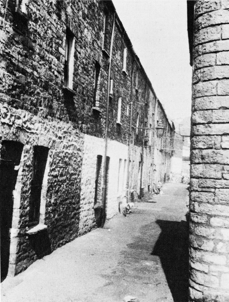
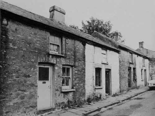
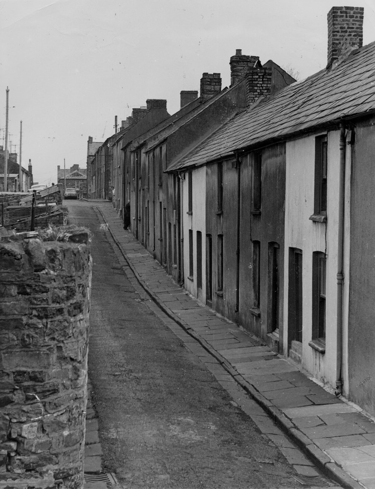
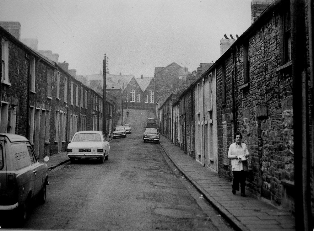
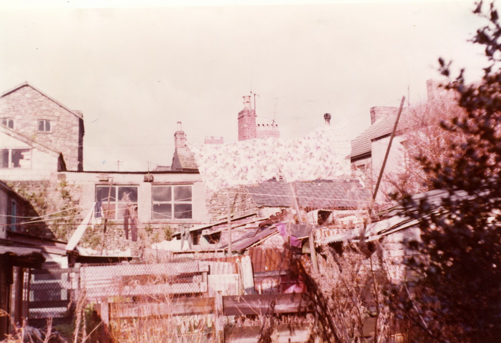
West Lane. off Howell Street.
They were the backs of John Street -below road level and
classified as
cellar houses. The authorities considered them as unfit for human
habitation because
there was no through flow of air and damp was a serious problem. Whilst
transfer to
new local authority housing removed these health and hygiene problems many
tenants
were faced with a 4,5 or even sixfold increase in their rents.
|
|

|
|
|
| |
|
|
|
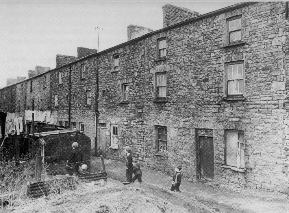
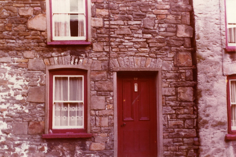
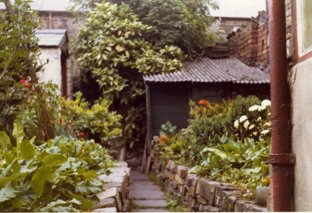
Michael Neal who spent many a summer holiday at
his grandparents in John Street,
has sent some detail on how life was in Georgetown in the 60's.
West Lane ran off Howell Street between
Iron Lane and John Street. The houses in the picture are the backs
of the John Street houses. The Iron Lane houses actually had back
gardens. The second house from the end, just past the street lamp,
was my grandparents house.
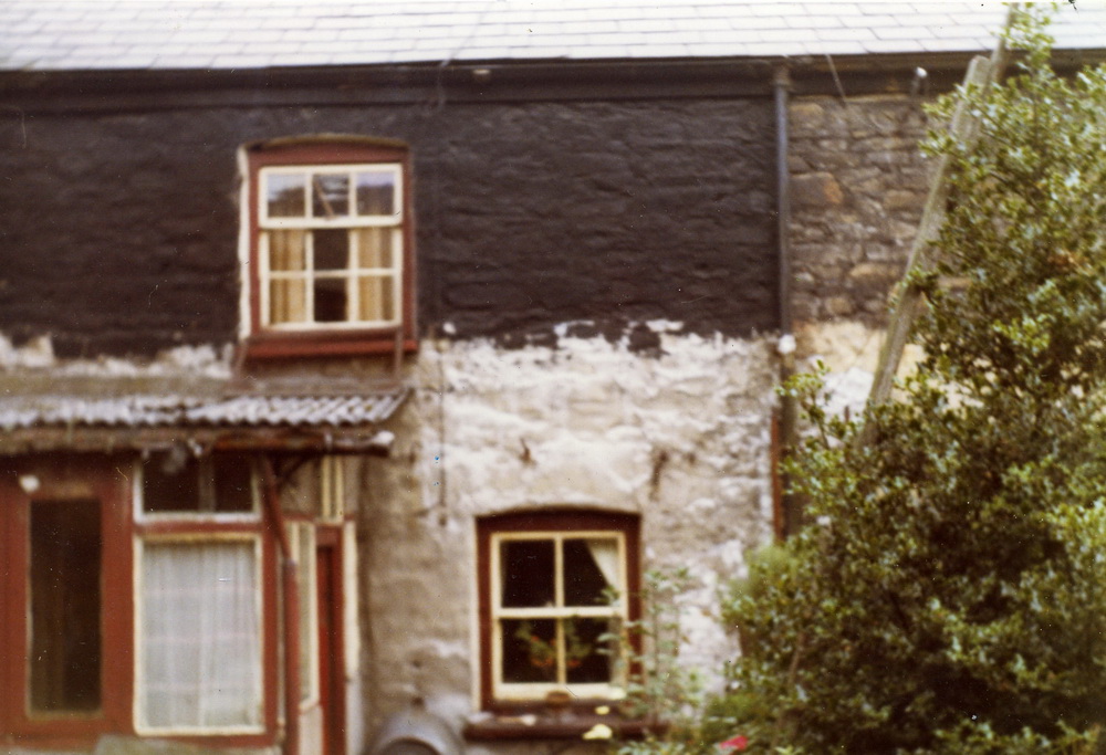
The cellar consisted of three rooms. There was a
tiny room where the water tap was. There was another room, a bit
bigger, which was used as a coal store. The main room was used as
a laundry room. There was a washing machine which was also used to
heat the water for the bath. When the water was hot enough, it
would be pumped from the washing machine into the zinc bath.
The cellar floor was made of large flag stones and could be very
uneven in places. Most 4-legged pieces of furniture would need a
wedge under one of the legs if they were to stand firm.
The toilet was across the lane. When nature called,
there was a dash down the stairs to the cellar, unbolt the cellar
door, grab a meat skewer, run across the lane then use the meat
skewer to lift the latch on the inside of the toilet door. If it
was dark, you would have to light a candle in the cellar and take
that with you. The meat skewer was used in order to stop
all-and-sundry from using the toilet.
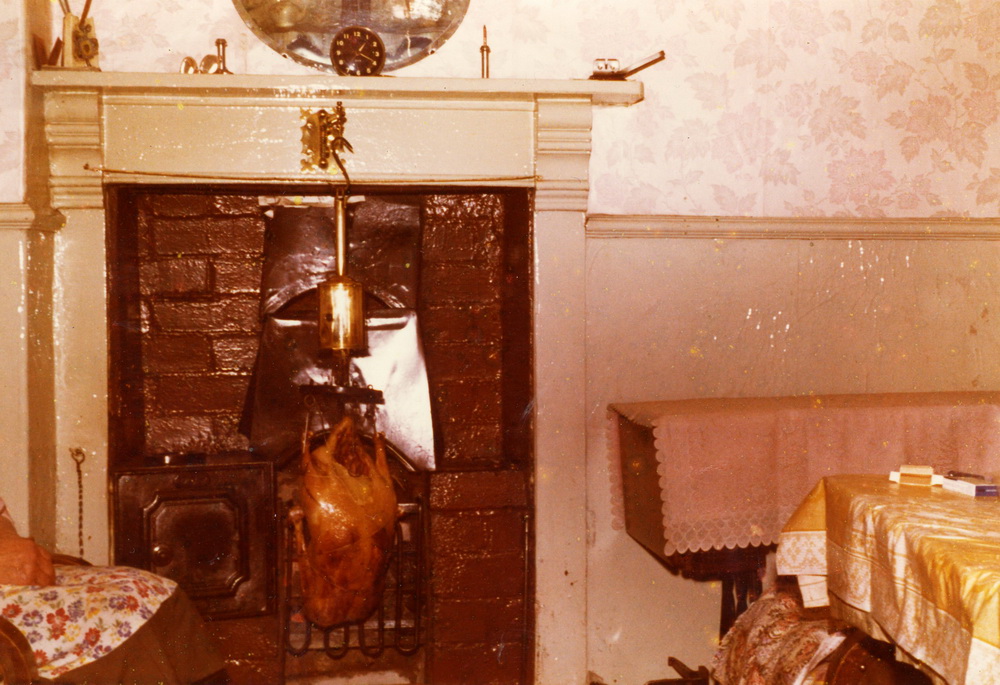
The window above the cellar was the scullery
window. It was really the living room as the "real"
living room at the front of the house was for show only, and was
only used on special occasions. There was an open coal fire in the
scullery which, when I was small, was lit every morning of
the year. All cooking was done on this. There was an iron baking
oven on one side of the hearth which would bake some lovely cakes.
Even the irons for pressing clothes were heated by the coal fire.
|
|
|
| |
|
|
|
Howell
Street, from the bottom end. Showing on the the left Arthur Parkers
betting shop, the O.A.P. Hut
|
|
 |
|
|
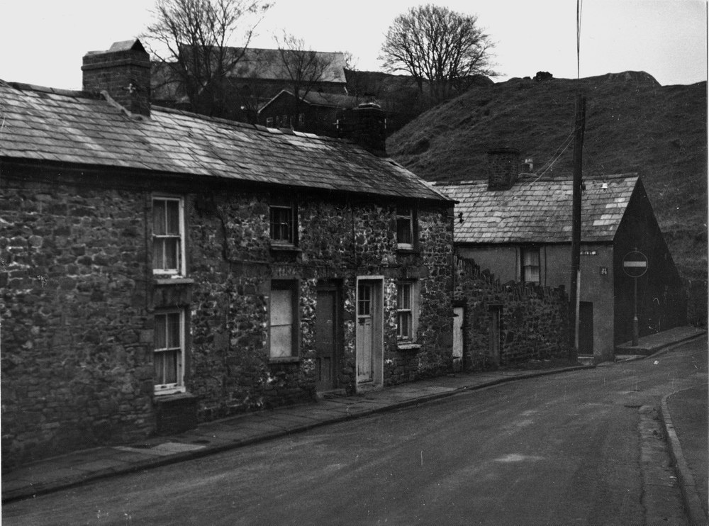
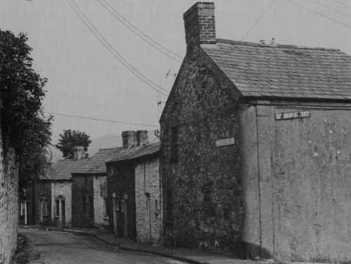
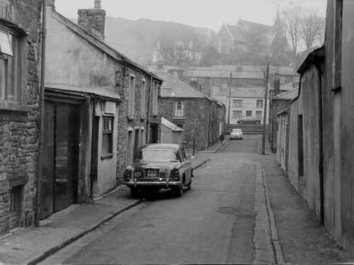
Nantygwenith
Lane. It ran around the western edge of Georgetown up to the Cyfarthfa Church Vicarage
on Aberdare Road. You can make out Cyfarthfa Church roof at the top of the
picture. Cyfarthfa Lane
is shown at the No Entry sign. Out of picture on the right is Georgetown
School
which was
built on the site of Crawshays Stables.
|
|
 |
| |
|
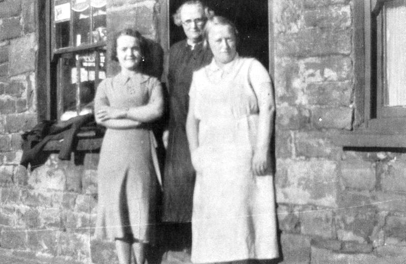
Nantygwenith Lane - Sweet Shop
Clive's grandmother Bessy turned
the front room of her house opposite Georgetown School into a Sweet Shop.
L-R: Lily
Dunscombe (nee Davies), Bessy Dunscombe, Anne Kennedy (nee Dunscombe). |
|
 |
| |
|
Nantygwenith Lane
also known as Gregory's Lane
|
|
 |
| |
|
|
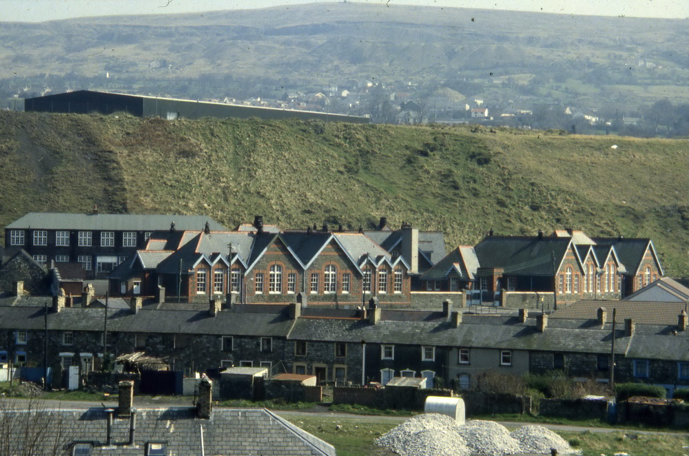
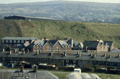
Georgetown School, with
Nantygwenith Street in the foreground. April 1981.
Georgetown Tip behind and the old
Texas D.I.Y. superstore.
(Photograp(h
courtesy of Dennis Bennett OBE.) |
|
 |
|
|
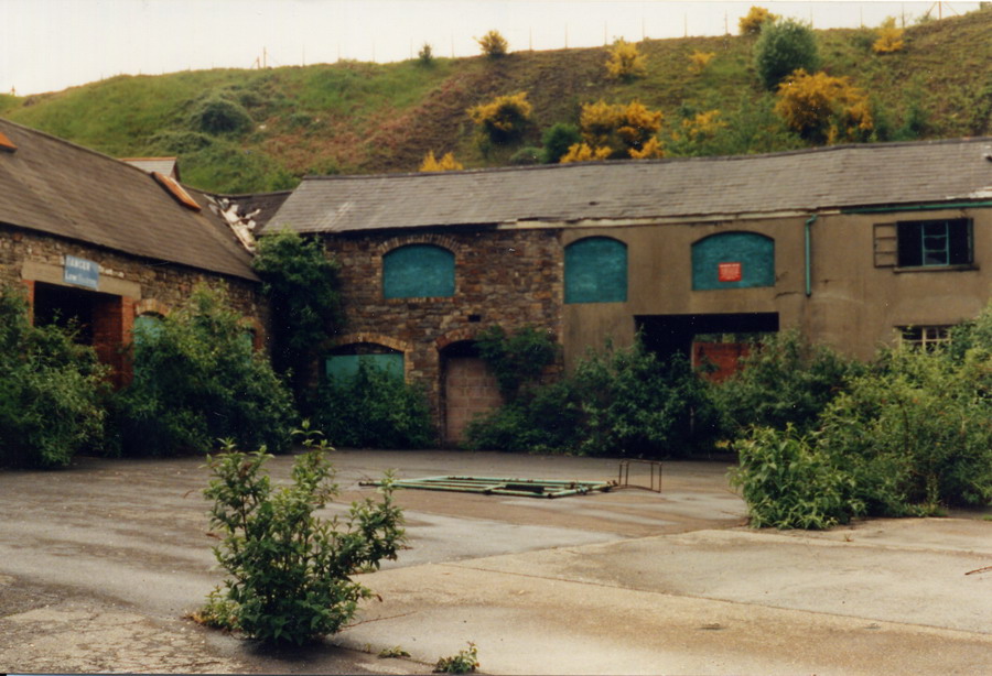
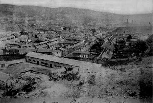
Crawshays stables.
A very old
photograph of Georgetown taken from the tip at the bottom of Swansea Road.
In the distance you can see the chimneys of the blast engine houses at Ynysfach Ironworks. |
|
 |
| |
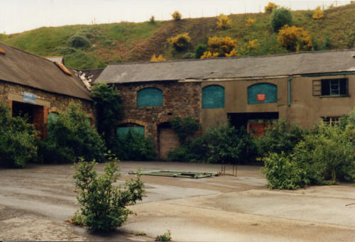
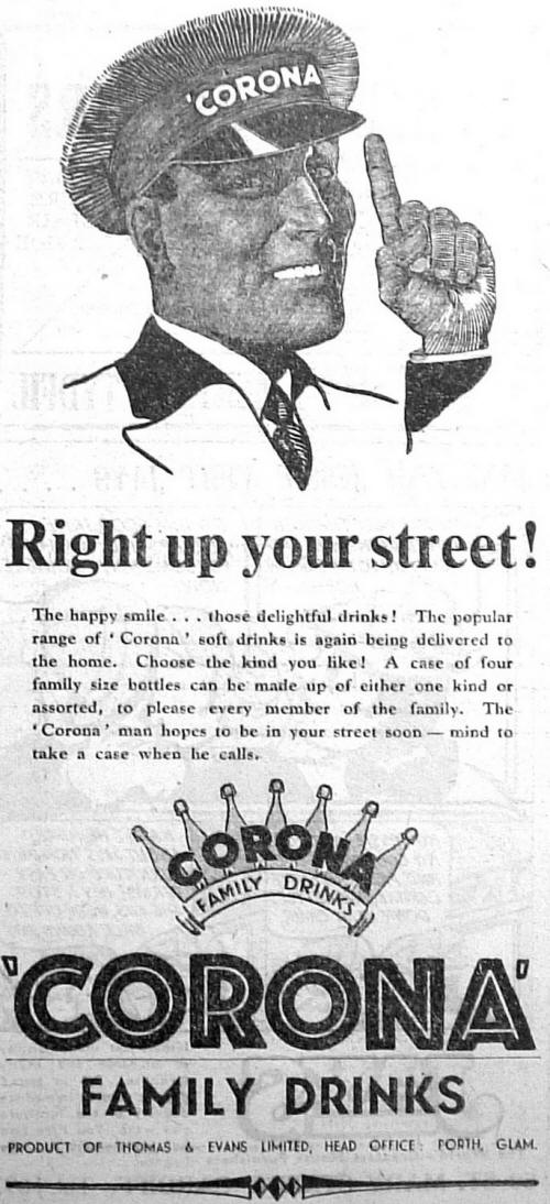
| The stables later became the
Corona 'Pop' Depot and it shown following it's closure in the 1970's. |
|
  |
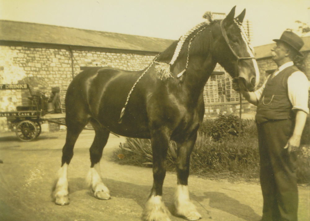
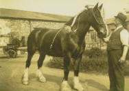
Dave Trailor sends us this photograph of
his Grandfather, William Merrick Trailor, with the Horse 'Dolly', at Corona
Pop Works. |
|
 |
| |
|
Corona Pop Man |
|
 |
| |
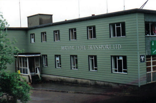
| Merthyr Tydfil Transport Ltd
Office, Nantygwenith Street - 1970s. |
|
 |
|
|
Click Here
To Visit
the Bus Garage |
| |
| |
| Nantygwenith Street 1972.
( Photograph courtesy of Mr Clive Bevan) |
|
| |
|
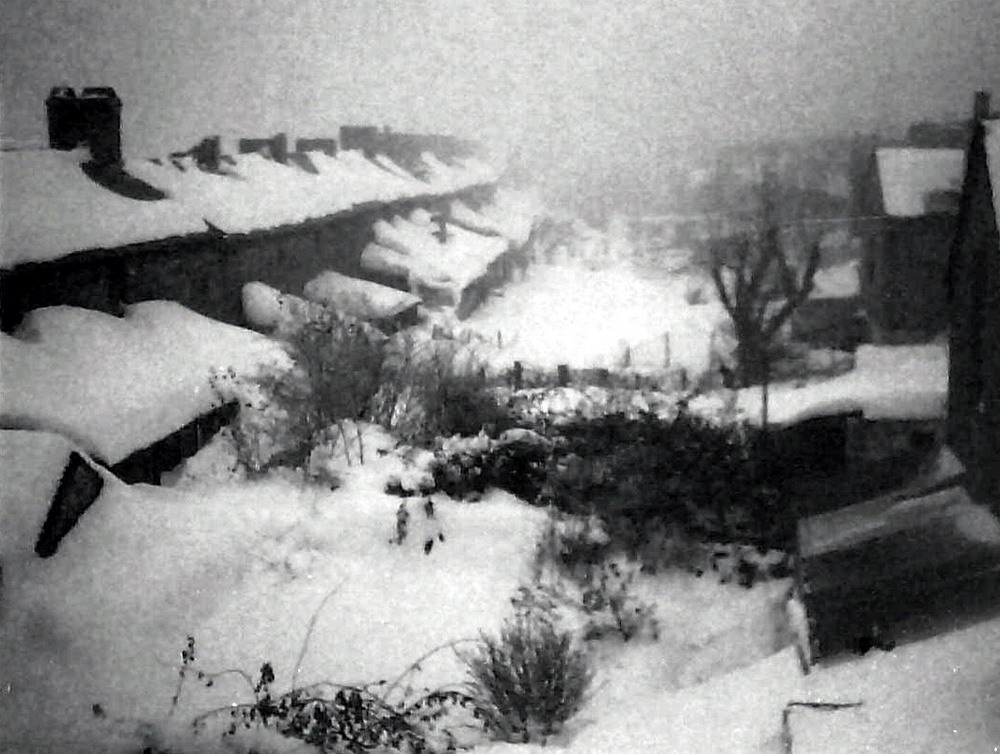
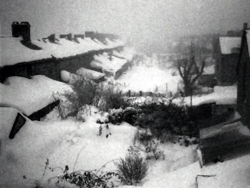
During the snow, looking down
between Cyfarthfa Row on the left and Nantygwenith Street on the right, from
the Nantygwenith Street Bus
Depot.
(Photograph
courtesy of Glyn Bowen) |
|
 |
| |
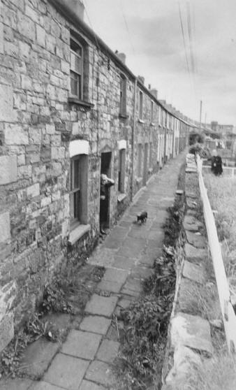
| Cyfarthfa Row in 1979. |
|
 |
|
|
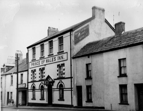
| Prince of Wales Inn, Nantygwenith Street. |
|
 |
|
|
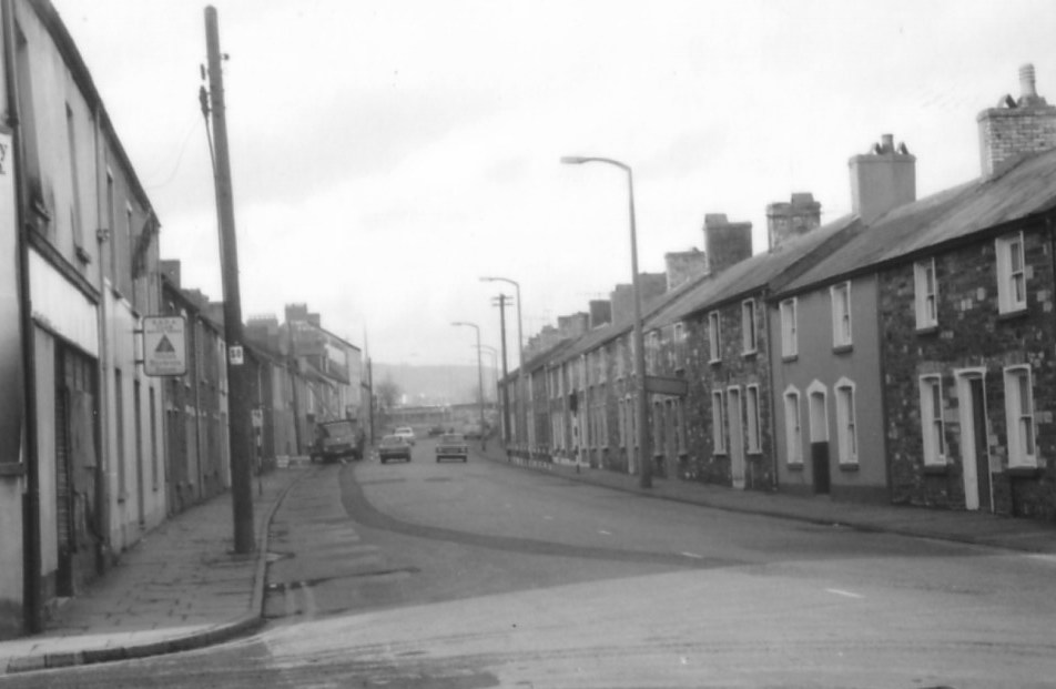
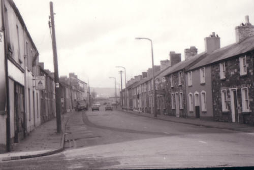
Nantygwenith Street in the
1960's.
(Photograph
Courtesy of Val Griffiths) |
|
 |
| |
|
Nantygwenith Street.
The Prince of Wales Inn, and the Cyfarthfa Brewery Behind - later Standard
Upholstery (Dai the up).
|
|
  |
|
 |
| |
|
Do
you have any photographs or information relating to Georgetown,
Merthyr Tydfil?
If
so, please contact us, by clicking the 'Contact Us' button. |
|
|
|
Go To:
 |
|
Go To:

|
|
|
|
| |

To Georgetown Map page |
To Merthyr Map page |
|
| |
|
 |
|
|


_TudorJones.jpg)