|


| |
| |
|
Georgetown |
|
Merthyr Tydfil |
| |
| |
| |
|
This district
was named after George Crawshay, the son of William I, who married a
French ironmaster’s daughter after visiting the ironworks of France.
This area grew up mainly from the 1820s onwards ( alongside Cyfarthfa
Castle built in 1825 ) and is located on the 1841 census returns;
identified as ‘North’ or ‘South’ Georgetown. The area reflects the
typical industrial housing of the time, with cat-slide roofs etc. and
properties built back to back, with numerous courts and alleys. In the
Georgetown area was once Coffins Court, where the Court of Requests was
attacked and destroyed in the Merthyr Rising of 1831. The Three Horse
Shoes public house is here also, which, according to legend is where Dic
Penderyn used to attend meetings. Later Chartists were reputed to have
held their political meetings here. The River Taff runs through this
district. The Glamorgan Canal from Merthyr to Cardiff began at the
Cyfarthfa Works and ran through the Georgetown area, passing along
Chapel Row, where the musician Doctor Joseph Parry was born in 1841.
His birthplace, number 4 Chapel Row, is now an interesting small museum,
reflecting the 1850s when the Parry family lived here. A short distance
from Chapel Row was Bethesda Chapel, where his mother taught Sunday
School. At the end of Chapel Row are the ruins of a large octagonal
building with white limestone archways. This was the Chapel of Ease for
the Cyfarthfa workers which was built in 1800 by the Crawshays, but by
1851 was used as a storehouse. Legend has it that the famous Cyfarthfa
Band held their practice sessions here. The first Roman Catholic Church
of St Mary’s was in Georgetown. This building then became a lodging
house for the Spanish workers after 1900 and then a store house. This
was an area of dense housing with a large population. The old Georgetown
has been demolished (together with Georgetown schools and Bethel
Chapel); although the old houses had disappeared by the early 1970s,
there is now a new Georgetown with luxury modern houses.
Carolyn Jacob |
|
|
|
|
|
|
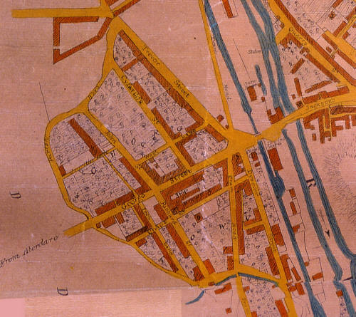
Click on the Map to
visit the area you wish to see
| |
 |
|
|
Click on the Map
to visit the area you wish to see |
|
|
|
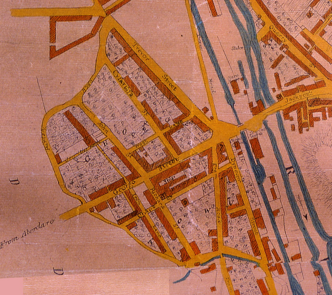
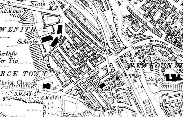
Georgetown Streets were
renamed in the mid 1800s prior to the 1851 Public Health O.S. Map. This
extract from john Woods 1836
map of Merthyr shows the original street names. (Click on the map to
enlarge) |
|
 |
|
|
|
Click Here for the Area known as 'China' |
|
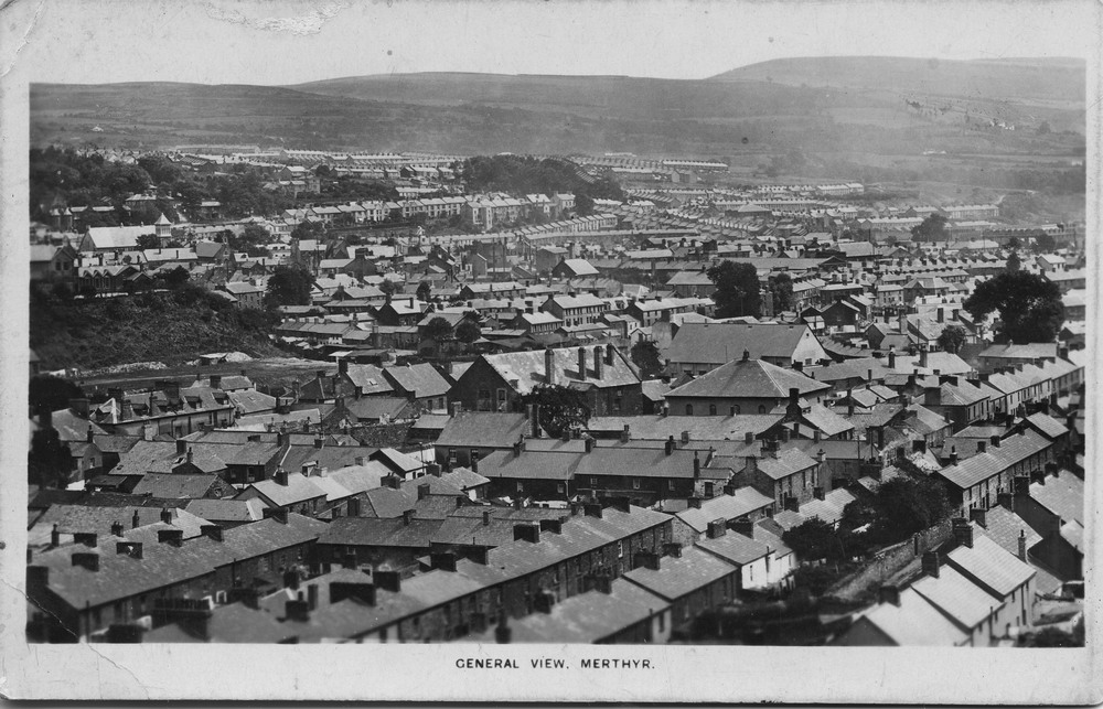
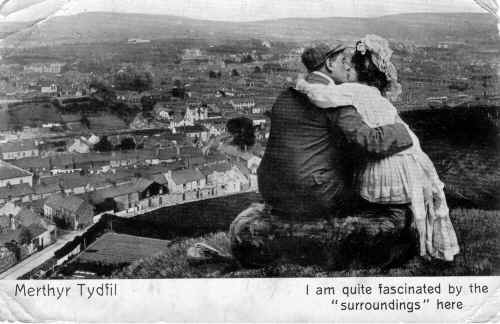
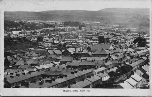
A
lovely Postcard
Sent
in by Micheal Neal ex of John Street, Georgetown, but now living in
Norway. On
the left hand side of the picture is the top of Bethel Street and part of
Bethel Chapel. In
the middle of the photo the tall white building is the original Taff Vale
Brewery which moved up
to Danyparc in 1904.At the very top of the picture is Cae Mari Dwn farm. |
|
 |
| |
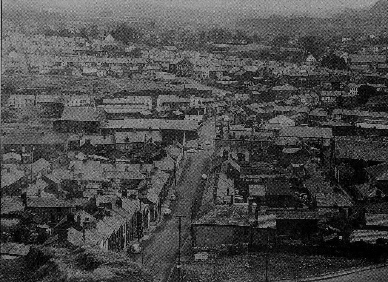
| From the same spot as above
but taken in 1970's |
|
 |
|
|
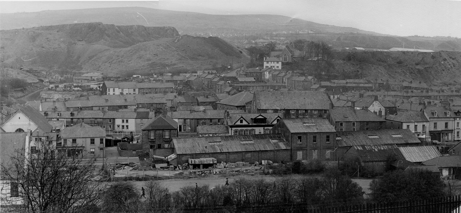
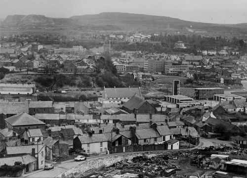
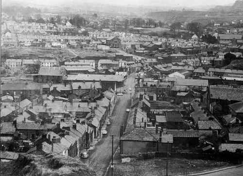
A view of
Georgetown and Merthyr from the Cyfarthfa Tips. The Original
Catholic Church, Bethel
Chapel and the Kirkhouse in the middle of the picture. Miners Hall
(Shiloh Chapel) with
tower, on left hand side of picture. Twynyrodyn is in the
distance, showing Primrose
Hill and you can make out Christopher Terrace and Melbourne Terrace below
it. |
|
 |
| |
|
From Georgetown Tip,
showing George Street running down to the
roundabout, circa 1969
|
|
 |
|
|
Georgetown
in the Early 1970's, from Abermorlais School playground.
At the front
from left to right we have the Kirkhouse (Coolers), Weekes Sweets, Court
of Requests, Golden Lion,
Gayday pop factory previously Horrocks pop factory. The light
coloured building on the far right
is the Dynevor pub. In the
middle L to R is Tramroadside, John Street , Bethel Chapel and the
original Catholic Church. At the top of Georgetown is Pullmans Yard, White
Row, George Street and the
Vicarage with Cyfarthfa Church behind it.
|
|
 |
|
|
|
Do
you have any photographs or information relating to Georgetown, Merthyr
Tydfil?
If
so, please contact us, by clicking the 'Contact Us' button. |
|
|
|
To see Georgetown
photographs click on the Map above or on the page numbers below. |
|
|
| |
|
|
|
|