|
Georgetown |
|
Merthyr Tydfil |
|
|
|
| |
|
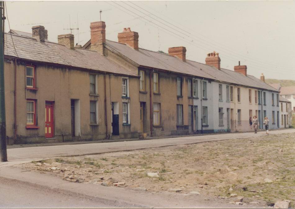
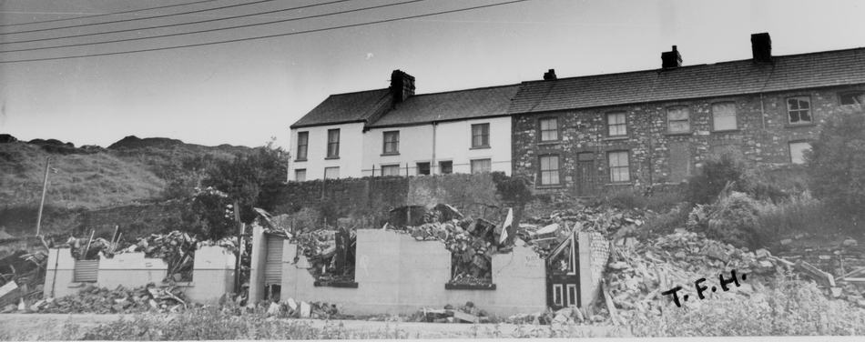
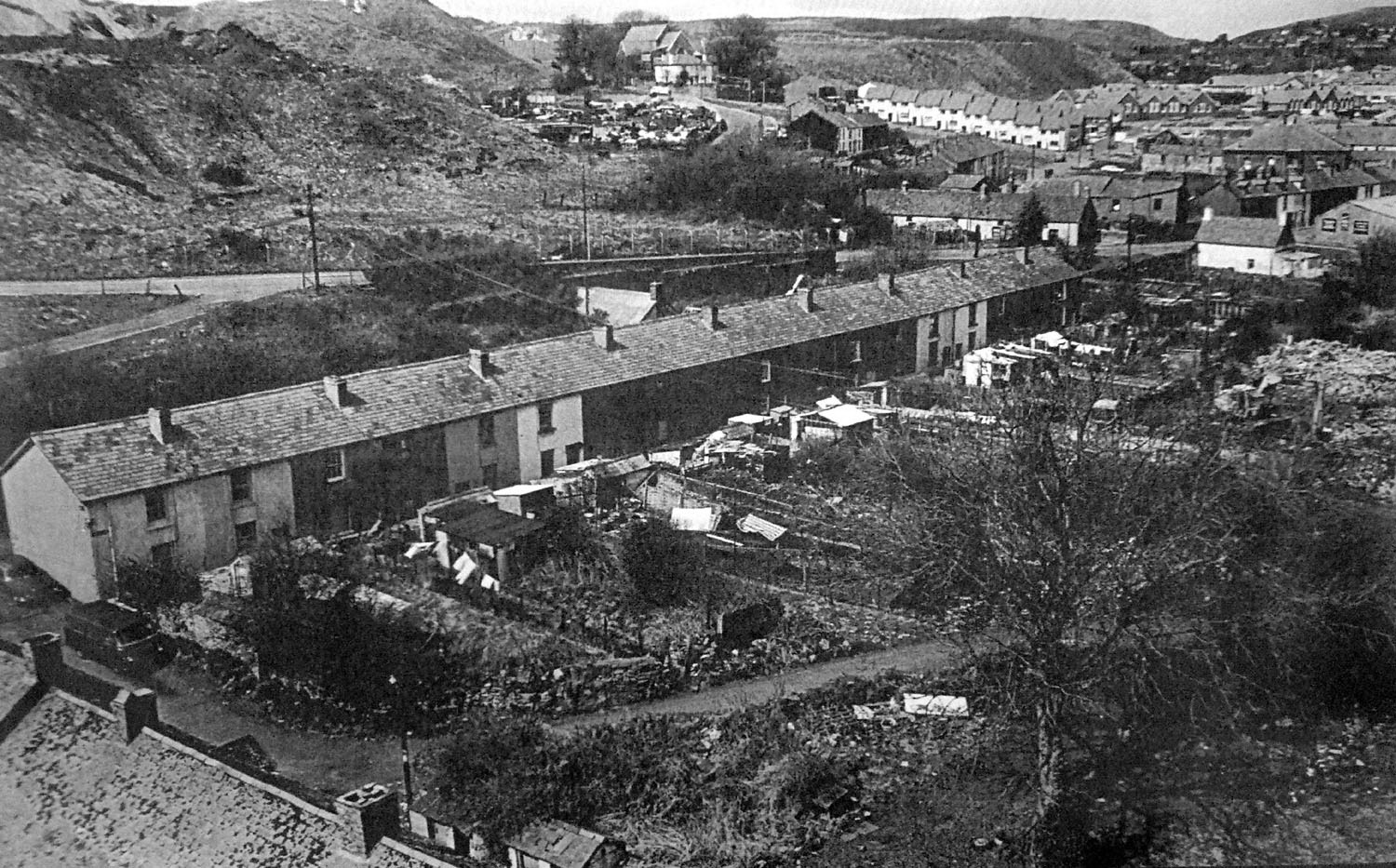
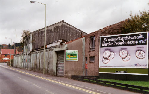
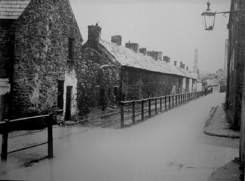
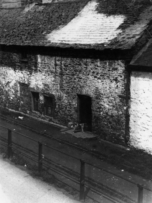
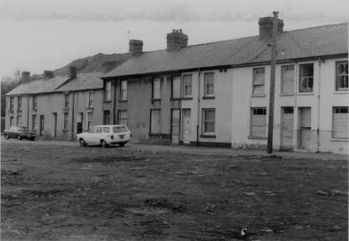
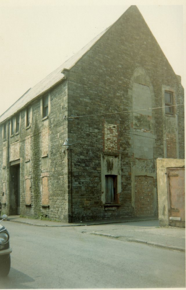
Nantygwenith
Street.
In the early
1980's. Just prior to demolition.
(Photograph Courtesy of Mr Clive Bevan.) |
|
 |
| |
|
|
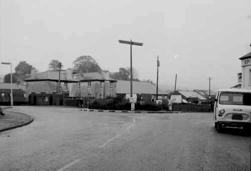
Georgetown Roundabout in the
1970s
(Photograph
courtesy of Clive Thomas) |
|
|
| |
| Georgetown Post Office |
|
 |
| |
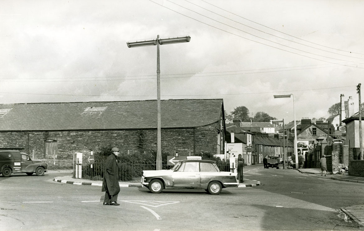
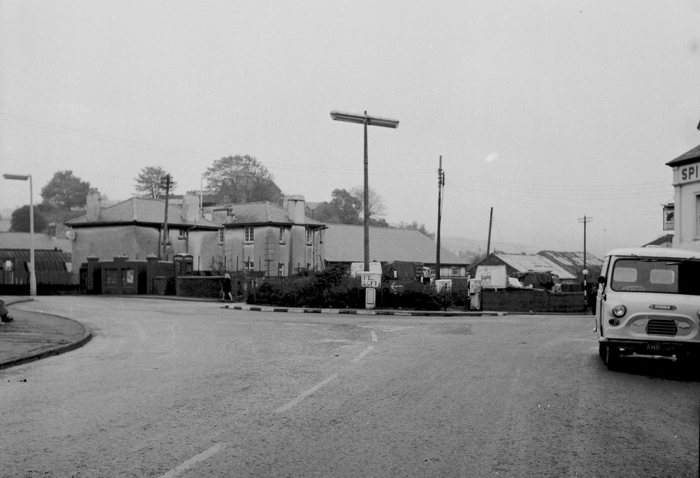
| Georgetown Roundabout in the
1960s |
|
 |
|
Georgetown Roundabout in the 1970’s (courtesy of Tony Hyde) |
|
 |
|
|
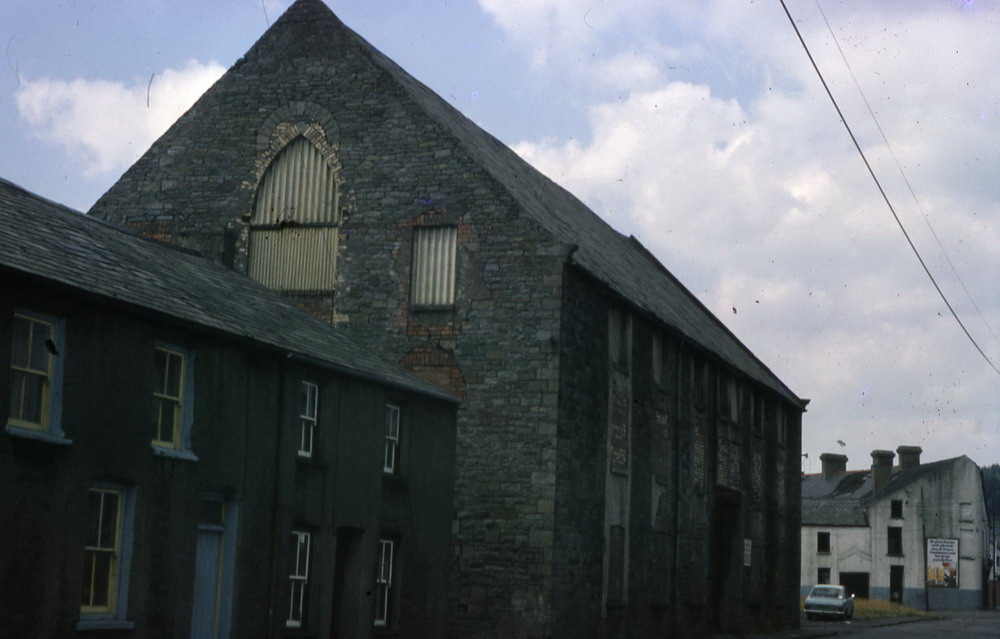
Bethesda Street in the 1960's.
Merthyr Hide &
Skin Company (The Skin Yard) on the left-hand side, the Drill Hall on the
right. |
|
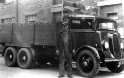
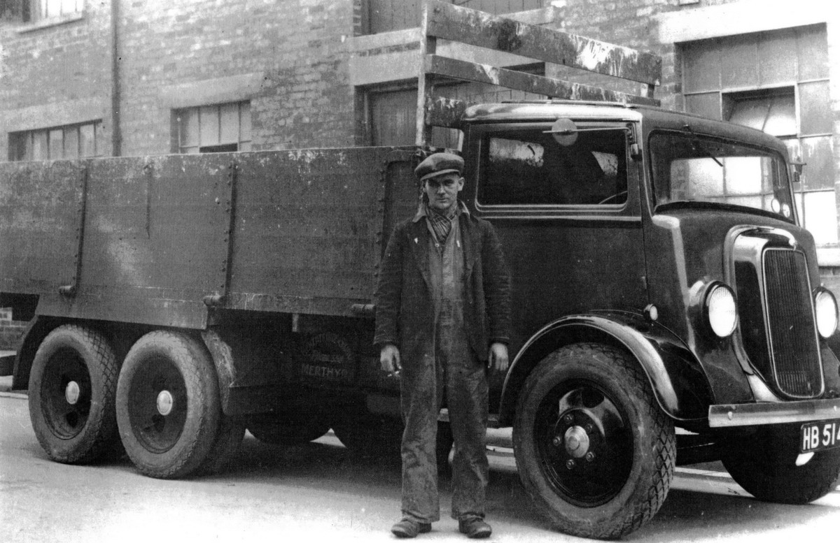
Merthyr Hide & Skin Company Lorry - Early
40's/50's
Showing driver Phil Wakeham of Jowet Avenue, Keir
Hardy Estate.
(Photograph Courtesy of Peter Wakeham) |
 |
|
 |
| |
|
| |
|
Jackson's Bridge - 1962
(Photograph Taken
by Dennis Quinlan, Courtesy of June Quinlan) |
|
 |
| |
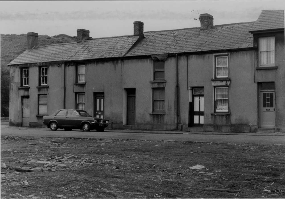
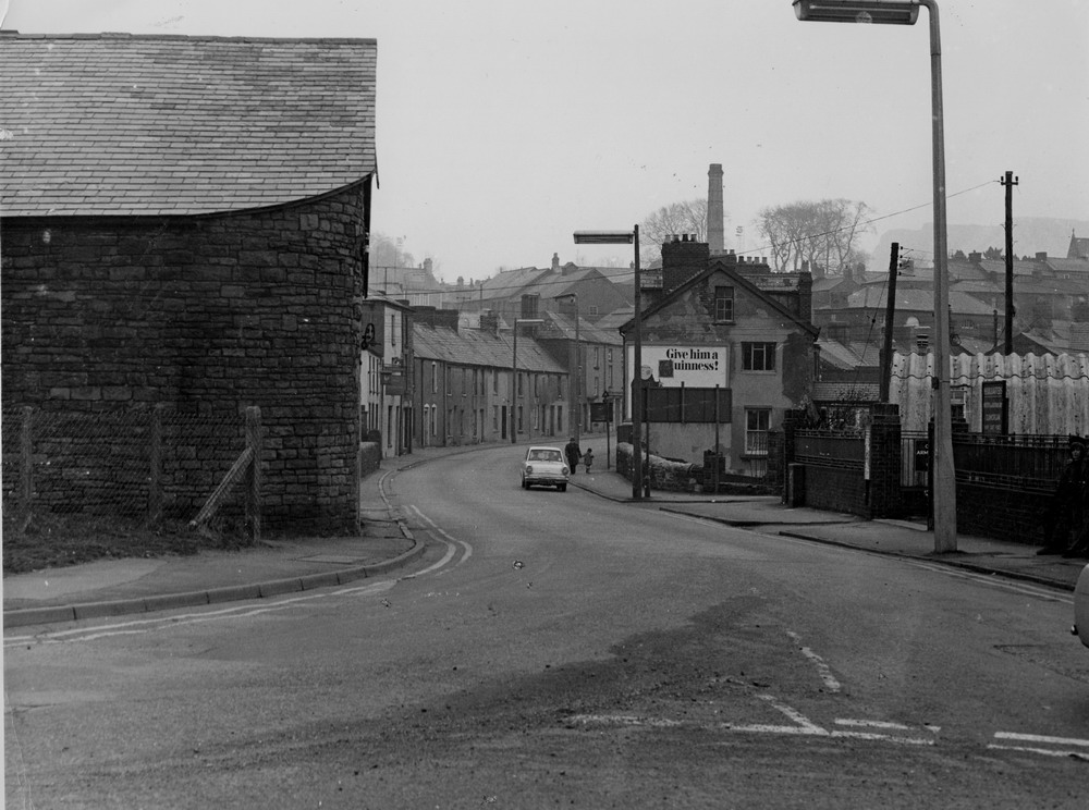
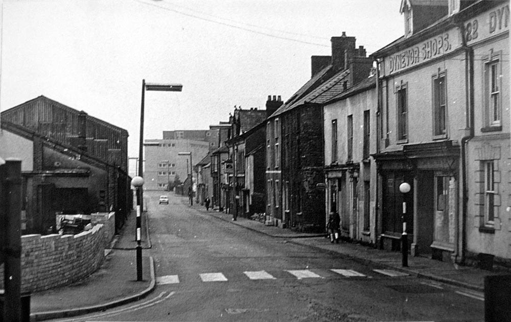
| Dynevor Street in the 1960's |
|
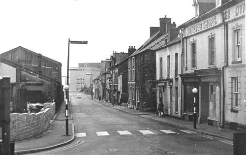 |
| |
|
Dynevor Street. |
|
 |
| |
|
Dynevor Street, Old GayDay Pop
factory.
(Photograph
Courtesy of Dr. Holley) |
|
 |
|
|
|
The Golden Lion, Dynevor Street. (Now site of Georgetown Boys Club)
|
|
|
 |
|
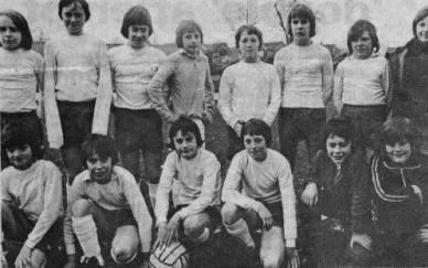
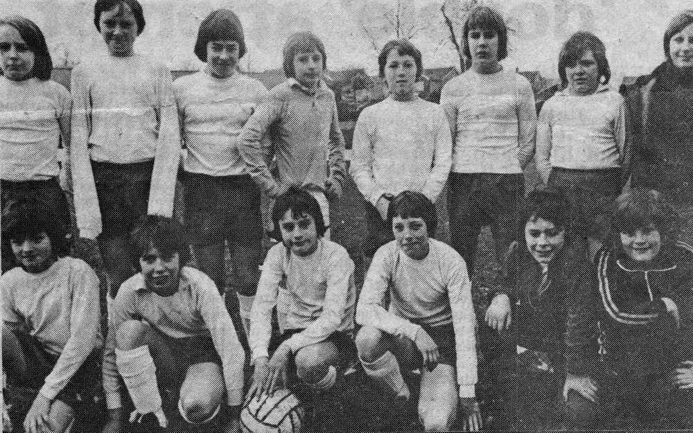
GeorgeTown Boys
Club Football Team early 1970s
Back Row:- ?, A Owens, ?, Mark Walters, Paul S. Thomas,
Arwel Williams, Mark Chamberlain, Andrew Reynolds.
Front Row:- Wayne Sears, ? Jones, Mark Hagerty, Martin
Dorricot, ?, Andrew Aris.
(Photo
Merthyr Express Courtesy of Allan Owens)
|
|
|
 |
|
|
|
| |
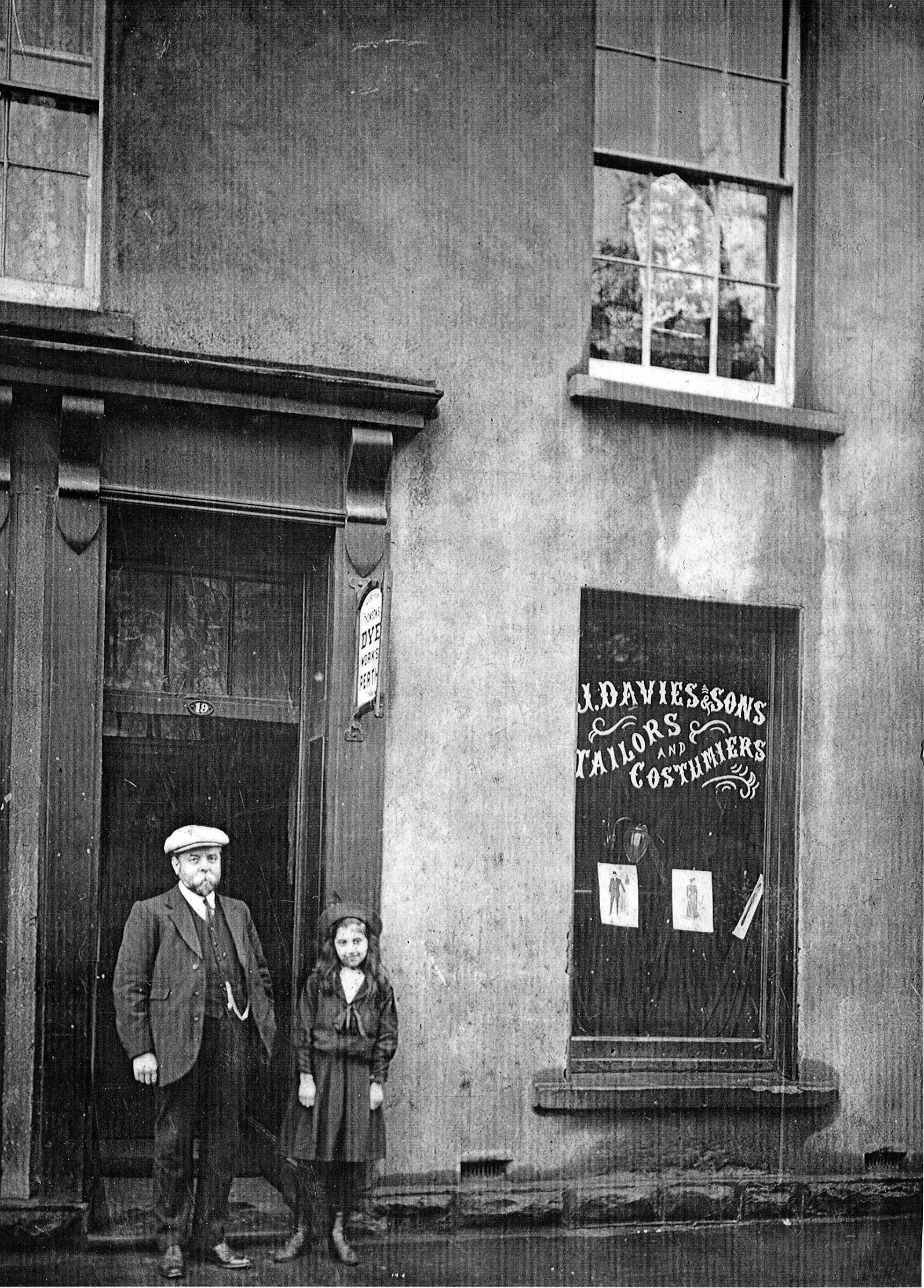
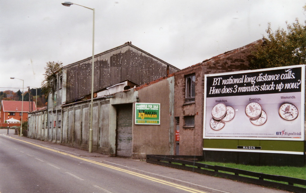
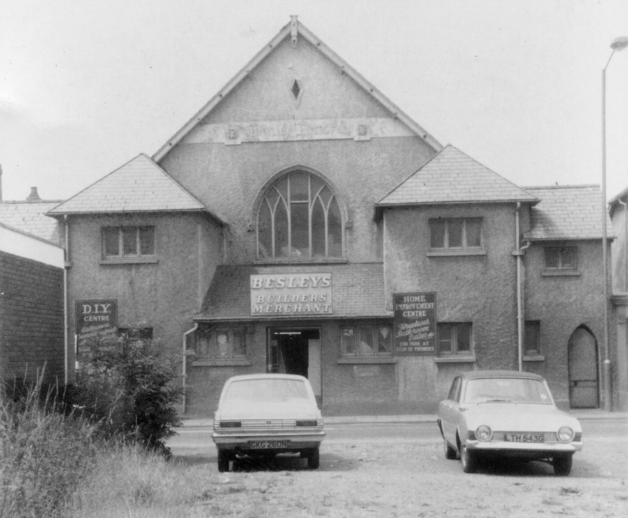
| Besley's Builders Merchants,
Dynevor Street. The Old Kirkhouse Hall now Coolers. |
|
 |
| |
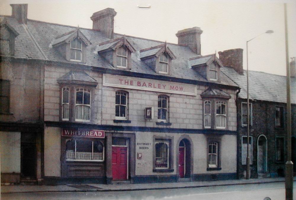
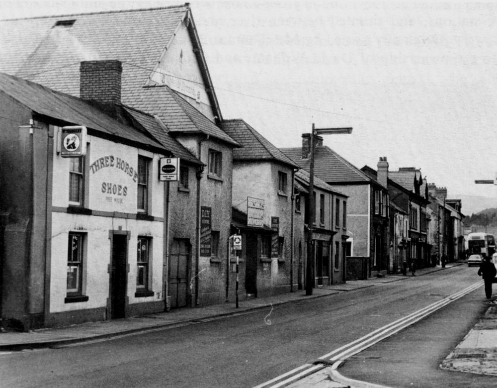
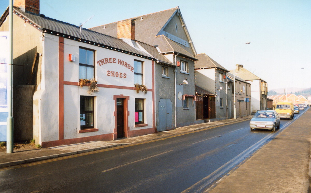
|
The Three Horse Shoes, and the Kirkhouse
|
|
| |
|
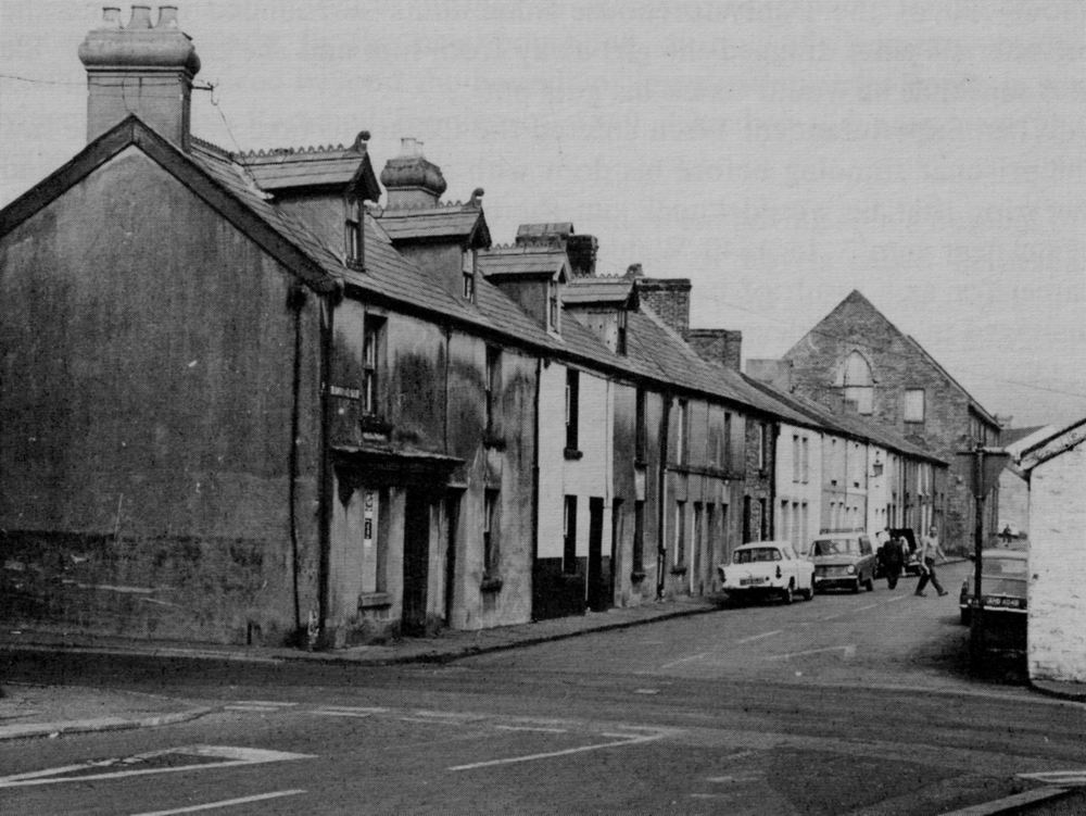
Tramroadside.
(At the end of the street is Merthyr's first
Catholic Church)
|
|
|
|
|
|
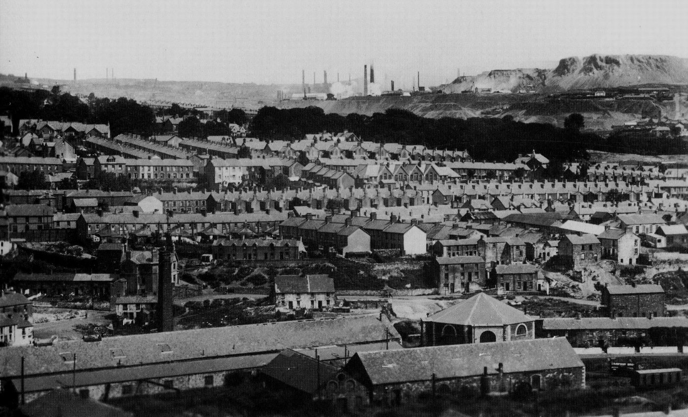
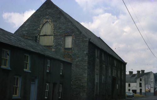
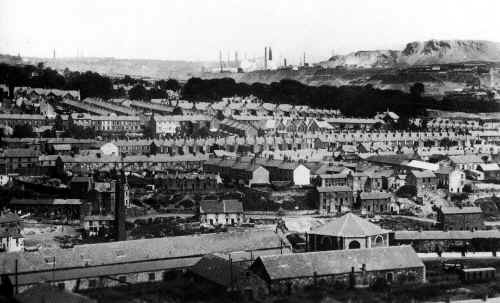
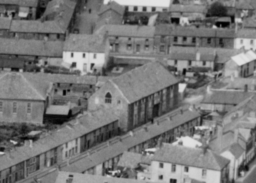
Aerial Shot centred on
Tramroadside, showing the Catholic Church
and Bethel Chapel on the extreme
left. |
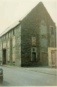
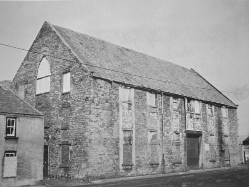
Georgetown St. Mary's Catholic Church. Once
it became obsolete it was convert into apartments (Sectioned Housing) as lodgings for spanish immigrant workers
and in its final days was used as a council store.
|
|
 |
|
 |
| |
| Georgetown St. Mary's Catholic Church. |
| |
 |
|
From the Leo Davies Collection |
|
 |
|
|
|
| |
|
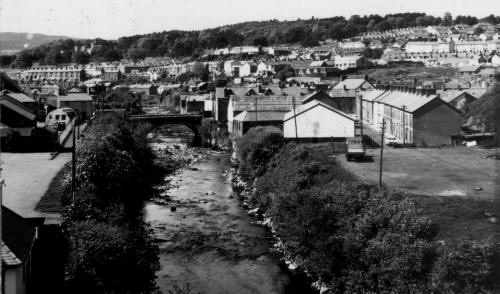
Tramroadside.
Complete with the tramroad, looking towards the Ynysfach
Ironworks. |
|
 |
| |
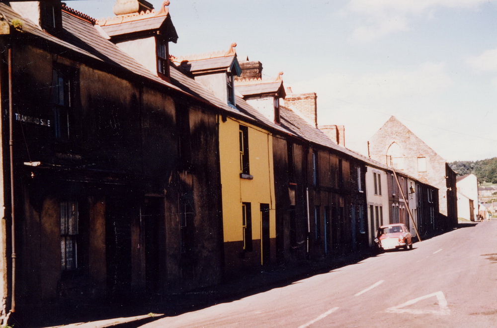
| Tramroadside, Georgetown |
|
 |
| |
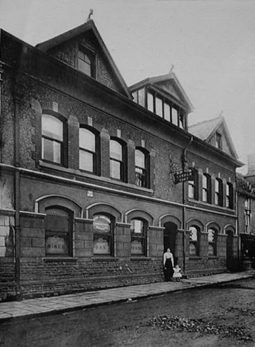
|
The Hollybush, Tramroadside,
Georgetown.
(Photograph
courtesy of the Ken Gunter Collection) |
|
_Hollybush_KenGunter_small.jpg) |
|
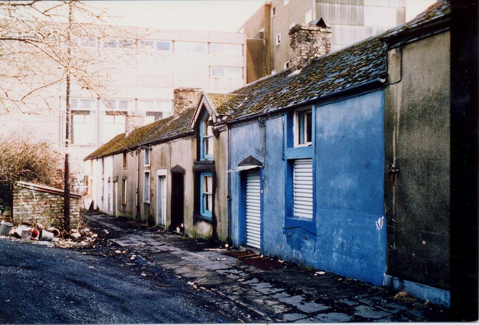
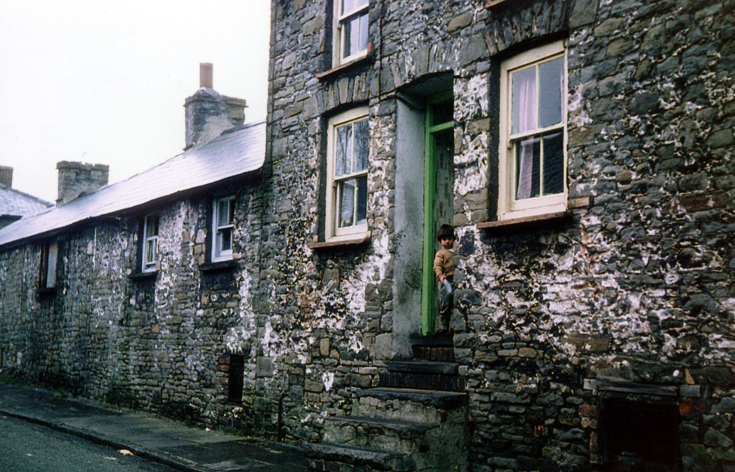
| John Street. |
|
 |
|
|
John street in 1979-80.
(Photograph
Courtesy of Brian Wall) |
|
 |
|
|
|
Click Here
For
John Street
Festival Of
Britain
Celebrations |
| |
| |
|
John Street in 1979-80.
(Photograph
Courtesy of Brian Wall) |
|
 |
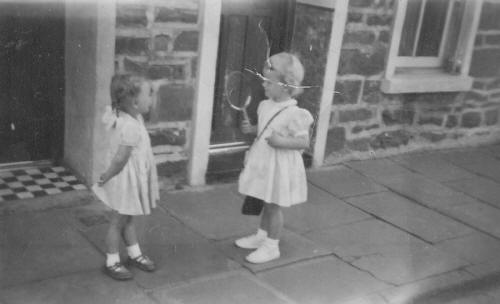
22 John Street - Georgetown
Mari Williams on the right, and
Yvonne Egan is on the left.
(Photograph Courtesy of Mari
Sloman nee Williams) |
|
 |
| |
| |
|
Upper John Street 1960’s. |
|
 |
| |
|
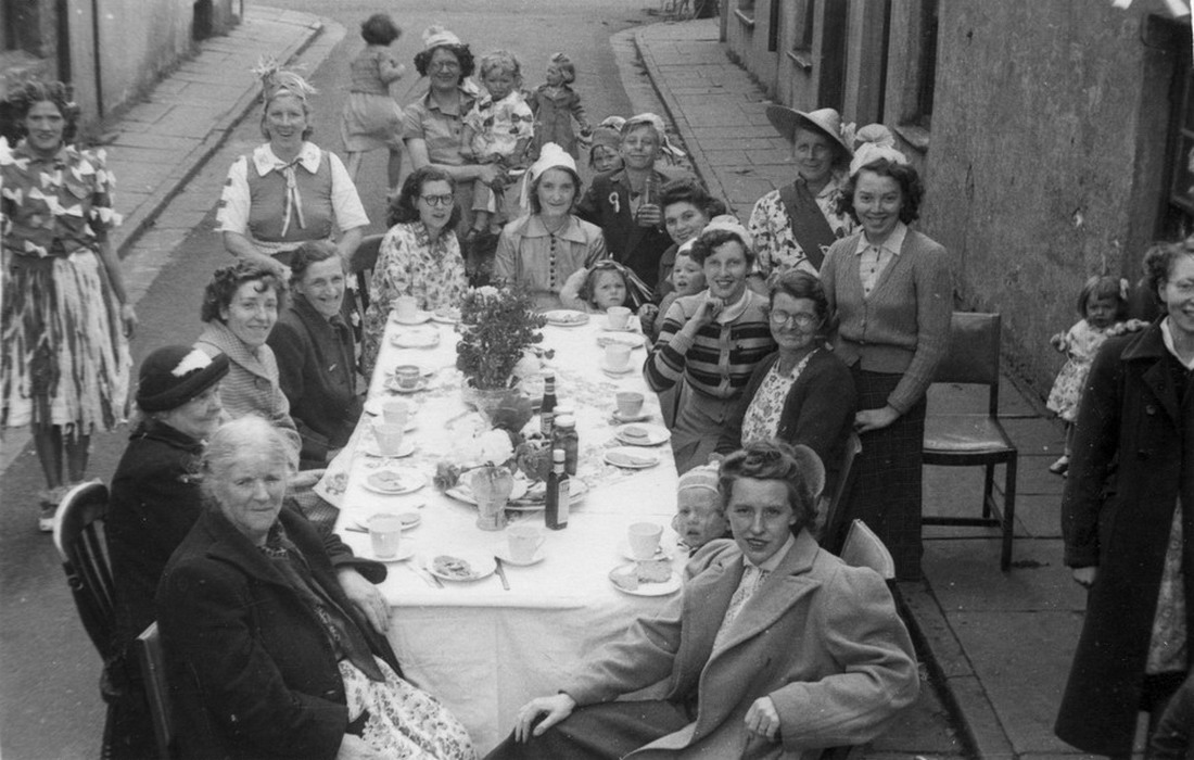
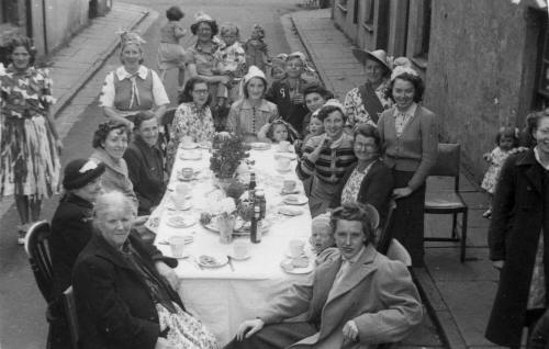
1953 Coronation, street
party in Bethel Street .
Brian Wall tells us that in the
photograph are, Bessie Mac (sitting at the table to the right, with glasses
on), Mrs Mullins who lived at no 6, sitting
at the table to the left with
glasses on.
(Photograph
Courtesy of Michael Donovan) |
|
 |
|
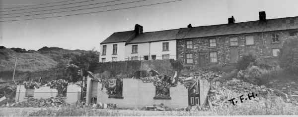
| White Row from John Street.
(Photograph courtesy of Dr T.F.Holly) |
|
 |
|
|
|
|
This Picture shows Chapel Row, birthplace of the composer Joseph Parry,
with the chapel still intact, also Caepantywyll, Brecon Road area, Dowlais Ironworks, and the Whitey. |
|
 |
| |
|
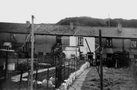
Ynysfach Houses in 1979.
(Photograph courtesy of Dr T.F.Holly) |
|
 |
| |
|
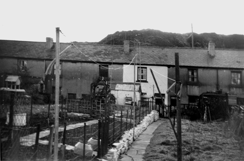
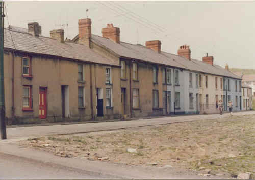
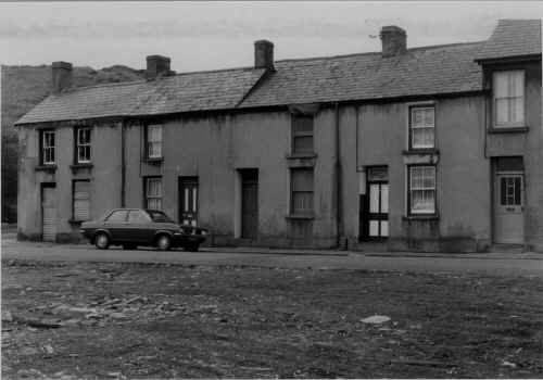
Ynysfach Row
In the first
photograph, the house with the nice garden was number 22 and belonged to
Trevor and Beryl Steed. In the second photograph, the house on the end -
number 17 belonged to Graham Rees.
(Information
Courtesy of Graham Rees) |
|
  |
| |
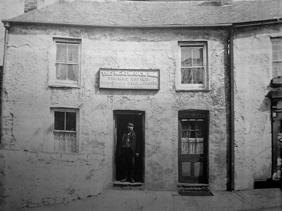
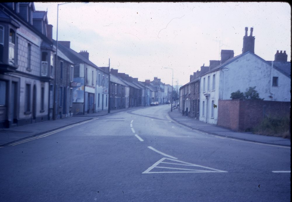
| Penry Street, The Heathcock Inn |
|
 |
| |
|
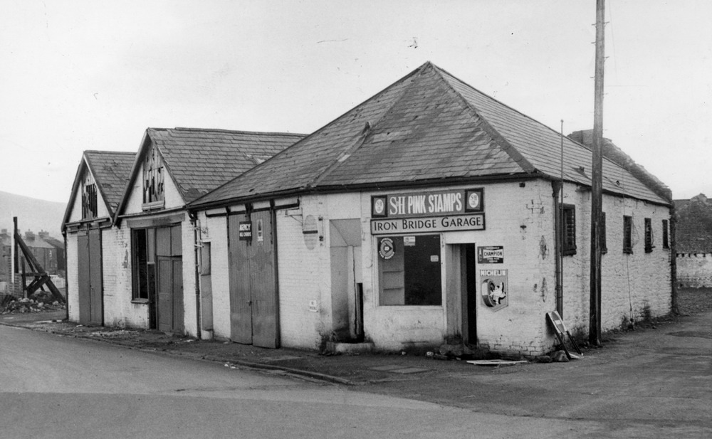
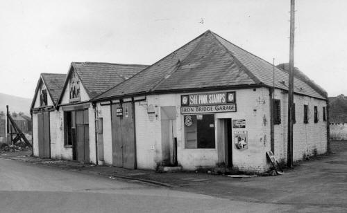
Iron Bridge Garage
(Photograph
Courtesy of K.M. McDonald) |
|
 |
| |
|
Do you have
any photographs or information relating to Georgetown, Merthyr Tydfil?
If so,
please contact us, by clicking the 'Contact Us' button. |
| |
|
|
Go to:
 |

To
Georgetown Map Page |
To Merthyr Map page |
Go to:
 |
|
|
| |
|
 |


_Hollybush_KenGunter.jpg)