![]()
![]()
![]()
![]()
![]()
![]()
|
Pantyscallog |
|||||||||
|
Merthyr Tydfil |
|||||||||
|
<Click On The Photograph To Enlarge> |
|||||||||
|
|||||||||
|
|||||||||
|
|||||||||
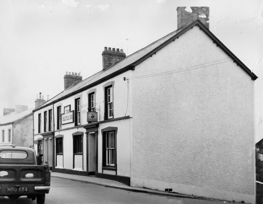
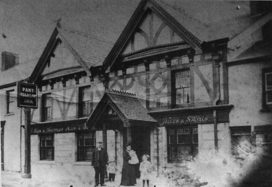
| The Ivor Castle Inn, Pantyscallog | |||||||||
|
|
|||||||||
|
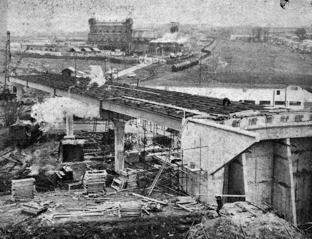
Building the Heads of the Valley Road From the Merthyr Express. (Photograph Courtesy of Selwyn Regan) |
|||||||||
|
|
|||||||||
|
|
|||||||||
|
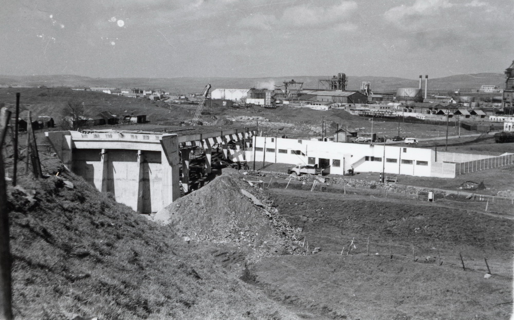
Building the Heads Of The Valley Road - 1963. showing Pant Baths and in the distance the I.C.I. Works (photograph from the book Pantyscallog Village, by J Ann Lewis) |
|||||||||
|
|||||||||
|
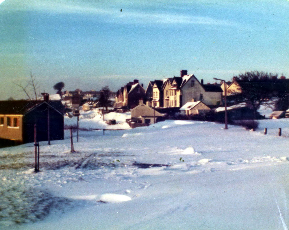
The Hafod - Winter 1982 (Photographs courtesy of Elwyn Jones) |
|||||||||
|
|||||||||
|
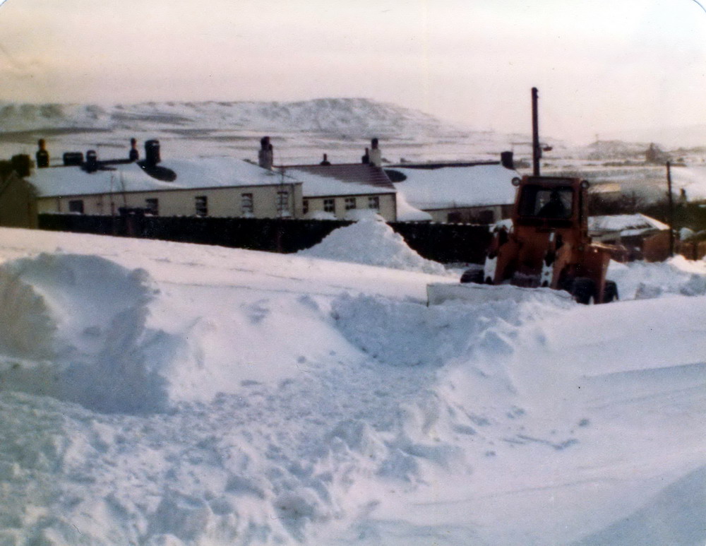
Building the Hafod - Pant Early 1980's (Photograph courtesy of Elwyn Jones) |
|||||||||
|
|
|||||||||
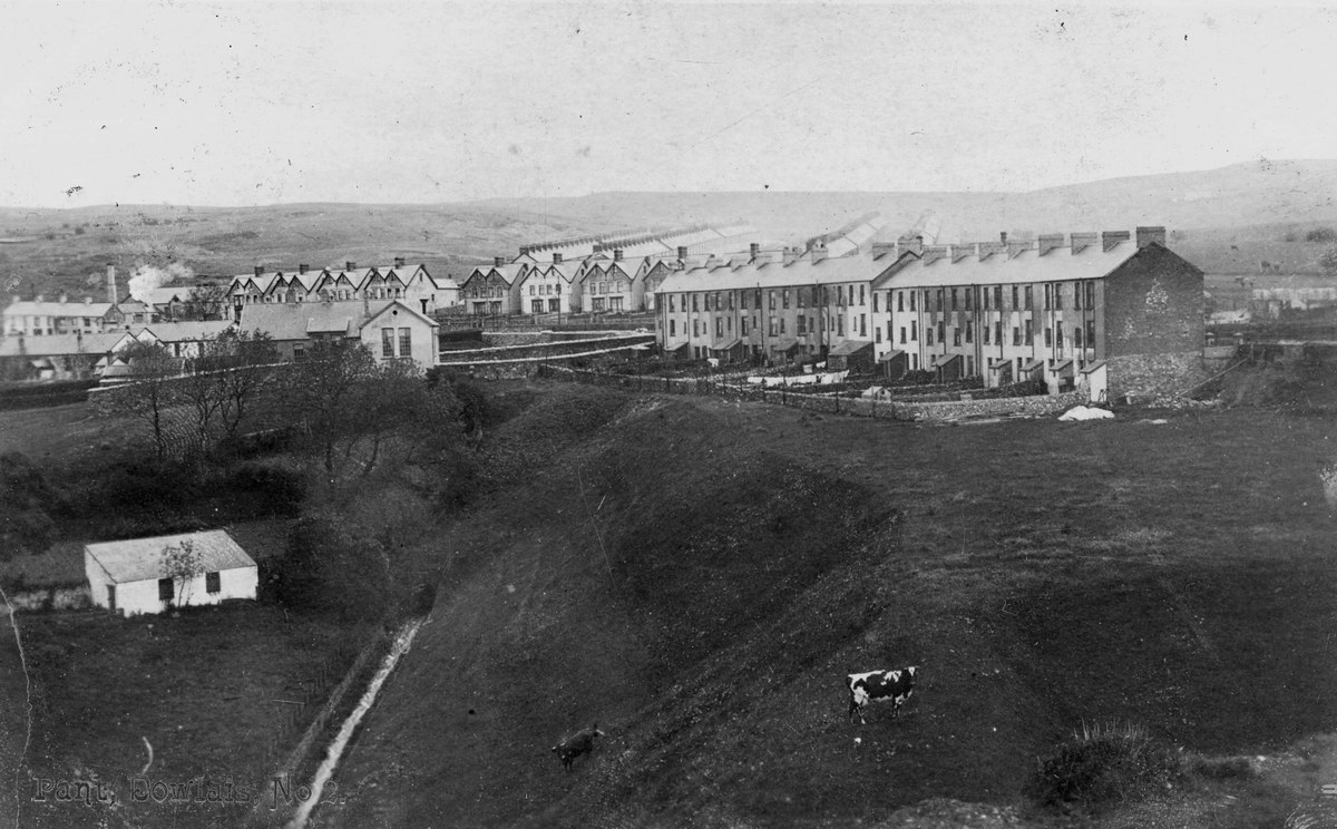
|
Pant, Dowlais The Morlais Brook can be seen. (Postcard courtesy of Gill Thomas) |
|||||||||
|
|
|||||||||
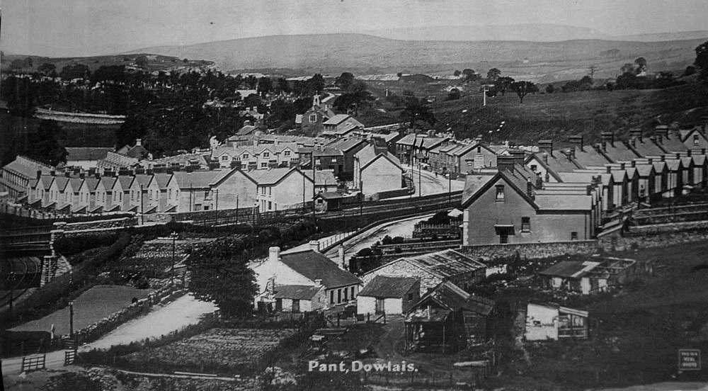
|
Pant, Dowlais |
|||||||||
|
With the railway from Dowlais Central station (now the Leisure Centre) to Pant Station, in the middle of the picture, On the left side, under the bridge, is the LNWR line which went through the "Miler" tunnel to Pontsarn, Cefn Coed and eventually Merthyr. |
|||||||||
|
|
|||||||||
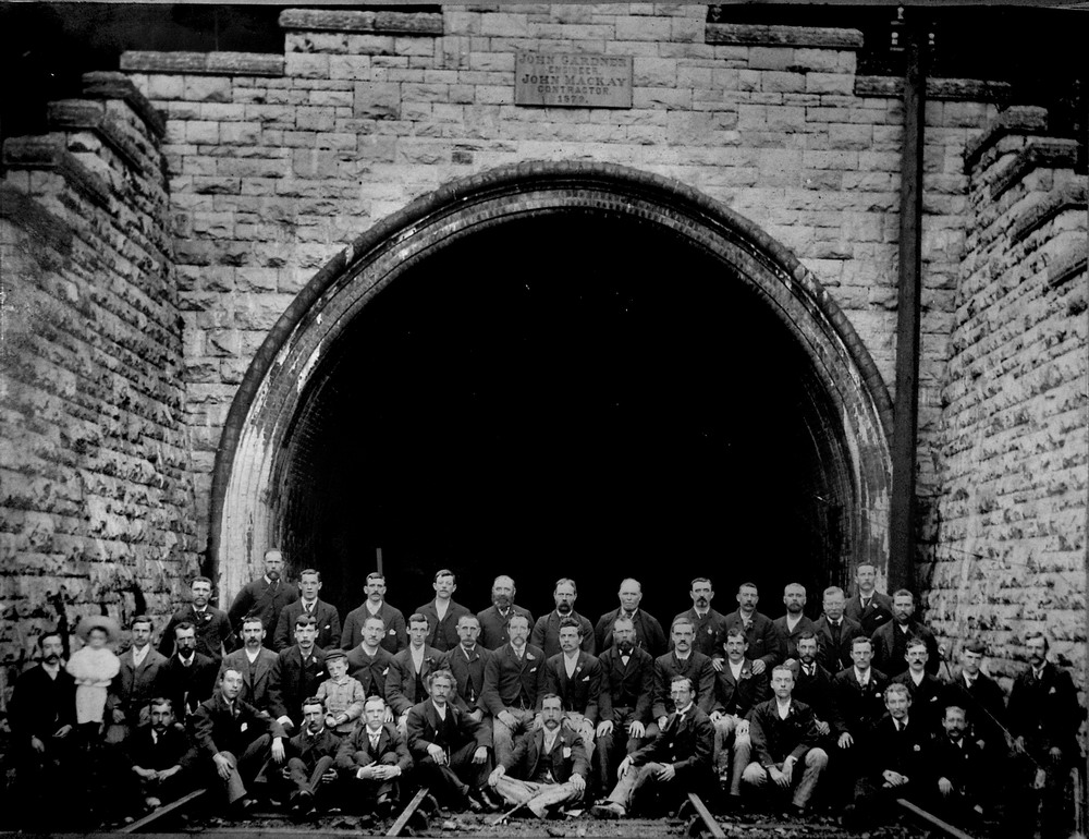
| Morlais Tunnel (Miler Tunnel) | |||||||||
|
|
|||||||||
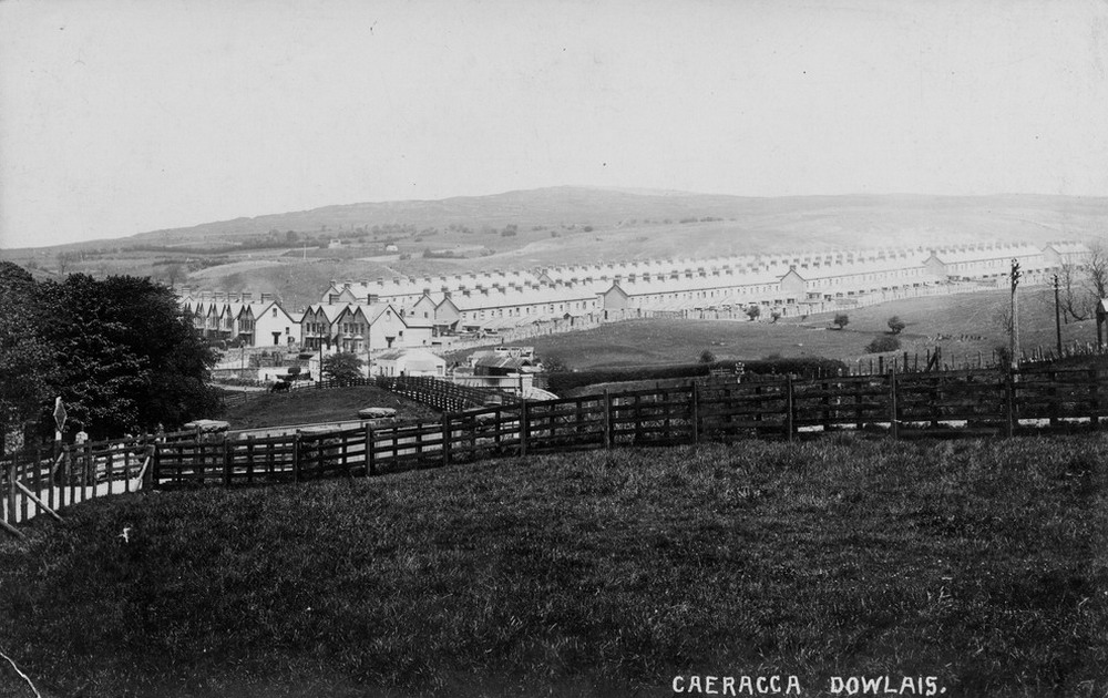
|
Caeracca, Pant (Photograph Courtesy of Mrs. Gill Thomas) |
|||||||||
|
|
|||||||||
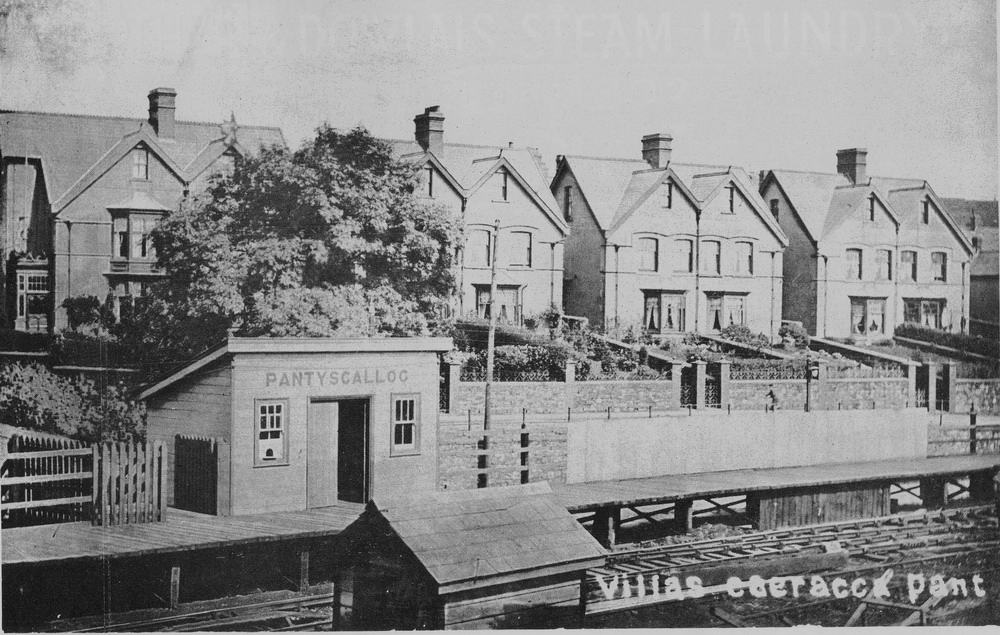
|
The Villas, Caeracca, Pant |
|||||||||
|
|
|||||||||
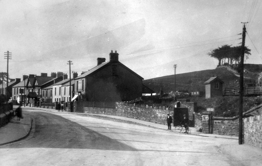
|
Site of the War Memorial, to the right is the old Caeracca Railway bridge, and in the distance the Pantyscallog Inn. (photograph from the book Pantyscallog Village, by J Ann Lewis) |
|||||||||
|
|
|||||||||
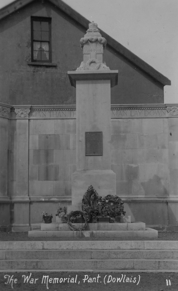
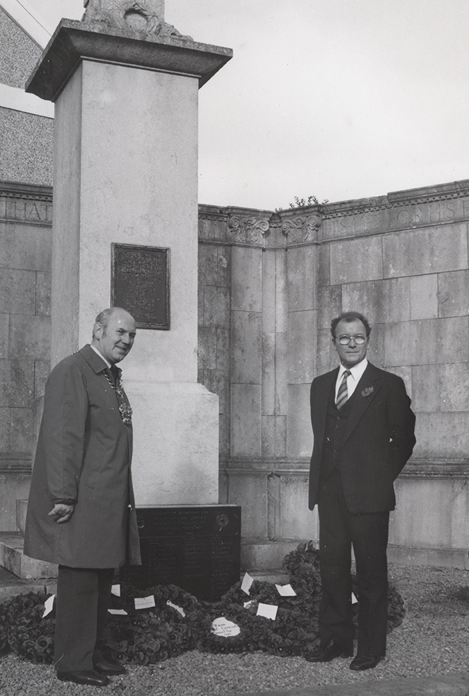
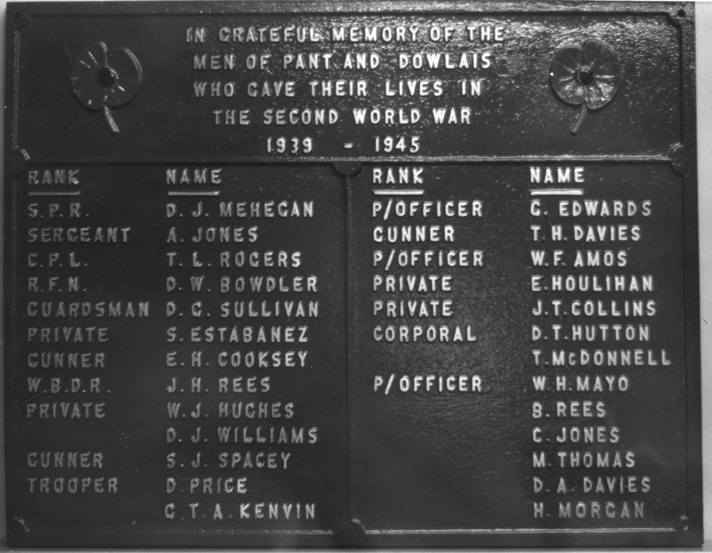
|
The War Memorial (Postcard Courtesy of Mrs Thomas, West Grove) |
|||||||||
|
|||||||||
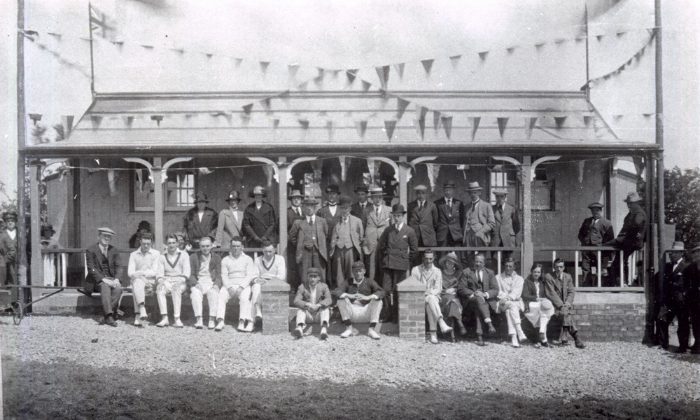
| Pant Cricket Club in the 1920's | |||||||||
|
|
|||||||||
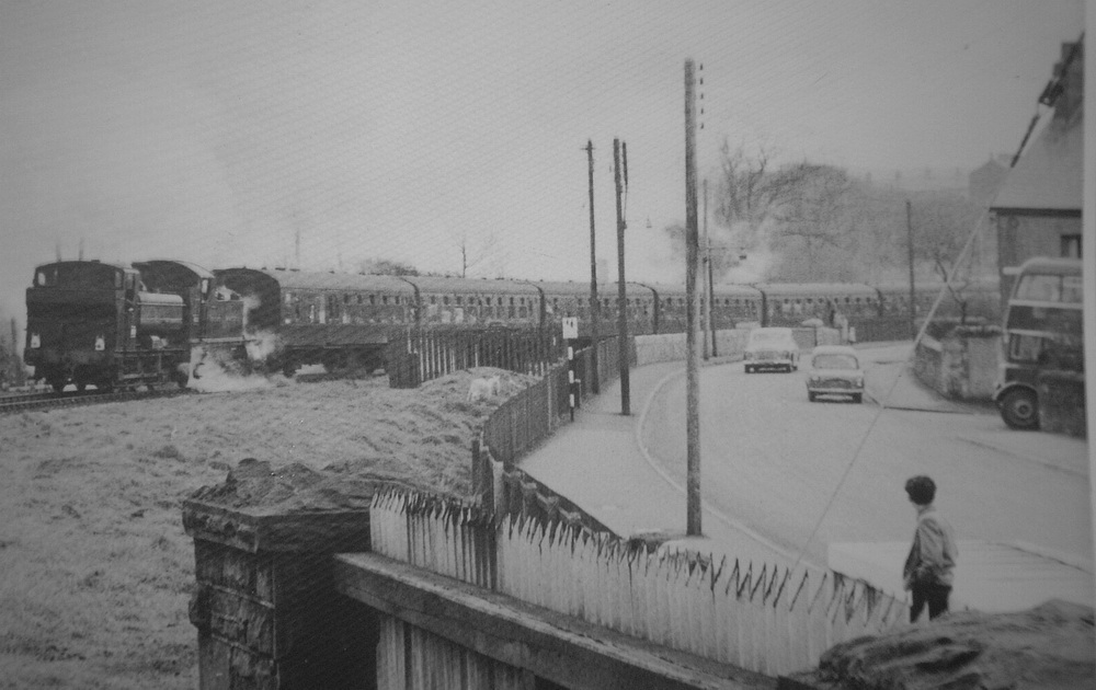
|
Pant Road A special train from Dowlais Central Station, in the early 60's. |
|||||||||
|
|
|||||||||
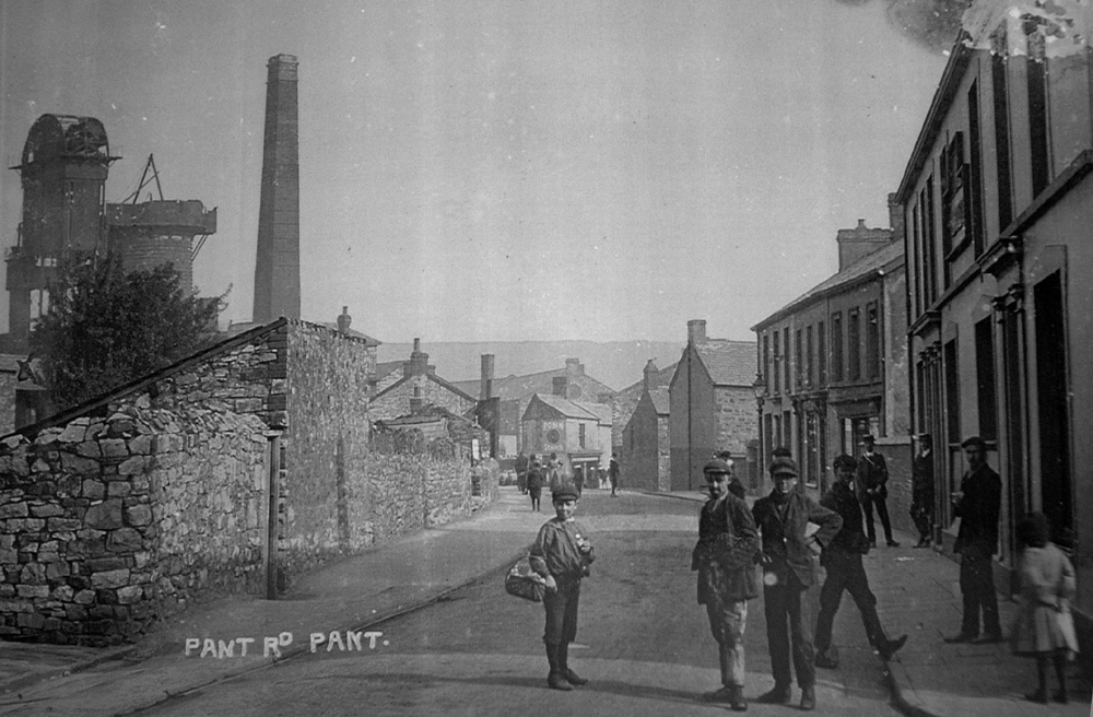
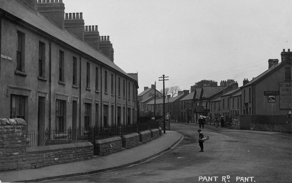
| Pant Rd., Pant. | |||||||||
|
|
|||||||||
|
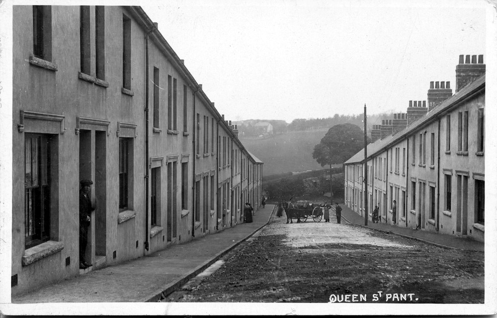
Queen Street. (Postcard courtesy of Gill Thomas, West Grove) |
|||||||||
|
|
|||||||||
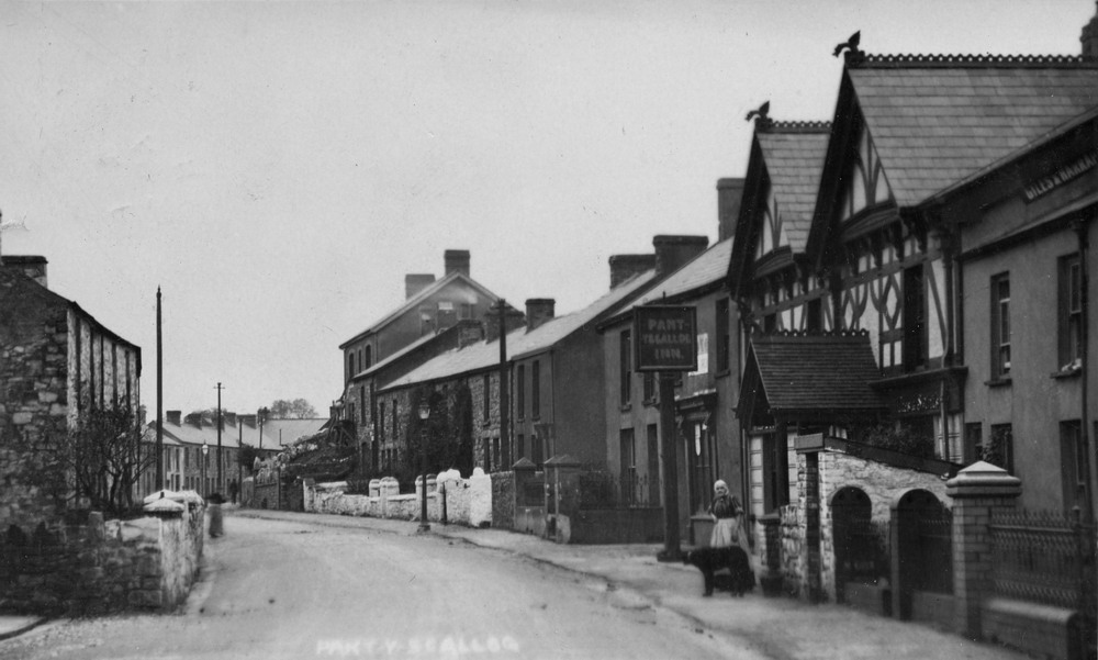
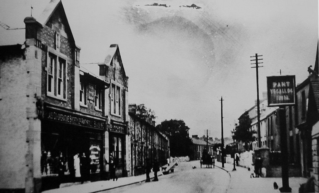
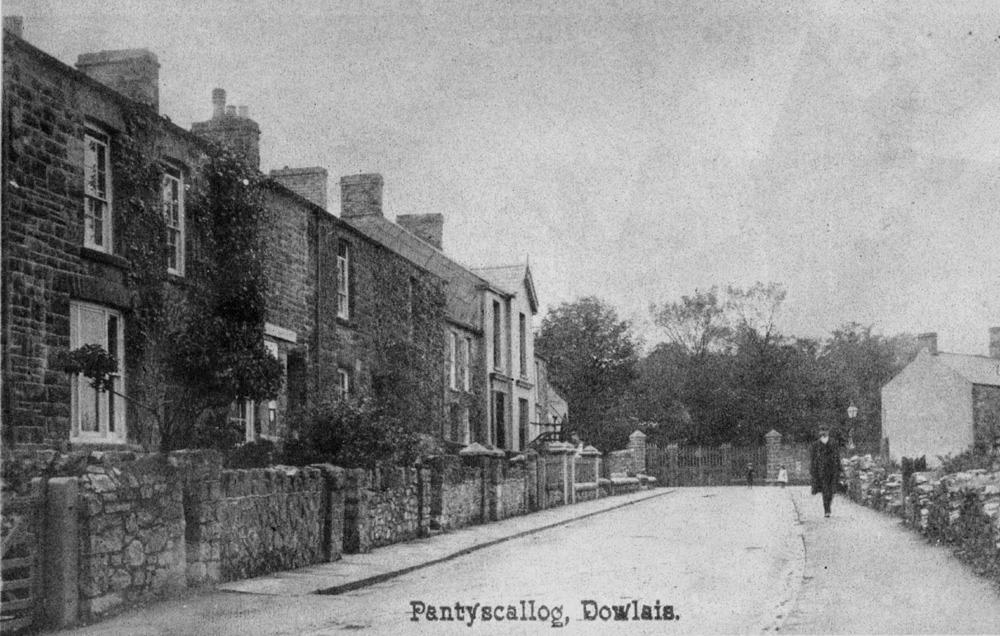
| Pant y scallog. | |||||||||
|
|
|||||||||
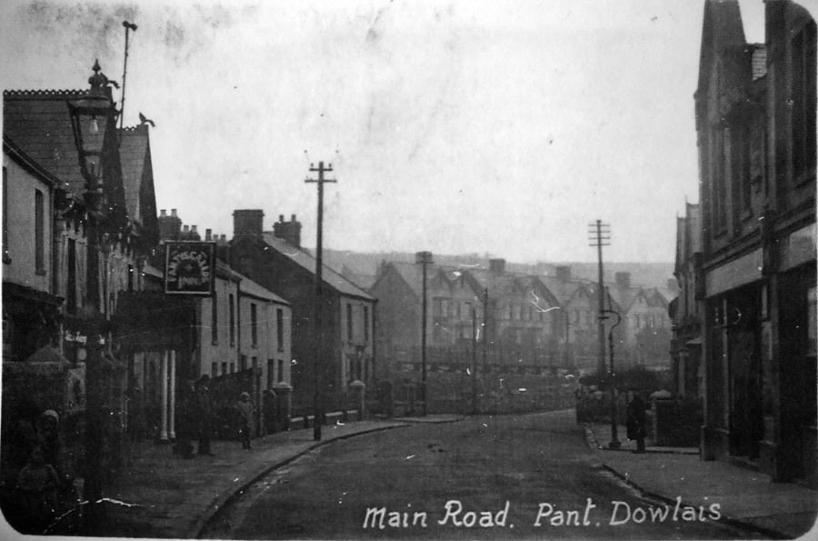
| Main Road, Pant | |||||||||
|
|
|||||||||
|
The Pantyscallog Inn (photograph from the book Pantyscallog Village, by J Ann Lewis) |
|||||||||
|
|
|||||||||
|
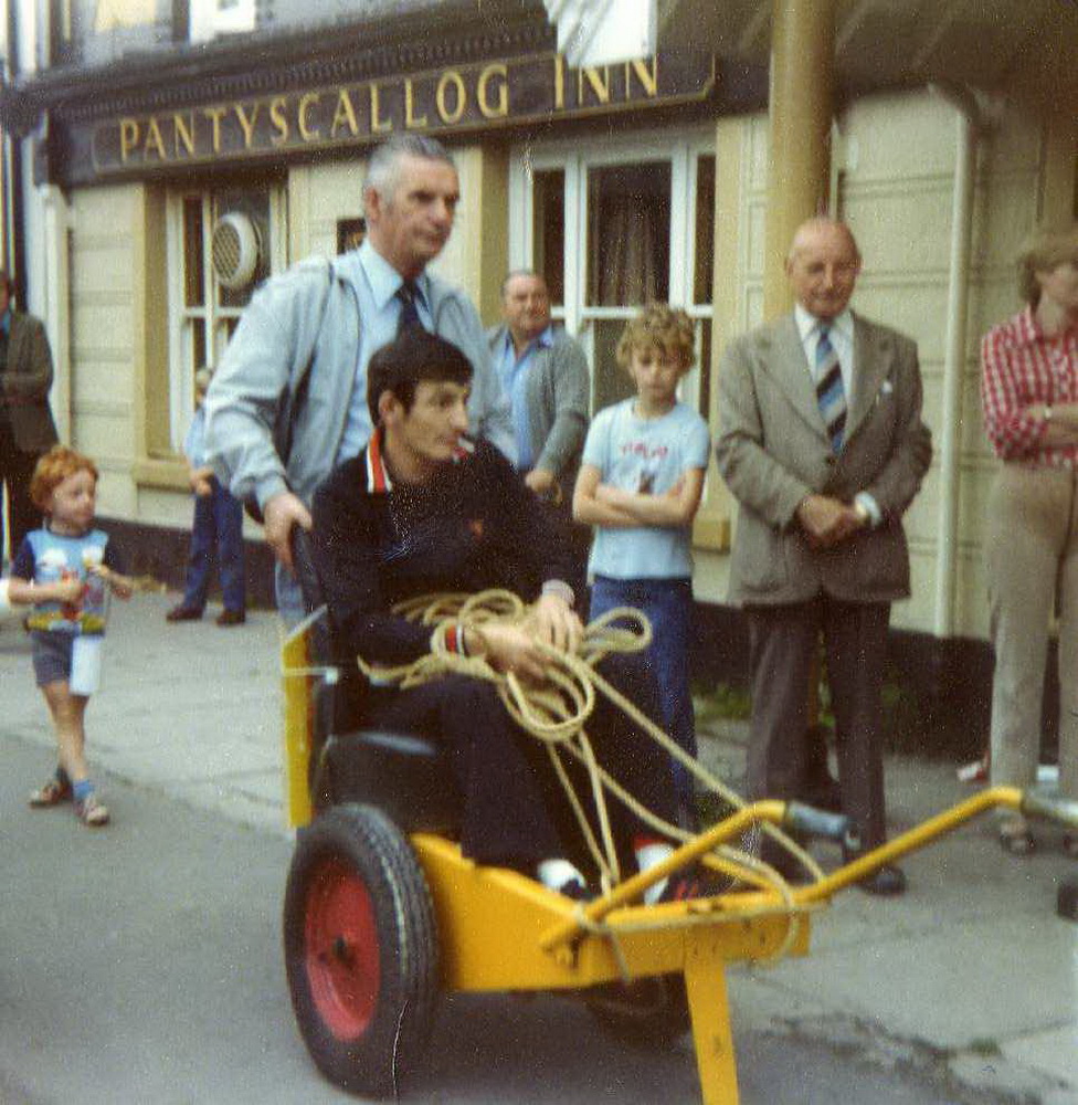
Merthyr's Boxer Johnny Owen on a charity event in Pant, passing the Pantyscallog Inn. Eddie Dinham Landlord of the Silver Slipper Looks on. (Photograph courtesy of Idwal Peter) |
|||||||||
|
|
|||||||||
|
The Cooperative and the Pantyscallog Inn |
|||||||||
|
|
|||||||||
|
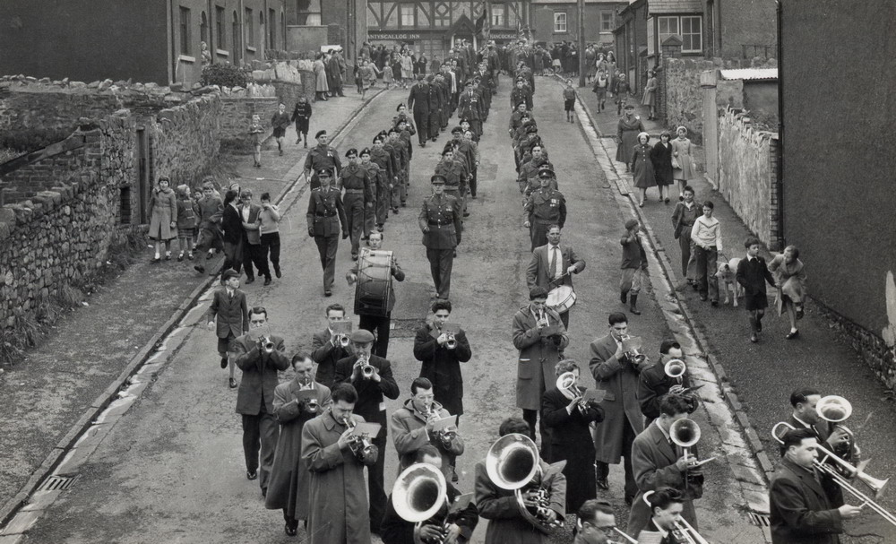
Band and soldiers, marching down Cross King Street from Pant Road and turning into King Street. (Photograph courtesy of Dick Meyrick) |
|||||||||
|
|
|||||||||
| Pant School. | |||||||||
|
|||||||||
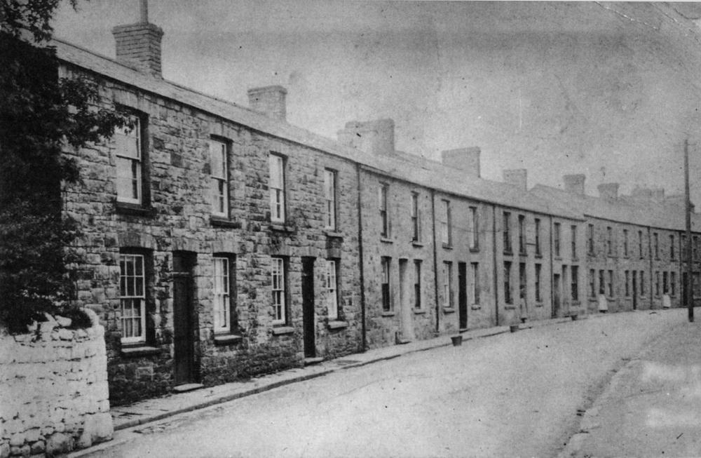
|
Francis Terrace (Photograph from the book Pantyscallog Village, by J Ann Lewis) |
|||||||||
|
|
|||||||||
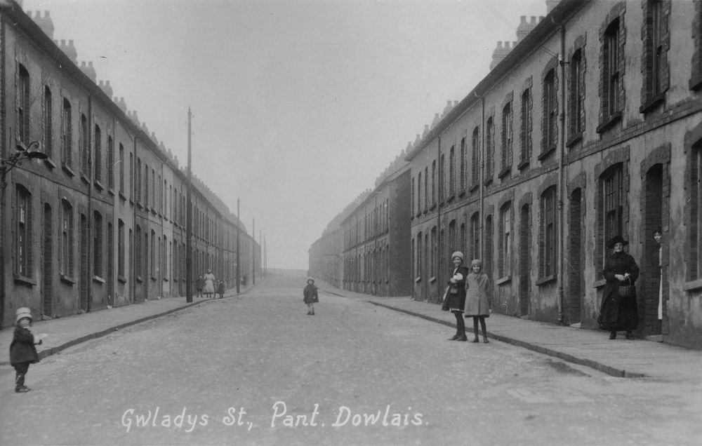
|
Gwladys Street |
|||||||||
|
|
|||||||||
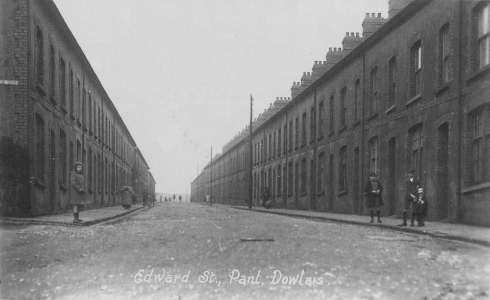
|
Edward Street |
|||||||||
|
|
|||||||||
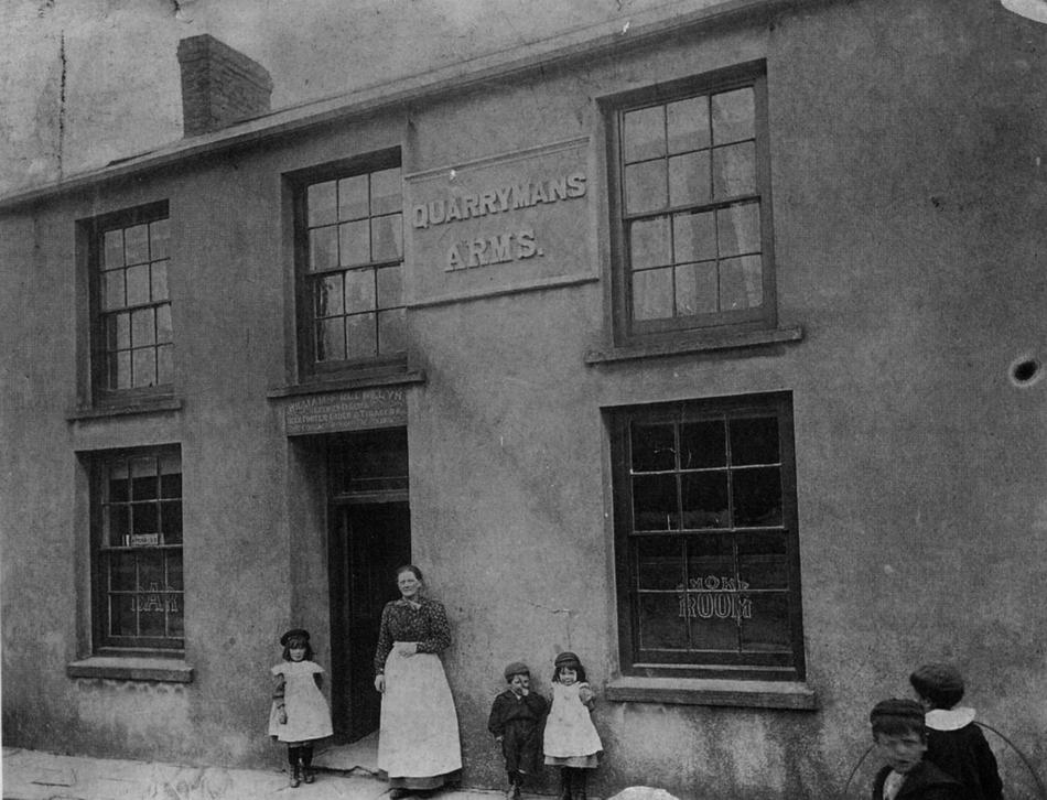
|
The Quarrymen's Arms (Photograph from the book Pantyscallog Village, by J Ann Lewis) |
|||||||||
|
|
|||||||||
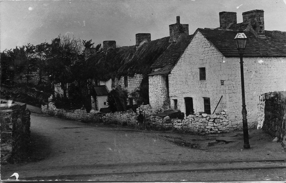
|
Pantyscallog Road, The Cemetery gates in the distance (Photograph from the book Pantyscallog Village, by J Ann Lewis) |
|||||||||
|
|
|||||||||
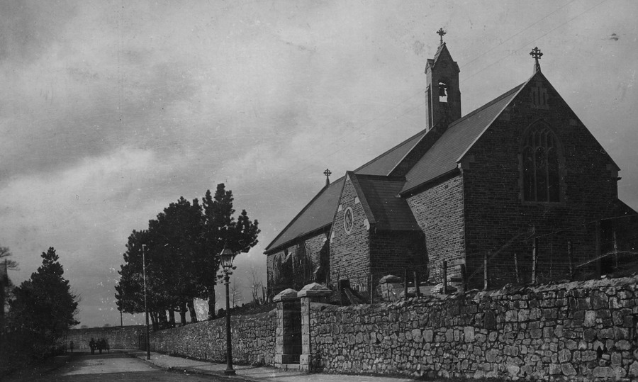
| Christchurch, Pant Church. | |||||||||
|
|||||||||
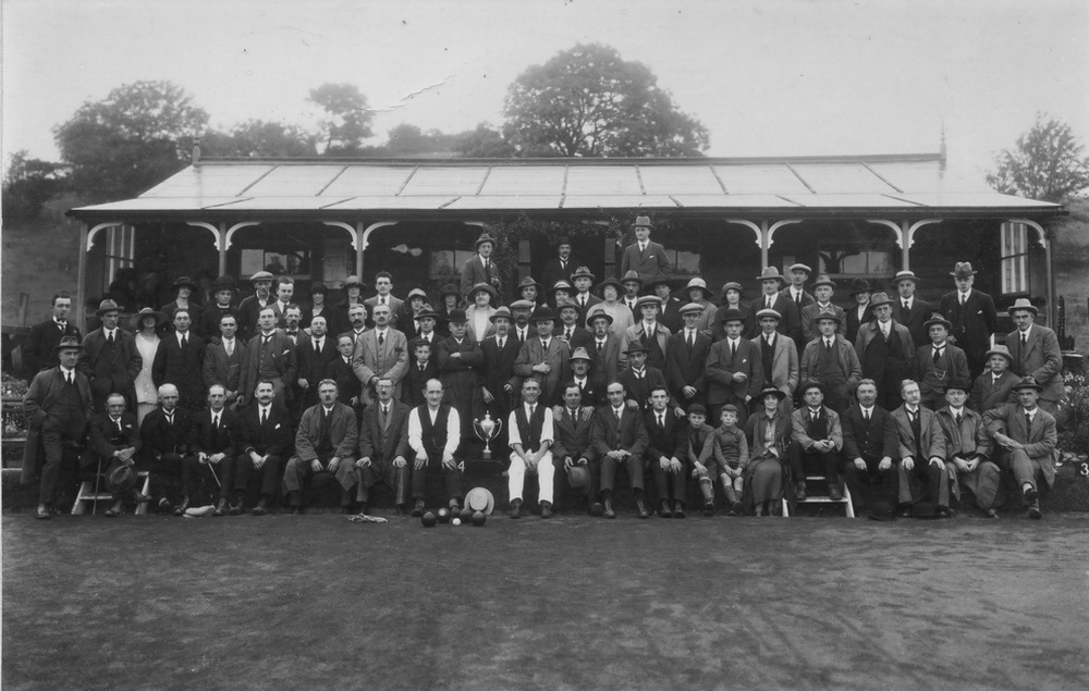
| Pant Bowls Club - Miner's Welfare - Circa 1920 | |||||||||
|
|
|||||||||
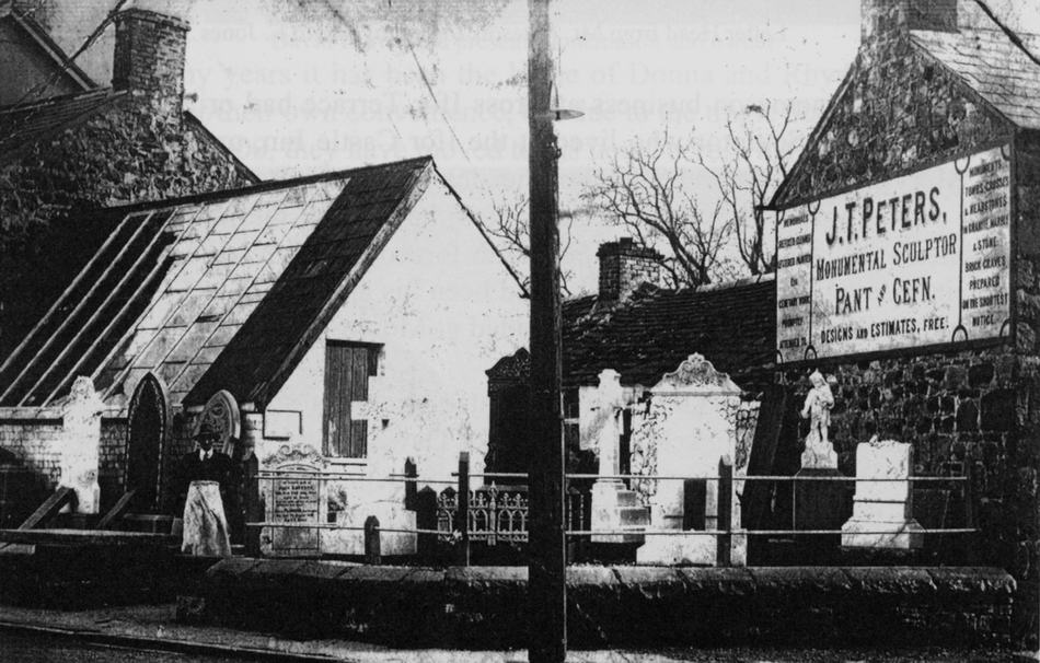
|
J.T.Peters Monumental Sculptor (Photograph from the book Pantyscallog Village, by J Ann Lewis) |
|||||||||
|
|
|||||||||
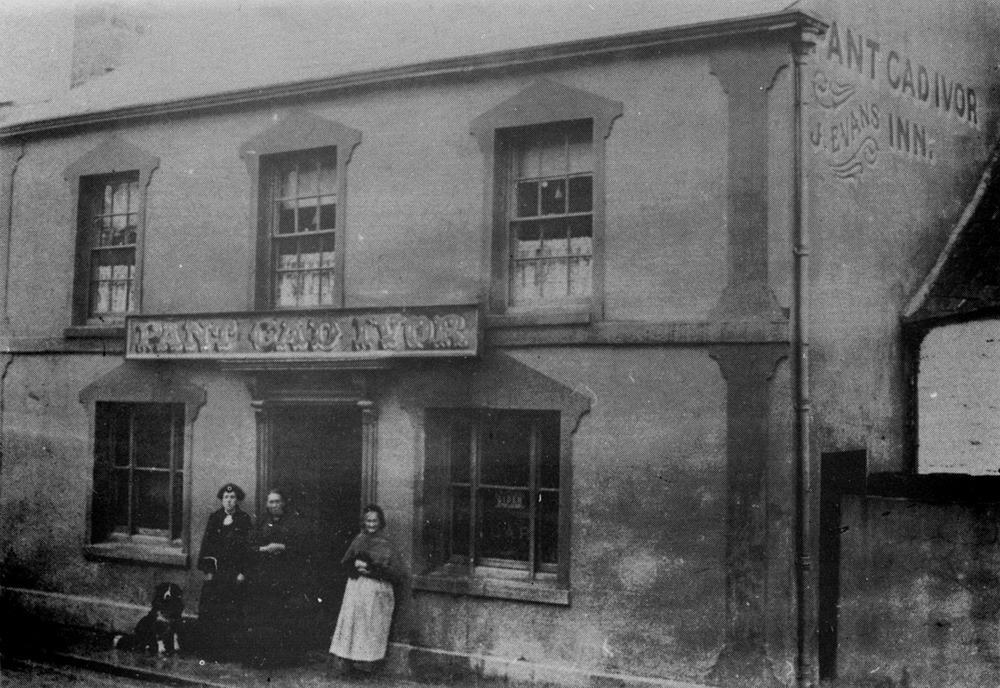
|
Pant Cad Ivor Inn - 1910 |
|||||||||
|
|
|||||||||
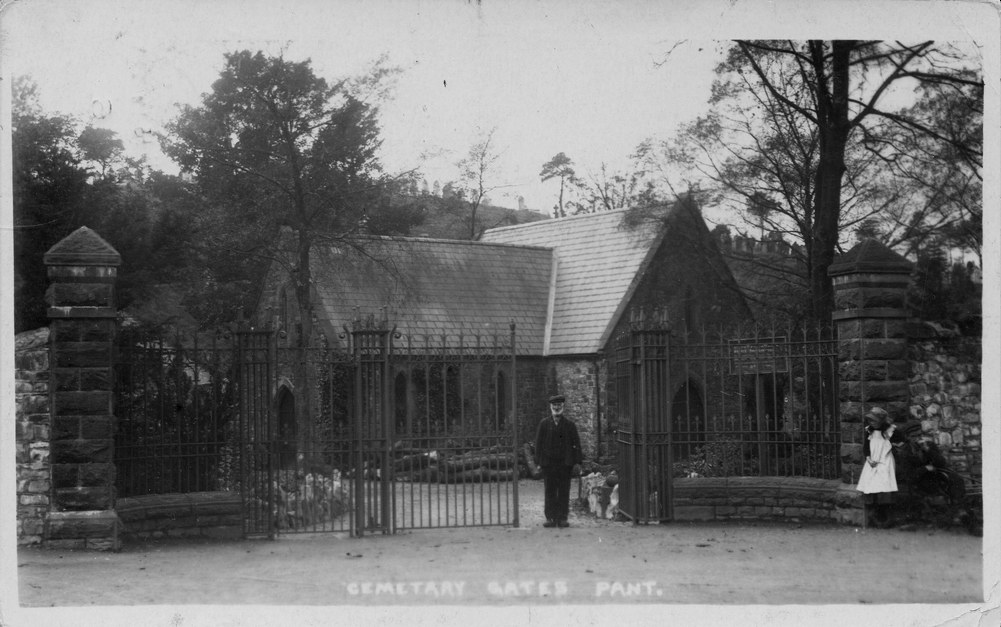
|
Pant Cemetery Gates. (Postcard courtesy of Gill Thomas, West Grove) |
|||||||||
|
|
|||||||||
|
(Postcard courtesy of The Leo Davies Collection) |
|||||||||
|
|
|||||||||
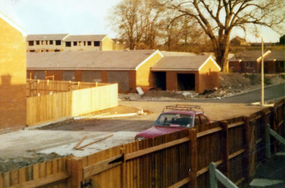
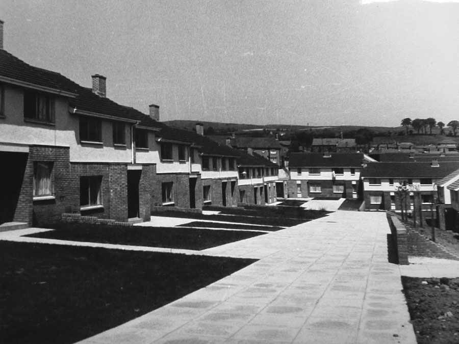
| St. Luke's Close just after Construction | |||||||||
|
|
|||||||||
|
Do you have any photographs or information relating to Pantyscallog (Pant)? If so, please email us, by clicking the 'Contact Us' button. |
|||||||||
|
To The Map |
|||||||||
|
|