![]()
![]()
![]()
![]()
![]()
![]()
| Plymouth Street | ||||||||||||||||
| Merthyr Tydfil | ||||||||||||||||
|
<Click on the image to enlarge> |
||||||||||||||||
|
||||||||||||||||
|
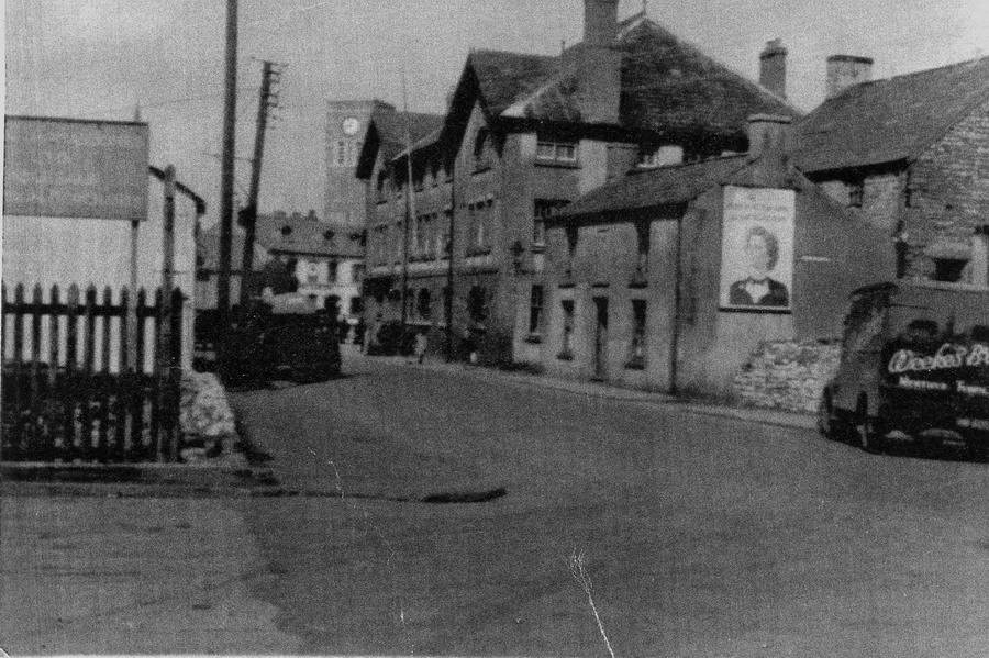
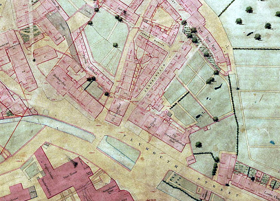
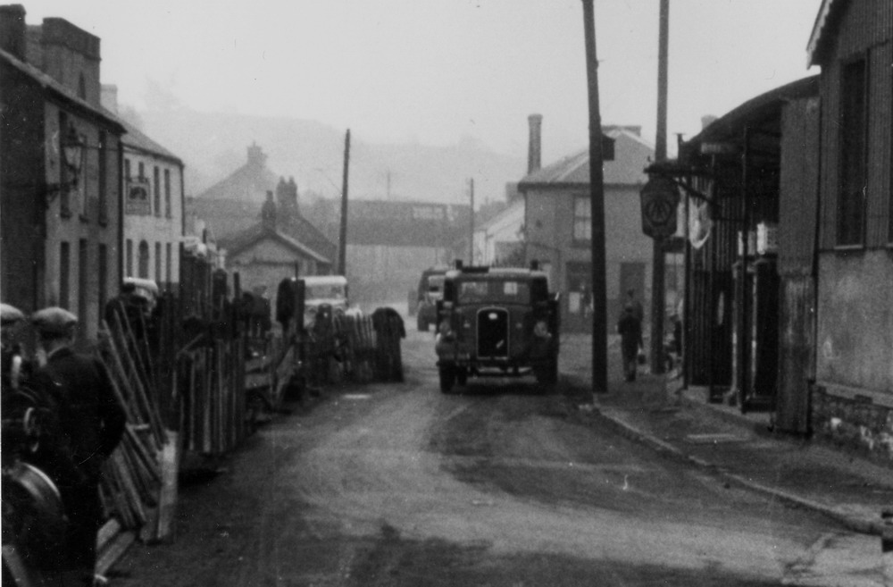
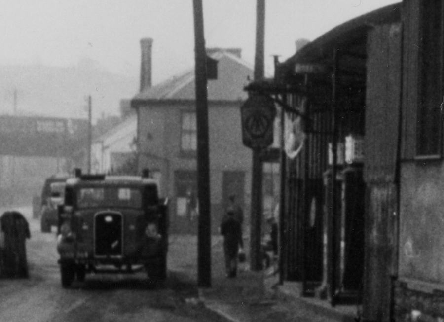
Plymouth Street. in the 1950's The building to the left of the van, with the billboard on is the "King's Head" public house, the street name sign by the billboard reads:- Pedwranfach - (see map below) The other side of the King's Head is the entrance to Ball Court (Click to see)
|
||||||||||||||||
|
||||||||||||||||
|
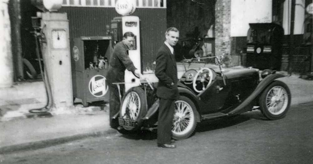
Snow's Garage in the 1950's. With Tommy Bona Senior left and Jim Bick with his gleaming MG TC sports car. |
||||||||||||||||
|
|
||||||||||||||||
| High Street - The Original Snow's Garage - Early 1900's | ||||||||||||||||
|
|
||||||||||||||||
Plymouth Street, The Vanguard Inn on the left, and on the right Mrs Breeze's Garage This photograph is part of a series of photographs taken by Birmingham Photography Club, during the provision of a new main sewer. |
||||||||||||||||
|
|
||||||||||||||||
|
The Vanguard, in the 1950's. It was called the Greyhound Hotel In the early 1900's . (not to be confused with the Greyhound in Bridge Street, Caedraw.) |
||||||||||||||||
|
|
||||||||||||||||
|
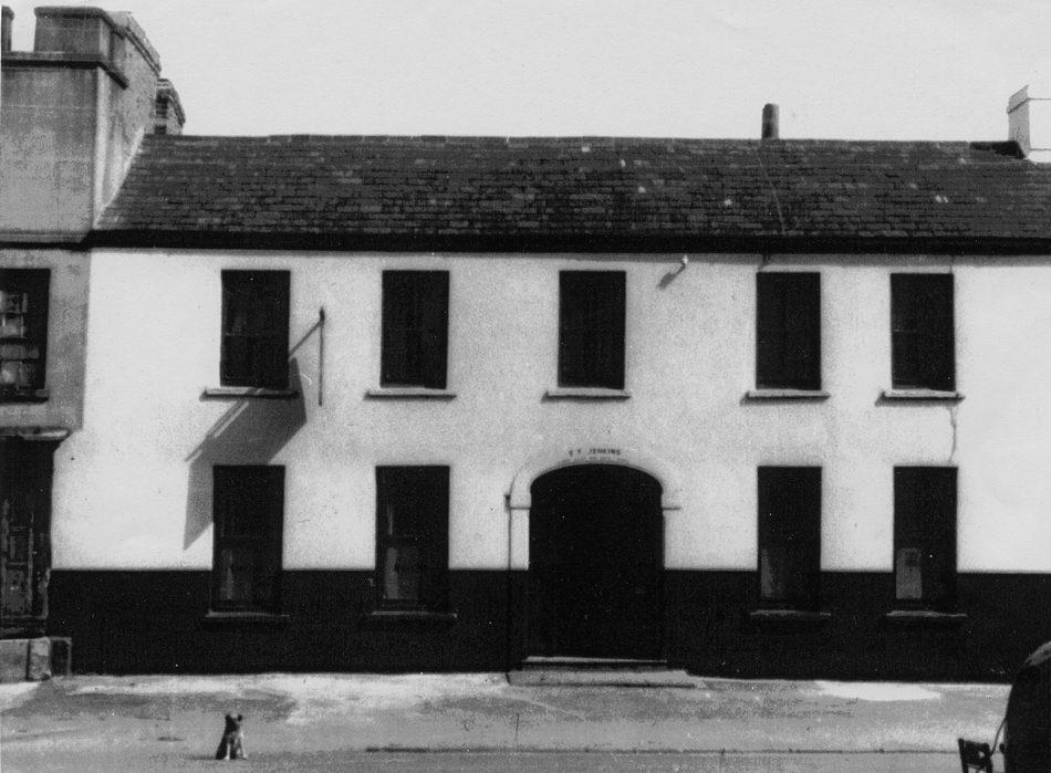
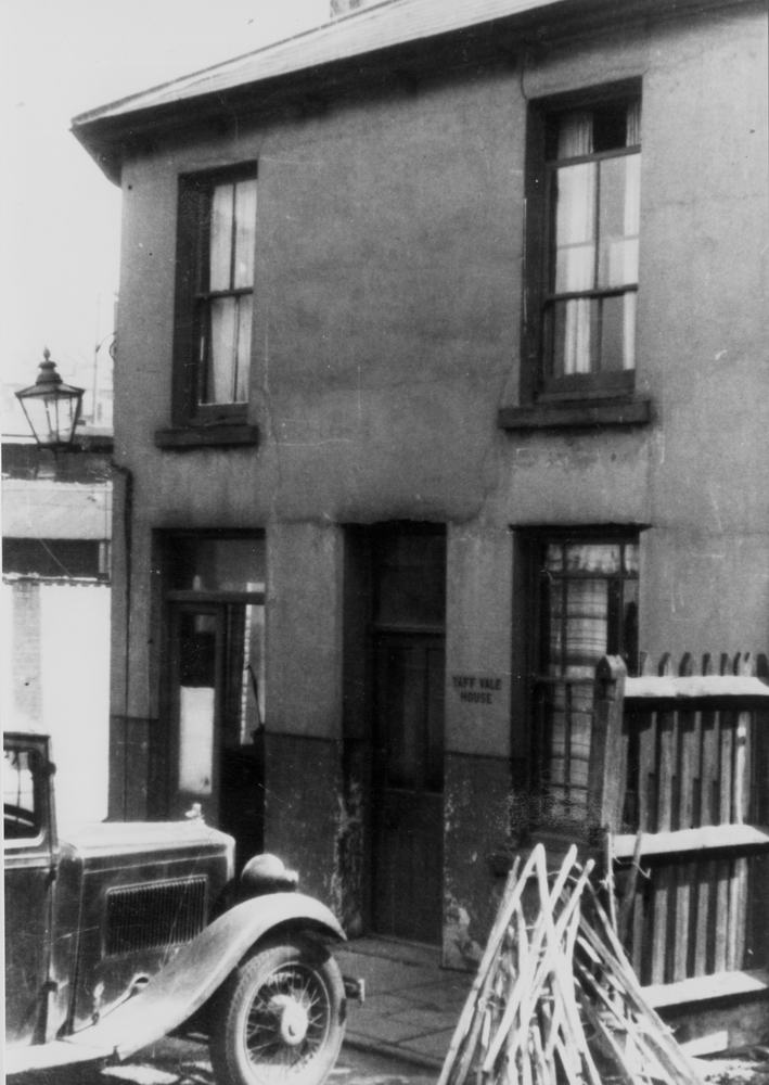
Taff Vale House, was situated at the entrance to the Taff Vale Railway Station, (later to become the Plymouth Street Goods Yard of the GWR). It was just about opposite the Vanguard. These photographs were taken in 1947. |
||||||||||||||||
|
||||||||||||||||
|
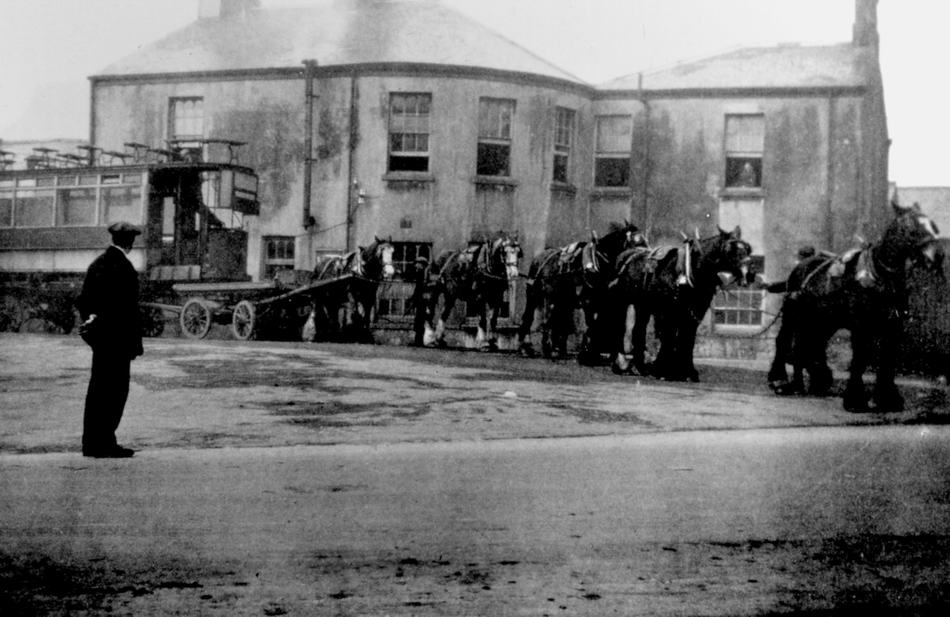
Taff Vale Railway Station. Looking from the Vanguard Inn. Here we see a second hand Tramcar purchased from the Birmingham & Midland Tramways Joint Committee, being drawn by horses on the final leg of it's journey to the Merthyr Electric Traction & Lighting Company Ltd, depot at Traction Yard, Penydarren. |
||||||||||||||||
|
|
||||||||||||||||
| Another photograph of the Taff Vale Station, taken in the late 1940s | ||||||||||||||||
|
|
||||||||||||||||
|
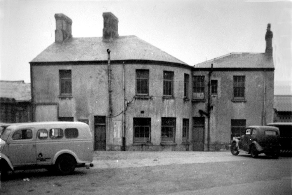
G.P.O. - Plymouth Yard Following the closure of the Plymouth Street Goods Station, the site was occupied by the General Post Office. This photograph, circa 1970, from a time when the Post Office also operated the telephone service. (Photograph Courtesy of Colin Rees) |
||||||||||||||||
|
|
||||||||||||||||
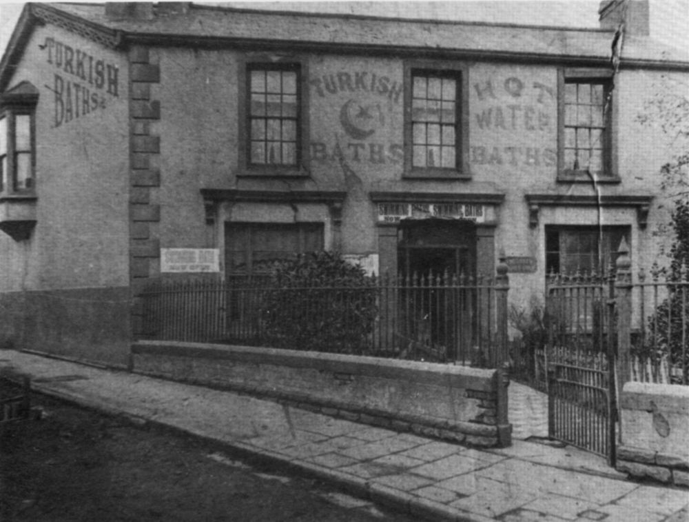
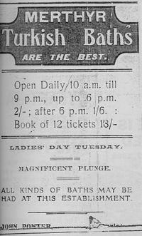
The Turkish Baths, Plymouth Street.
roundabout. |
||||||||||||||||
|
||||||||||||||||
|
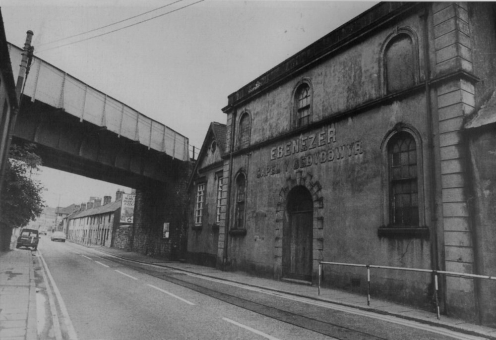
Plymouth Street, in the 1960s. Ebenezer Chapel and beyond the railway bridge Plymouth StCottages , both now demolished, Ebenezer made way for the entrance to Trevithick Gardens. |
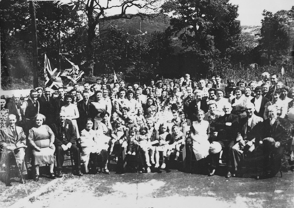
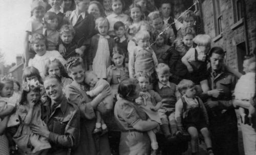
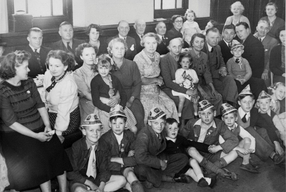
Coronation Party at Ebenezer Chapel - 1953 (Photograph courtesy of Allison Allen)
|
|||||||||||||||
|
|
 |
|||||||||||||||
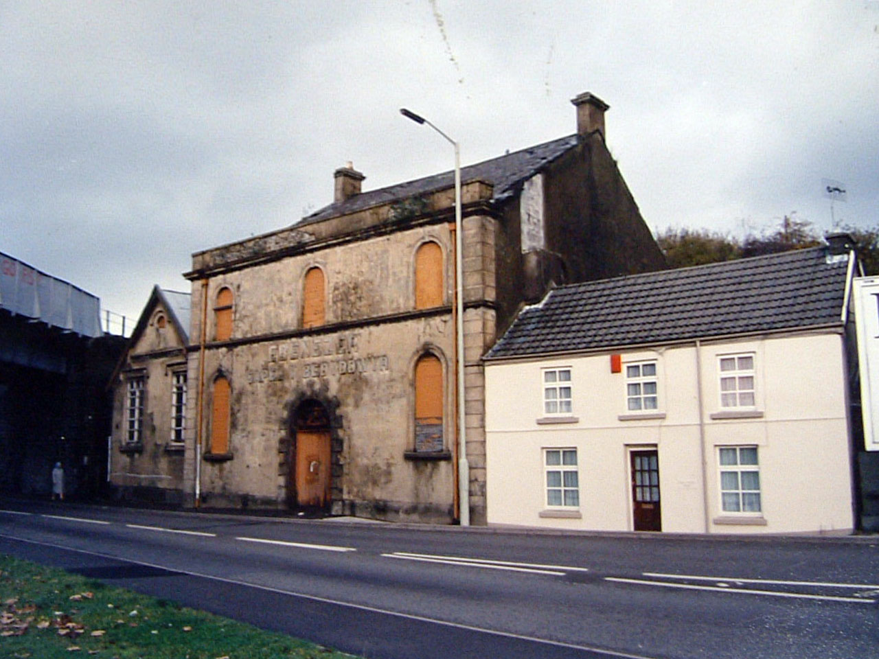
| Plymouth Street, The Ebenezer Chapel in the 1980's. | ||||||||||||||||
|
|
||||||||||||||||
|
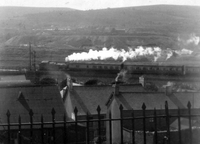
View from Fairview Terrace, Twynyrodyn - towards 'Aberdare Mountain' (Photograph Courtesy of Meryl Rees) |
||||||||||||||||
|
|
||||||||||||||||
|
Plymouth Street. The Britannia Inn on the left hand side. Next door down was used by Schwartz the furnishers as a wharehouse. |
||||||||||||||||
|
||||||||||||||||
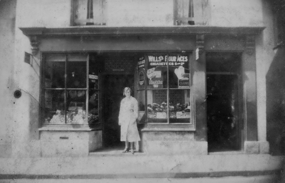
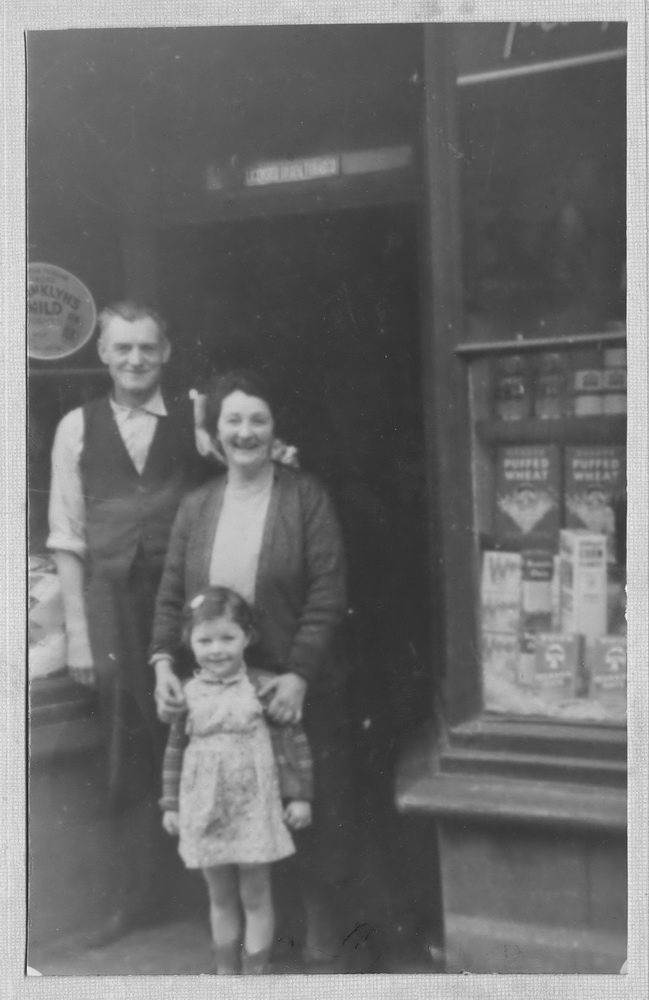
|
Mr & Mrs Weales Shop, 4, DaleTerrace, Plymouth Street. (opp Britannia Inn. (Photographs Courtesy of Wendy Rees) |
Mr & Mrs Weale outside their shop | |||||||||||||||
|
||||||||||||||||
|
|
||||||||||||||||
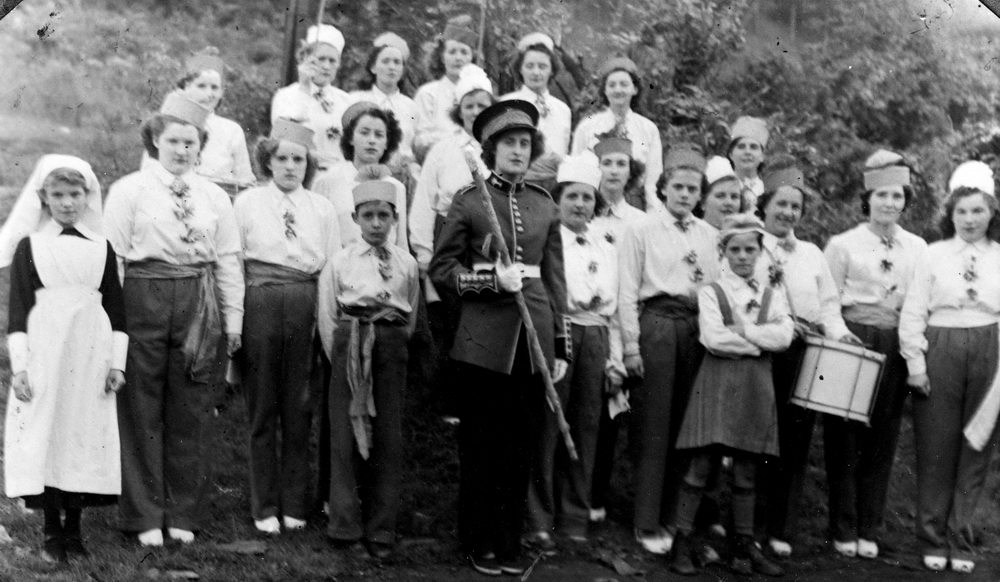
|
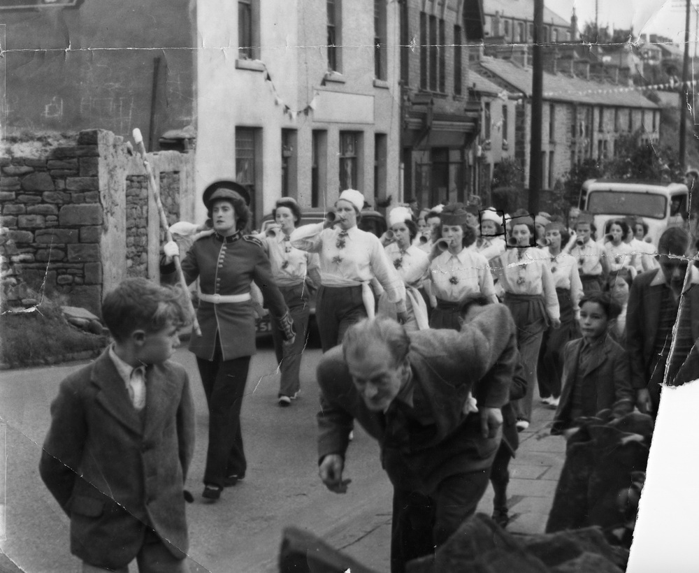
Plymouth Street Jazz Band, 1951 Festival of Britain. (Photograph Courtesy of Wendy Rees) |
||||||||||||||||
|
||||||||||||||||
|
|
||||||||||||||||
|
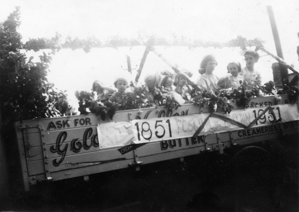
A Plymouth Street Carnival Float, Festival of Britain 1951. |
||||||||||||||||
|
|
||||||||||||||||
|
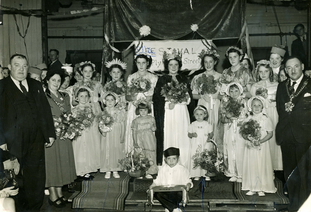
Plymouth Street Festival of Britain celebrations - 1951 With Mayor Alderman C.W. Bridges on the far right. (Photograph courtesy of Wendy Rees) |
||||||||||||||||
|
|
||||||||||||||||
| Plymouth Street - 1978 | ||||||||||||||||
|
|
||||||||||||||||
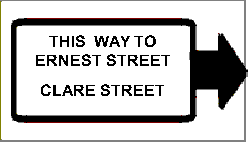
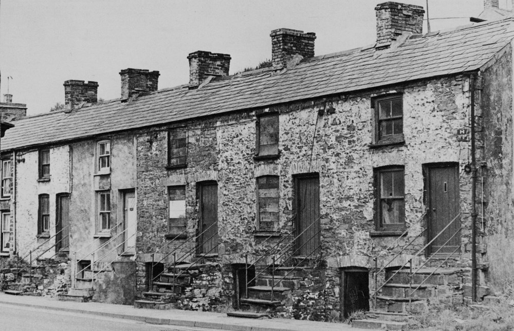
|
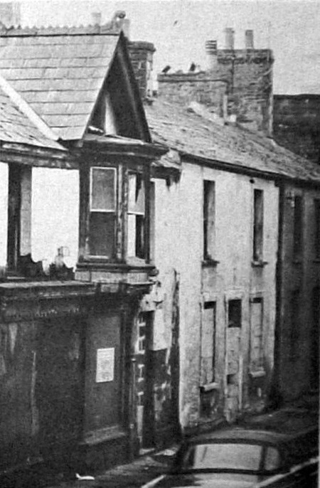
Plymouth Street Nos 65 to 73. Opposite the lower entrance to Ernest street, these houses were known as Cellar houses very unhealthy habitations. People lived in the rooms that were below street level and suffered those illnesses associated with dampness and poor ventilation. |
||||||||||||||||
|
|
||||||||||||||||
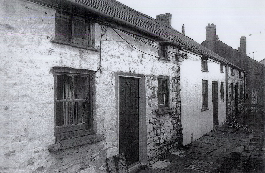
|
Plymouth Street (Photograph Courtesy of Jeremy Lowe) |
||||||||||||||||
|
|
||||||||||||||||
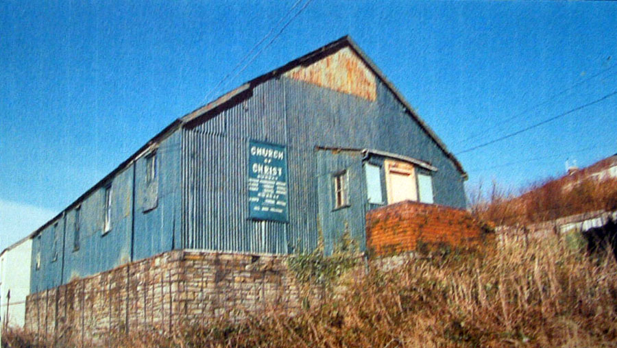
| Plymouth Street - Church of Christ | ||||||||||||||||
|
|
||||||||||||||||
|
|
||||||||||||||||
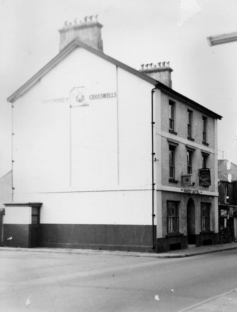
| The Mardy Hotel, Plymouth Street | ||||||||||||||||
|
|
||||||||||||||||
|
|
||||||||||||||||
|
|
||||||||||||||||
|
|
||||||||||||||||
|
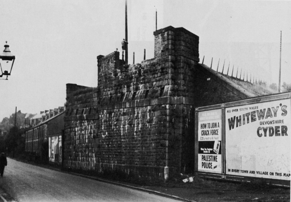
Plymouth Street. Buttress of the bridge which carried the Dowlais Railway from the Plymouth Street sidings to the Dowlais Iron Works. Known to locals as the "inky" |
||||||||||||||||
|
|
||||||||||||||||
|
Hankey Place VE Day Party - 1945 (Photograph courtesy of Mary Watkins) |
||||||||||||||||
|
|
||||||||||||||||
|
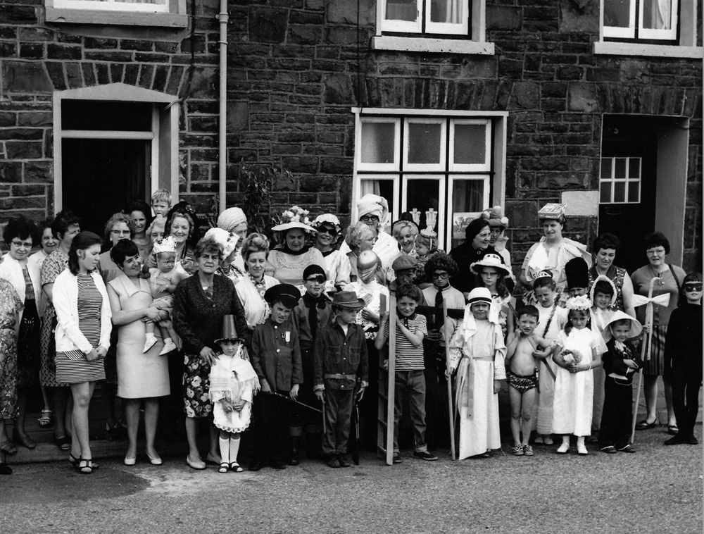
Railway Terrace - Street Party to mark the Investiture of Charles, Prince of Wales - 1969 (Photograph Courtesy of Gareth Powell) |
||||||||||||||||
|
|
||||||||||||||||
|
Railway Terrace - V.E. Day Celebrations John Griffiths tells us: "The soldiers came down from Brecon each week and parked their lorries in Railway Terrace whilst they went to town. When war ended they came to join in the street celebrations. I'm top right with my arm around my brother." Click the photograph to read John Griffiths' index of names (Photograph Courtesy of Roger Edwards & Extra Information Courtesy of John Griffiths) |
||||||||||||||||
|
|
||||||||||||||||
|
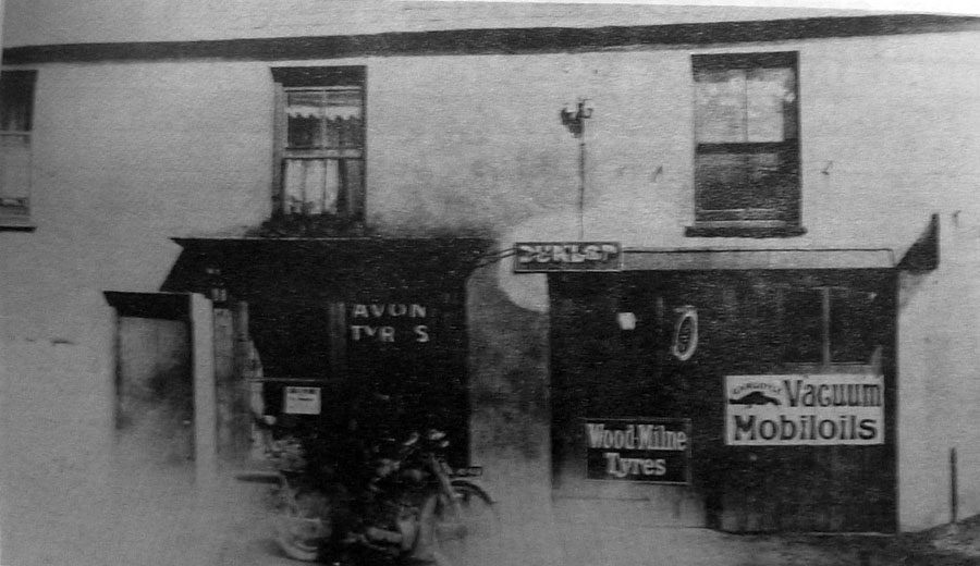
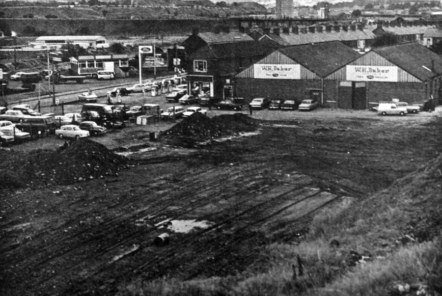
W.H. Baker Garage - Plymouth Street - 20th August 1971. (Photograph from the Merthyr Express) |
||||||||||||||||
|
|
||||||||||||||||
|
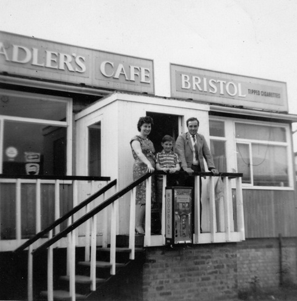
Adler's Cafe Maisie Adler, Jon Graham Adler (Son) and William Graham Adler on the steps of Adler's Cafe opposite the old Baker's Garage (It can be seen in the background of the above photo). The site is now occupied by a Carwash. (Photograph courtesy of son Steven Adler) |
||||||||||||||||
|
|
||||||||||||||||
|
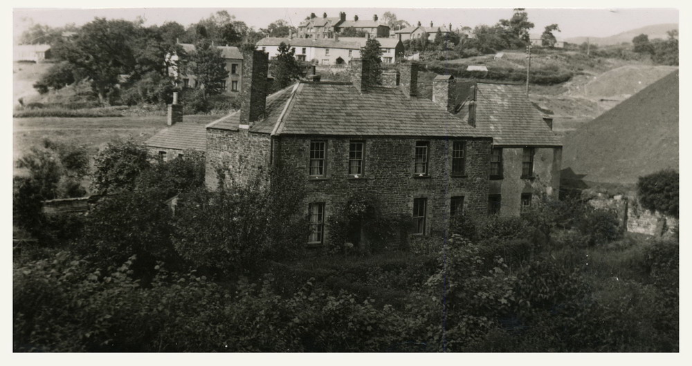
Plymouth House In the background Milborne Terrace can be seen, and behind it, the Mardy Hospital. |
||||||||||||||||
|
|
||||||||||||||||
|
Do you have any photographs and information relating to Plymouth Street? If so, please click the 'Contact Us' button. |
||||||||||||||||
|
||||||||||||||||