|
Brecon Road & Area |
|
Merthyr Tydfil |
|
|
|
<Click on the
photograph to enlarge> |
|
|
|
| |
| |
|
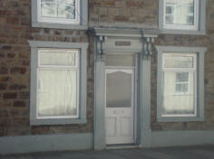
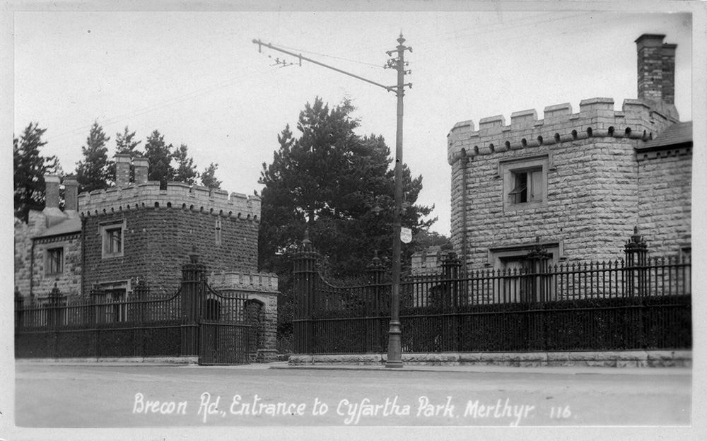
Brecon Road, Entrance To
Cyfarthfa Park.
(Photograph
courtesy of Martin Sullivan) |
|
|
|
| |
|
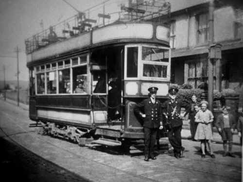
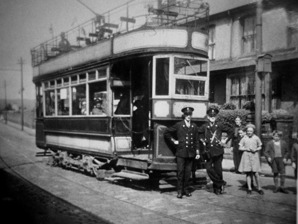
Tramcar at Brecon Road
The conductor is Tom
Havard. |
|
 |
| |
| |
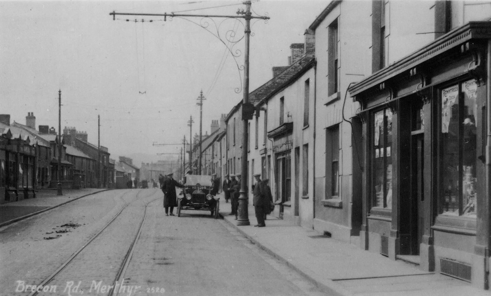
Brecon Road
The main route into Merthyr Tydfil from Brecon
was the Brecon Road.
This was once a thriving commercial area. There
was a thriving shopping centre here and a large number of public
houses. The Bernstein Family lived here at number 86; apparently
Moses Abraham went off to Australia for the good of his health
leaving his wife with the children to earn a living through their
pawn shop business but he then returned after 7 years and they had 4
more children.
The Pandy Farm
The original name suggests the building was
originally a fulling mill but the mill was probably nearer the
river. The present farm was built in 1816 and then the clock tower
was added in 1856. The original clock had 3 faces with one facing
the ironworks. The mechanical clock, which could have been heard up
to half a mile away was replaced by an electrical one in 1962.
The Tollgate House
Cattle, sheep, pigs and geese would all be
walked in Merthyr via this route to feed the growing industrial
population. The placing of toll-gates, bars or chains at strategic
points enabled a good deal of revenue to be extracted from
travellers. The charges applied to livestock also and farmers taking
their animals and produce to market objected to the heavy tolls.
Conflicts around the toll houses would often erupt into violence and
the ‘Rebecca Riots’ against the tolls were famous in West Wales. The
Pandy Farm was once used as a Toll House until a new toll-house was
established in 1842. This building, once the Old Toll House, Grawen,
Brecon Road, still stands today and is called the Round House.
St Tydfil’s Well
St Tydfils’ Well Church is linked with the
Parish Church of Cyfarthfa, Christ Church
There was once a well in Well Street, (legend
says to be ‘Tydfil’s healing well) from which the local population
obtained their water, and this has given rise to the place name.
However, generally speaking the old wells started not to be used as
much after Merthyr Tydfil adopted the Public Health Act in 1850 and
each property had to have its own water supply.
The Brewery
Bryant’s Field was the name of the
area, immediately north of the former fishpond on
present-day Brecon Road between Cae Pant Tywyll and Pen y Darren
Park, now occupied by Tudor Street, Cromwell Street and The Walk. It
was very clearly marked on the 1836 Street Map and the 1876
Ordnance Survey Map both showed a pond immediate south of
Brecon Road, called Old Brewery Pond and Merthyr Brewery was
alongside. It seems that the Brewery here was owned by a Mr. Bryant
at the beginning of the 19th century.
Vulcan House
Between Georgetown and Caepanttywyll, this
building was once a small iron foundry
but it also housed the Chartist printing press.
It was here that Morgan Williams and David John produced the Welsh
language paper Udgorn Cymr, Trumpet of Wales and a English language
Chartist news sheet, the Advocate and Free Press in the 1840s. In
spite of the short existence of both papers, they nevertheless
moulded the radical mind
of the Chartists in the borough. The house
dates form the early 19th century and there is an
original carriage arch which leads to the rear yard.
There was a tragic accident
in the foundry in the late nineteenth century when a new boiler
exploded and killed the owner of the business.
Tabernacle Welsh Baptist Chapel,
This religious building on the Brecon Road was
built in 1897 and is a mixture of ornate, classical and Romanesque.
The original chapel in Cae Brynant was built in 1835,
modified, altered or rebuilt in 1842 and in 1897 it was replaced by
the present building, designed by architect George Morgan at a cost
of £1,650.
St Mary’s Church
This splendid large Church dates from 1893 and
was the second religious building used by the Roman Catholics of the
town, the first was a simple chapel in Georgetown which became a
lodging house for the Spaniards.
|
|
|
| |
|
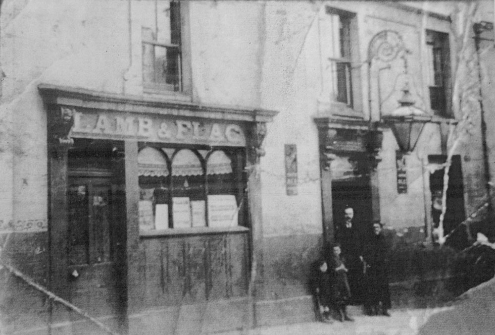
The Lamb & Flag. C1900.
L:R :- Glyn Edwards, Phyllis
Edwards, David Edwards (Landlord), Mary Ann Edwards (Landlady).
The Lamb and Flag
was situated opposite and a little further north than the Cyfarthfa Arms. |
|
 |
| |
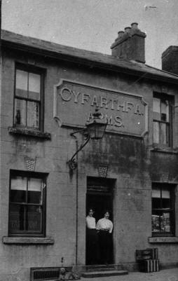
| Cyfarthfa Arms - Brecon Road |
|
 |
| |
|
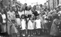
Brecon Road, Possibly Carnival
Queen for the Fete and Gala at Cyfarthfa Park
L-R: Pam
Norris (Jenkins), Mary John, ?, Shirley Phillips (now McCarthy), ?, ?, Pat Thomas, Colin ?,
Anymore
information on this photograph would be appreciated. Please contact us.
(Photograph
Courtesy of Pam Jenkins) |
|
,MaryJohn,-,-,-,-,PatThomas,Colin-._PamJenkins_small.jpg) |
| |
|
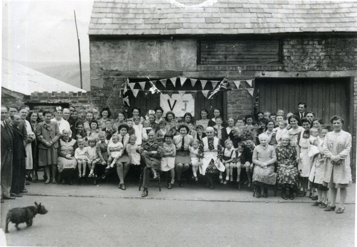
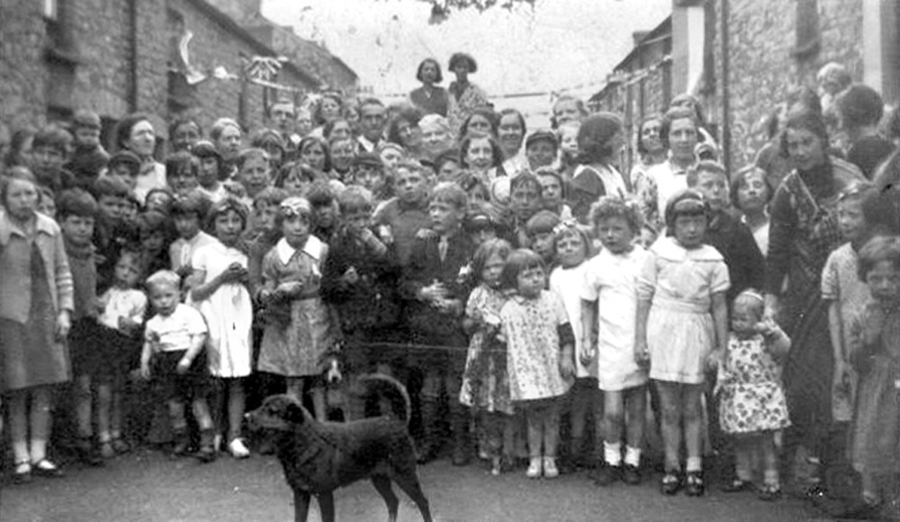
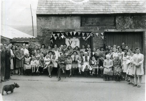
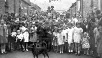
Brecon Road V.J.Day Street
Party. 1945.
(Photograph
Courtesy of Pam Jenkins) |
|
 |
|
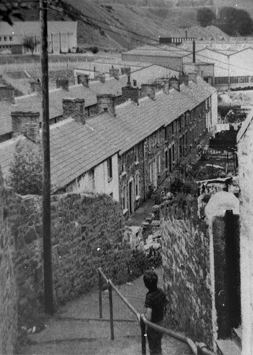
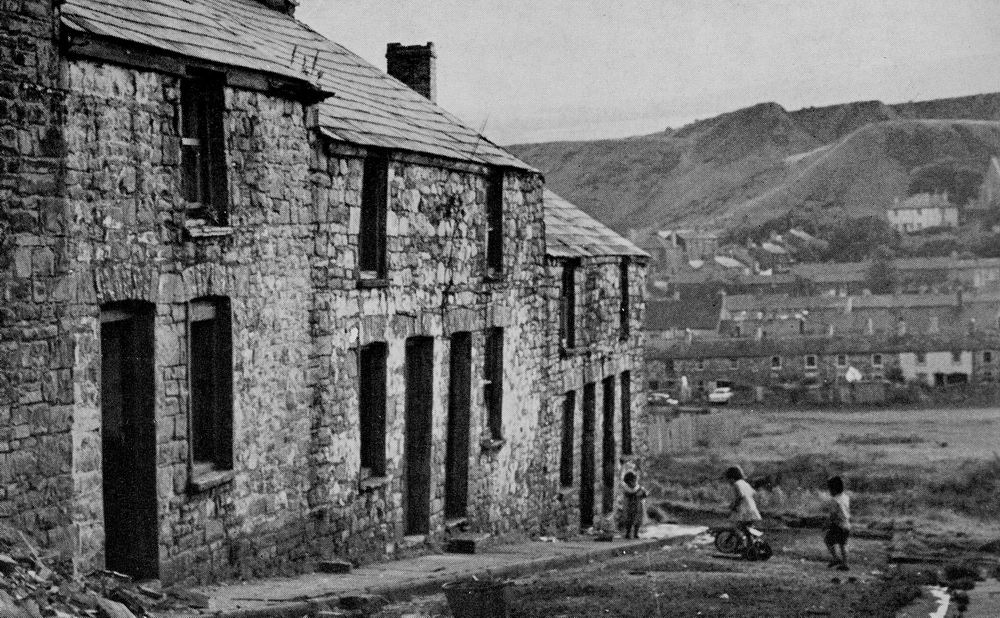
| Looking Over Caepantywyll from
the Brecon Road |
|
|
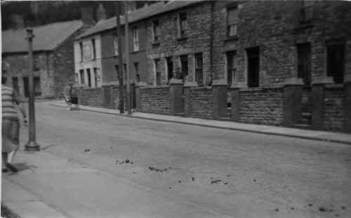
| Grawen Terrace in the 50's |
|
 |
| |
|
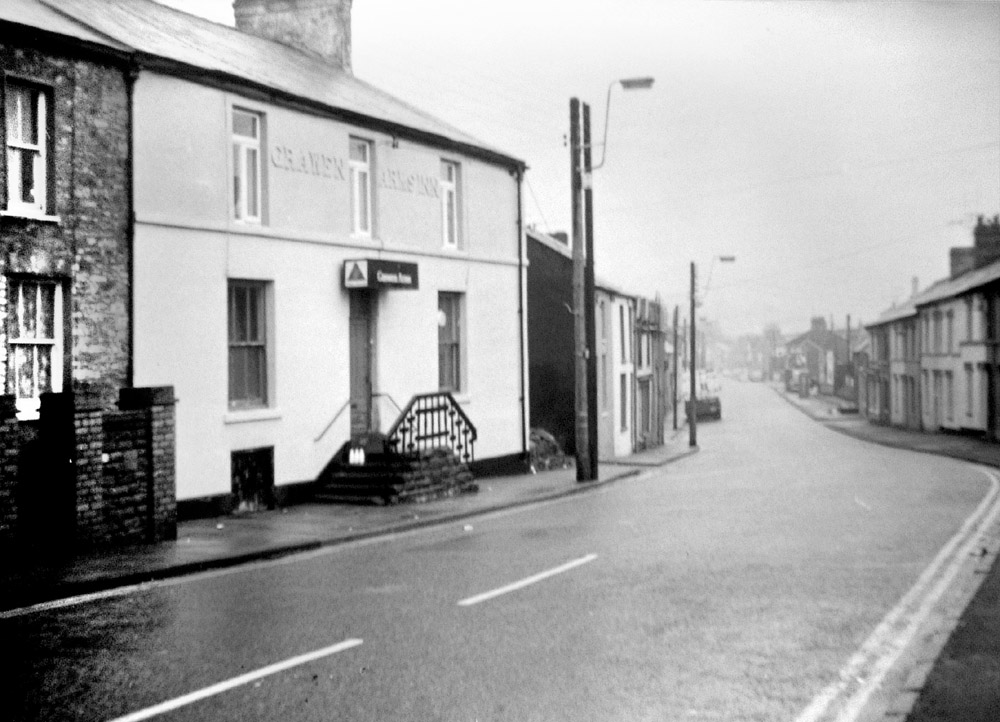
The Grawen Arms Inn - 1970's |
|
| |
|
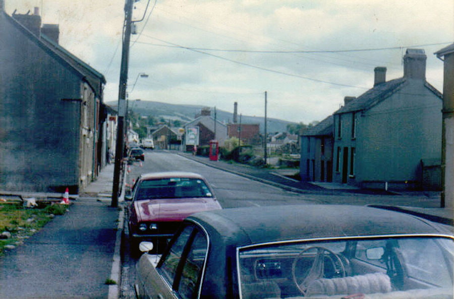
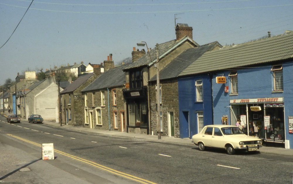
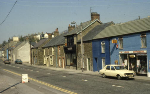
Brecon Road 1984.
(Photograph
courtesy of Ian Gravell) |
|
 |
|
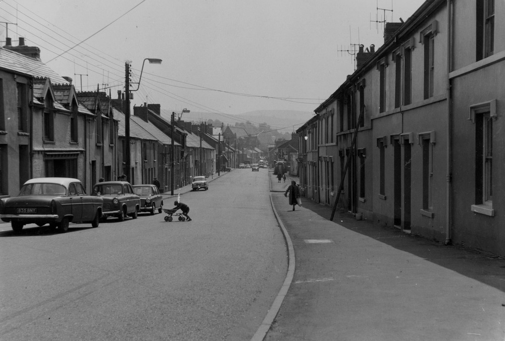
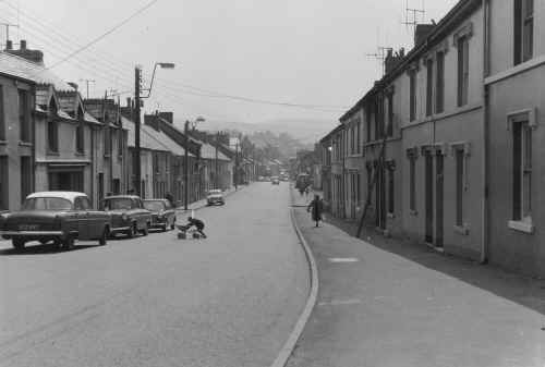
| Brecon Road - No Date |
|
 |
|
| Similar
Photograph Taken in 60's |
|
 |
| |
|
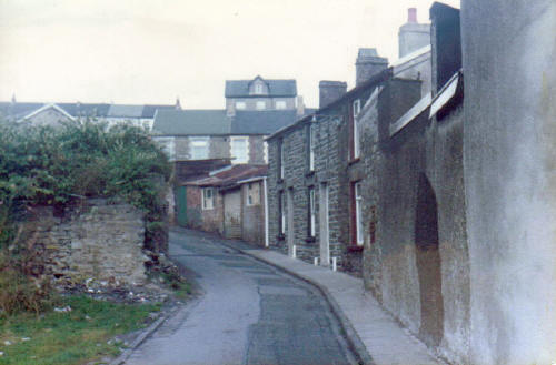
Well Street from the Brecon
Road 1984.
(Photograph
courtesy of Ian Gravell) |
|
 |
| |
|
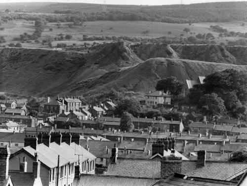
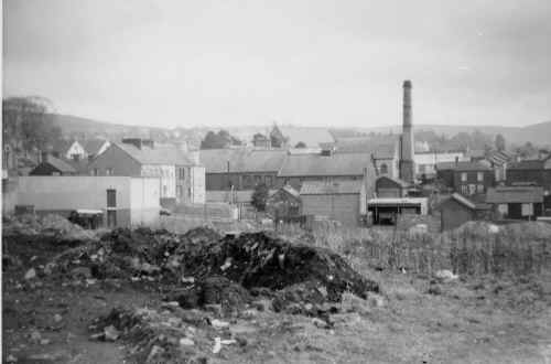
Georgetown Tips from Brecon
Road
Looking over Brychan Place (on
the bottom left) towards the old Cyfarthfa Cinder Tips. |
|
 |
| |
|
Brecon road, 4th April 1991.
Jack Jones Upholstery, N. Jones Newsagent.
(Photograph
courtesy of Dennis Bennett OBE) |
|
 |
| |
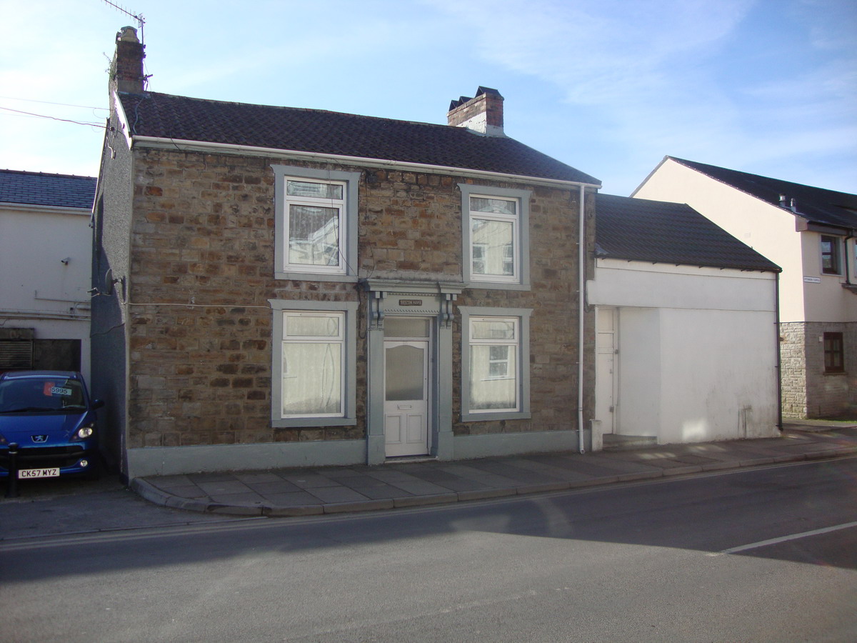
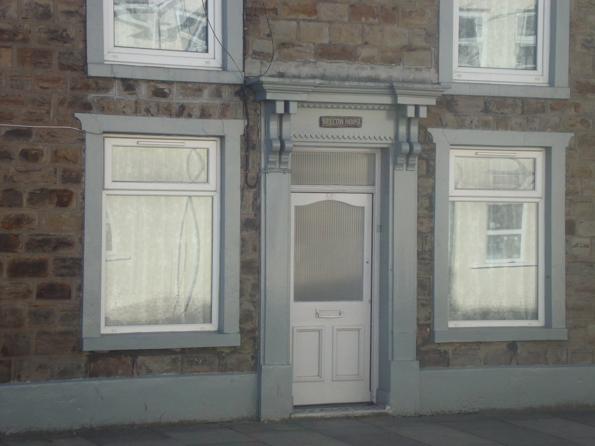
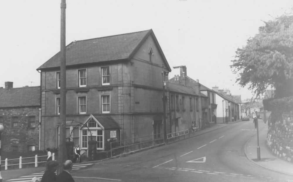
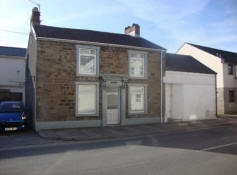
| Brecon House Inn, No.34 |
|
Brecon House, No.34 in 2011. |
|
 |
|
 |
 |
 |
|
|
|
| |
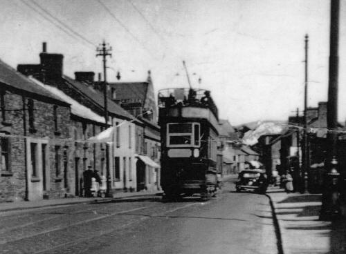
| A Tramcar from Cefn Coed on
Brecon Road in the 1930's. |
|
 |
| |
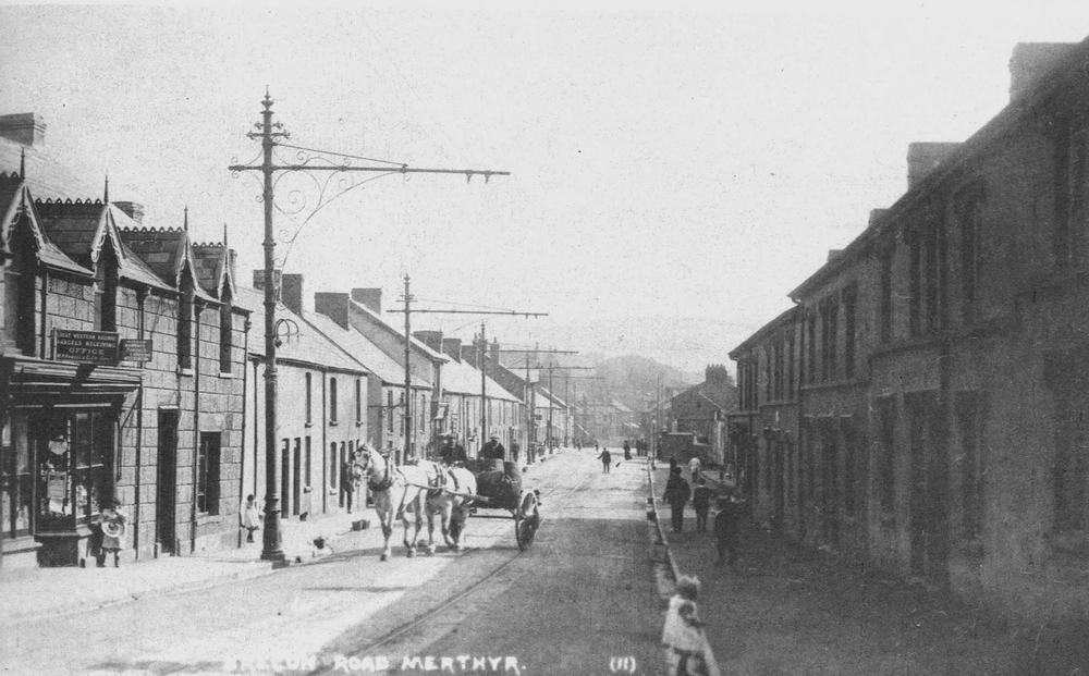
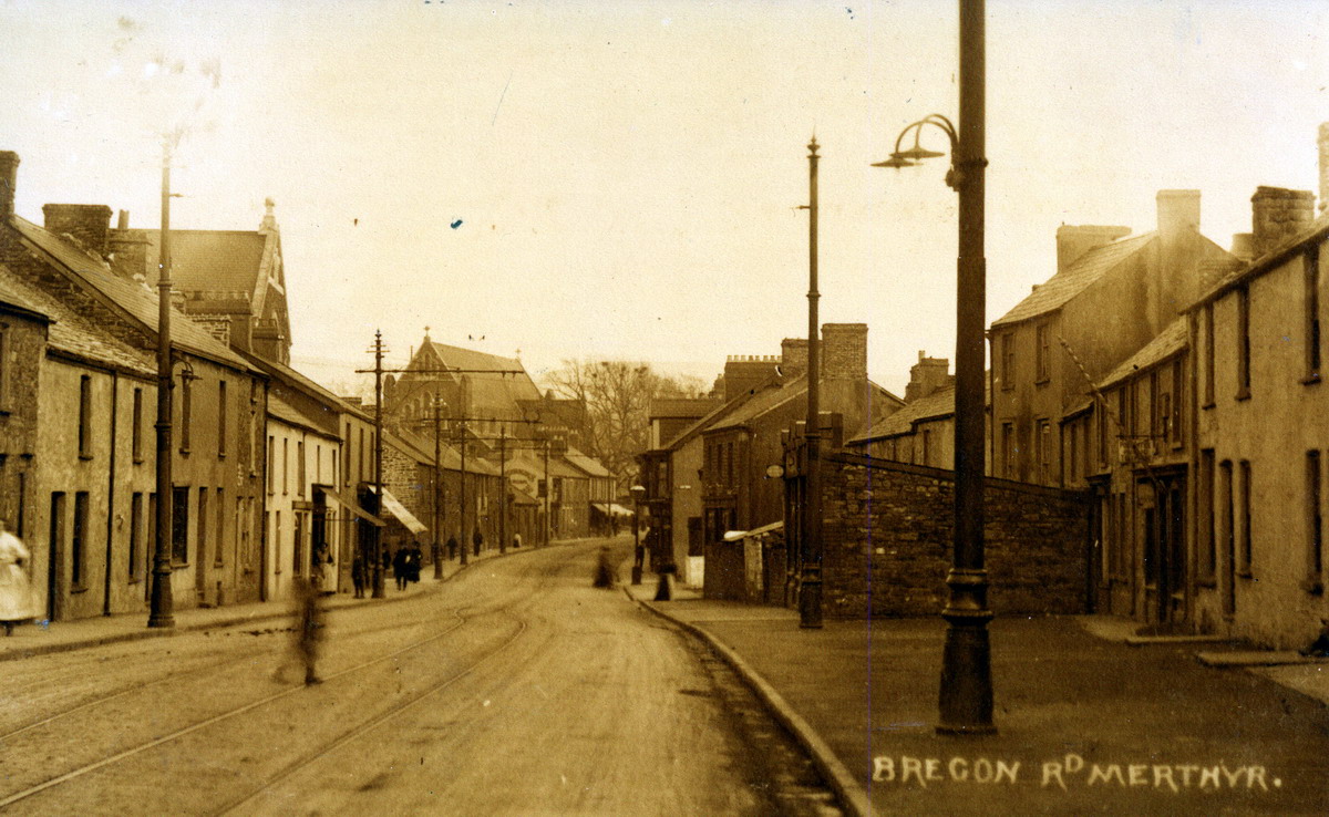
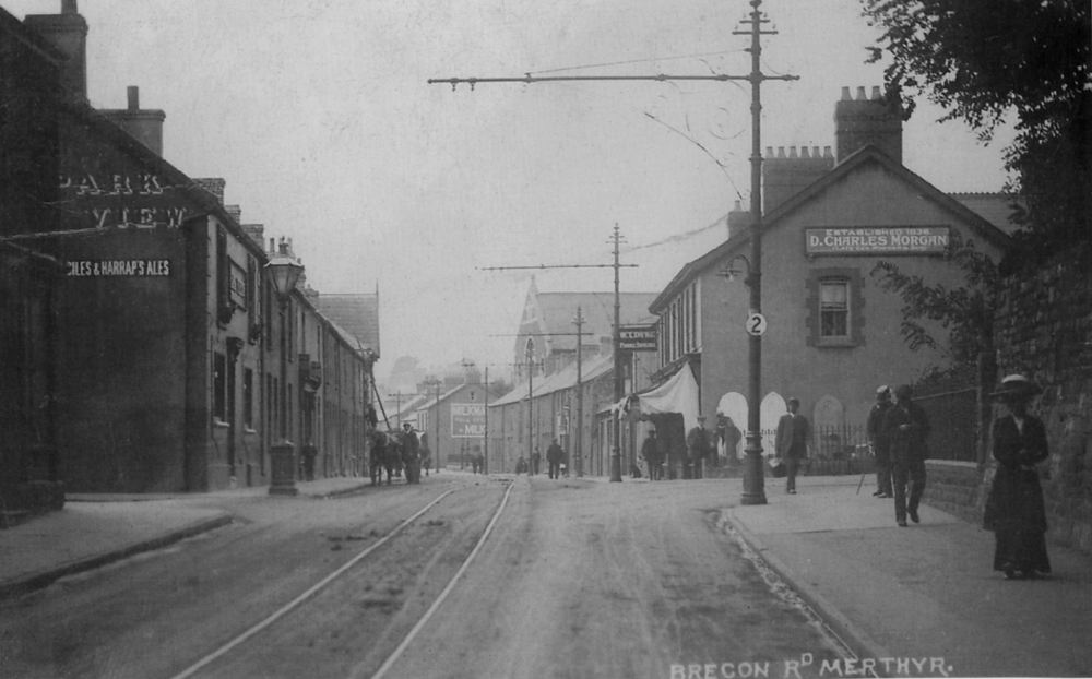
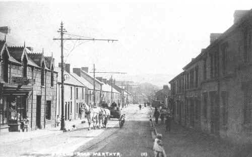
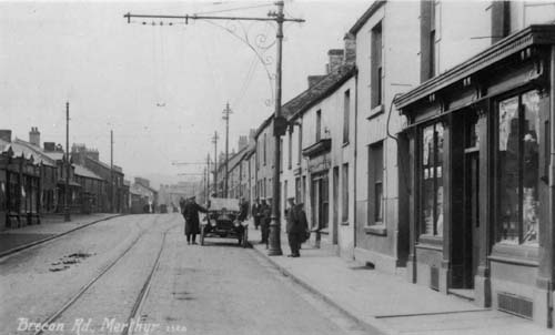
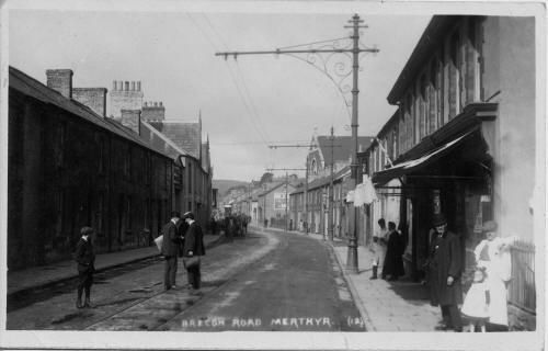
| Brecon Road in the early 1900s. |
|
 |
|
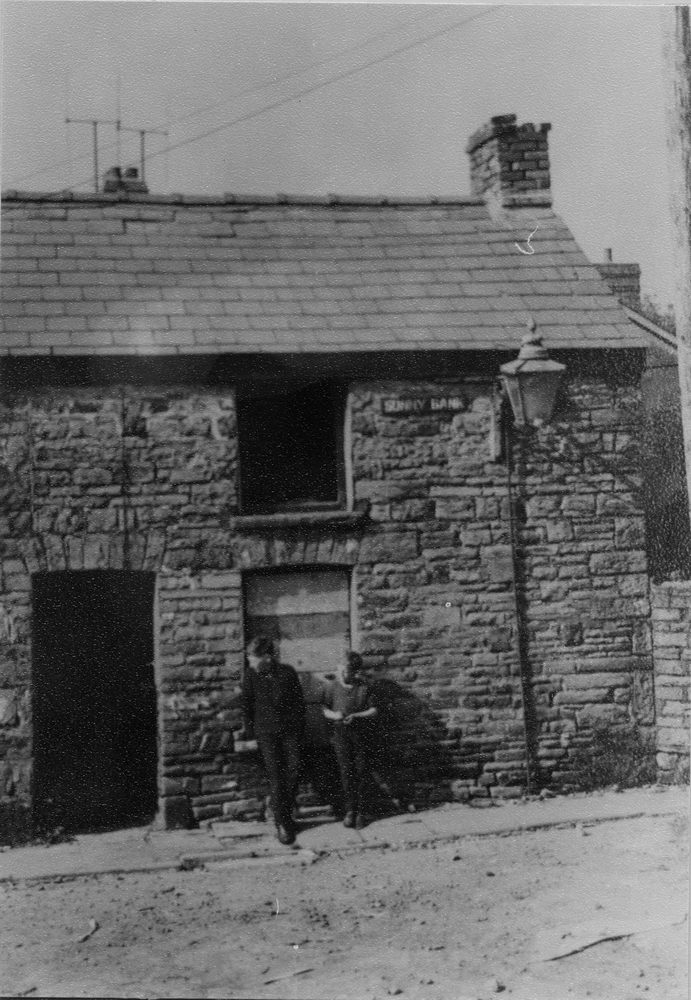
| Sunnybank in the 1950s |
|
 |
| |
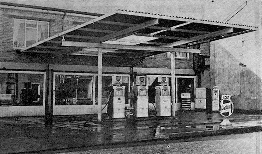
|
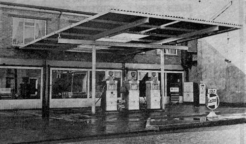
Paul Lawrence Motors
Petrol Filling Station - 1960s. |
|
 |
| |
|
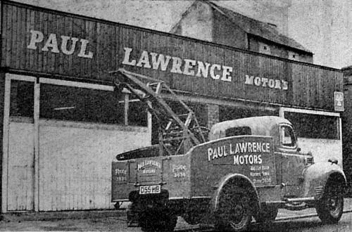
Paul Lawrence Motors
Workshops - 1960s. |
|
 |
|
| Brewery Street |
|
 |
Brewery Street - Coronation Party for King George VI - 1939
(Photographs Courtesy of Barrie Jones) |
|
 |
|
 |
| |
|
Brecon Road, 1923 |
|
|
| |
|
Taken from
Sunny Bank area, a view of Vulcan Road showing rear of the Co-op (in
pic above),
and the old
Giles & Harraps Brewery, later to become Hancocks, and finally a
Merthyr Council Depot.
(Photograph
Courtesy of Michael Donovan). |
|
 |
| |
|
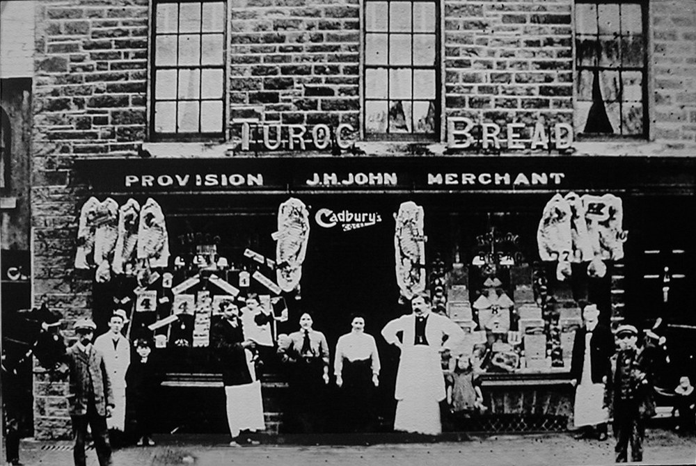
15, Brecon Road - J.H.John
Provision Mechant.
Earlier this premises had been
the Dyffryn Arms Public House.
Later it became the Cooperative
Store. |
|
 |
| |
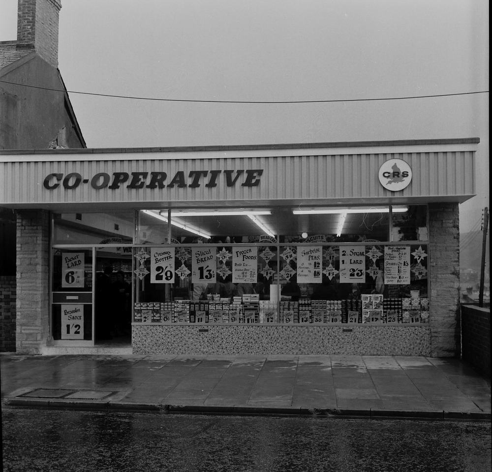
| The
Co-operative - 1967. |
|
 |
| |
|
|
| |
|
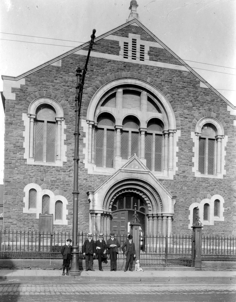
Tabernacle
Chapel, circa 1904.
(Photograph by Harris & Son, courtesy of the Leo Davies Collection) |
|
| |
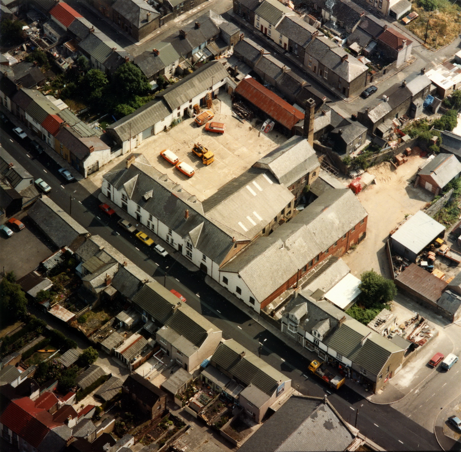
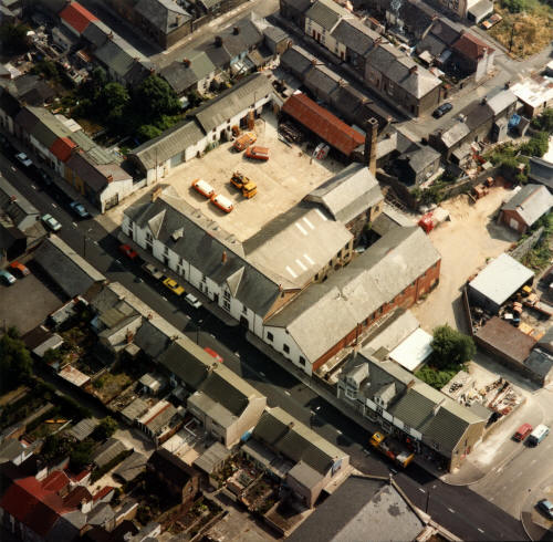
| An aerial view of the Vulcan
Brewery on Brecon road, taken in 1989 |
|
 |
| |
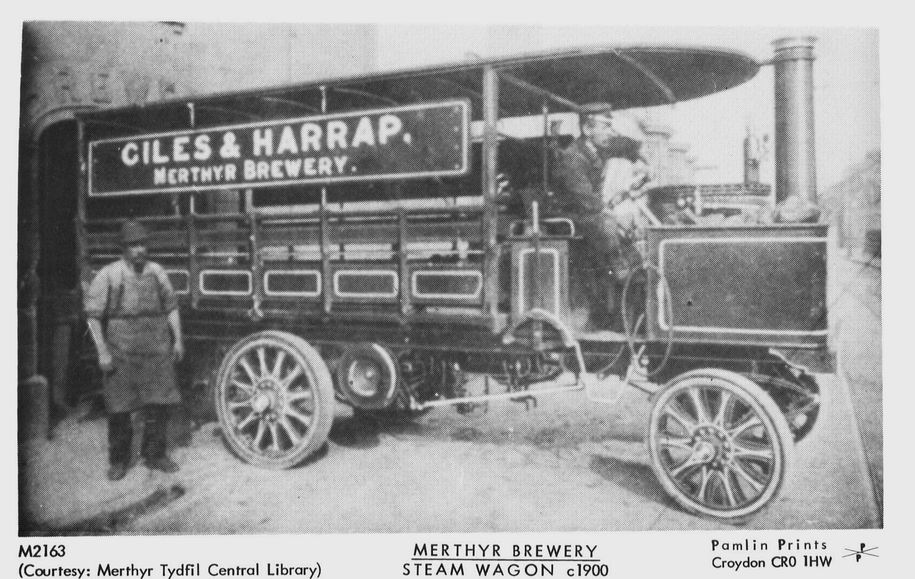
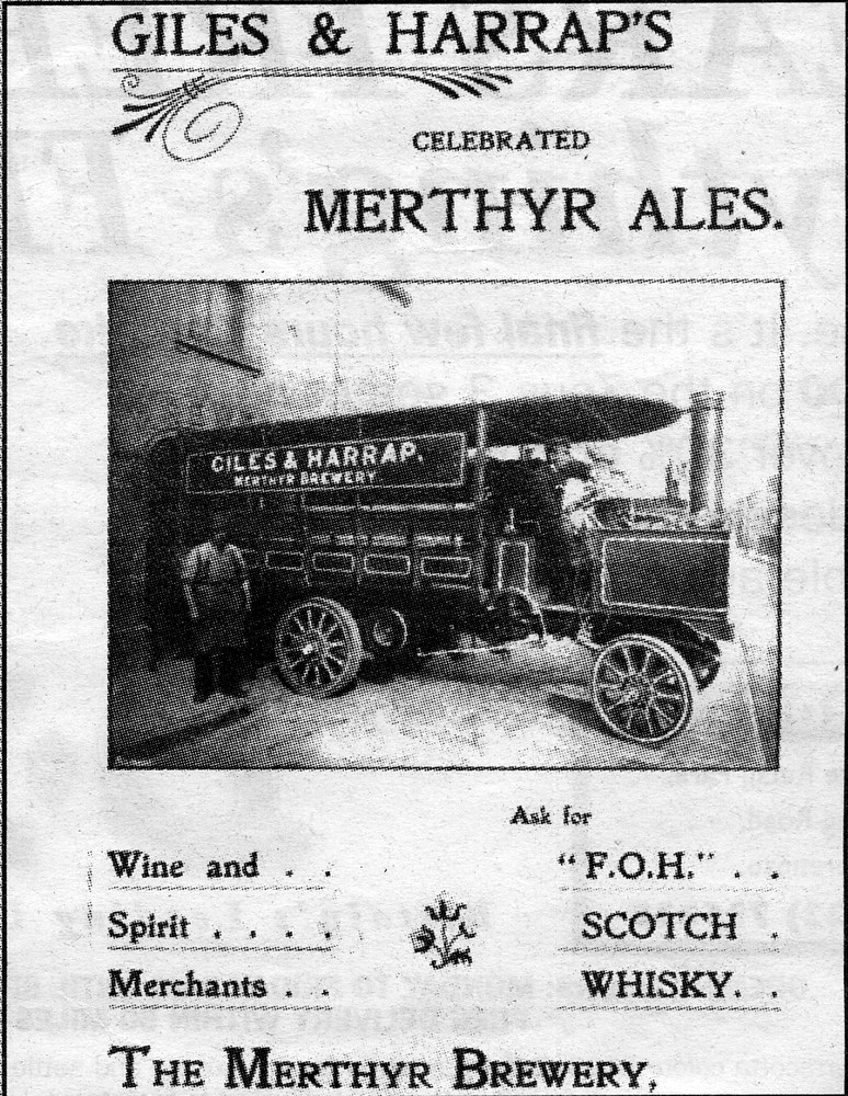
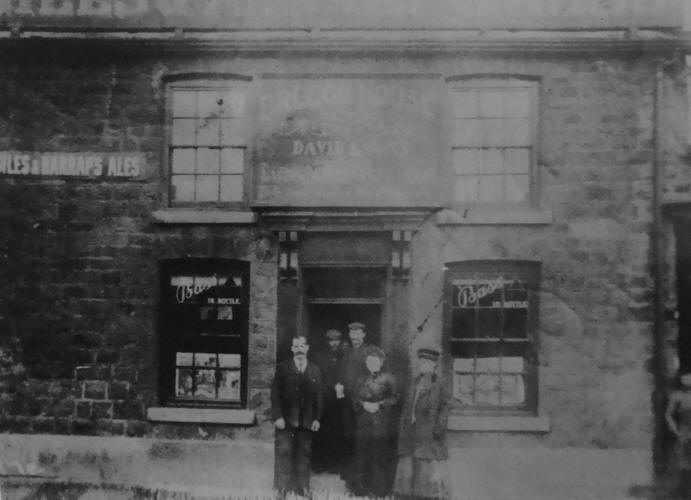
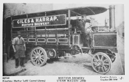
| Giles
& Harrap - Merthyr Brewery - Brecon Road. |
| |
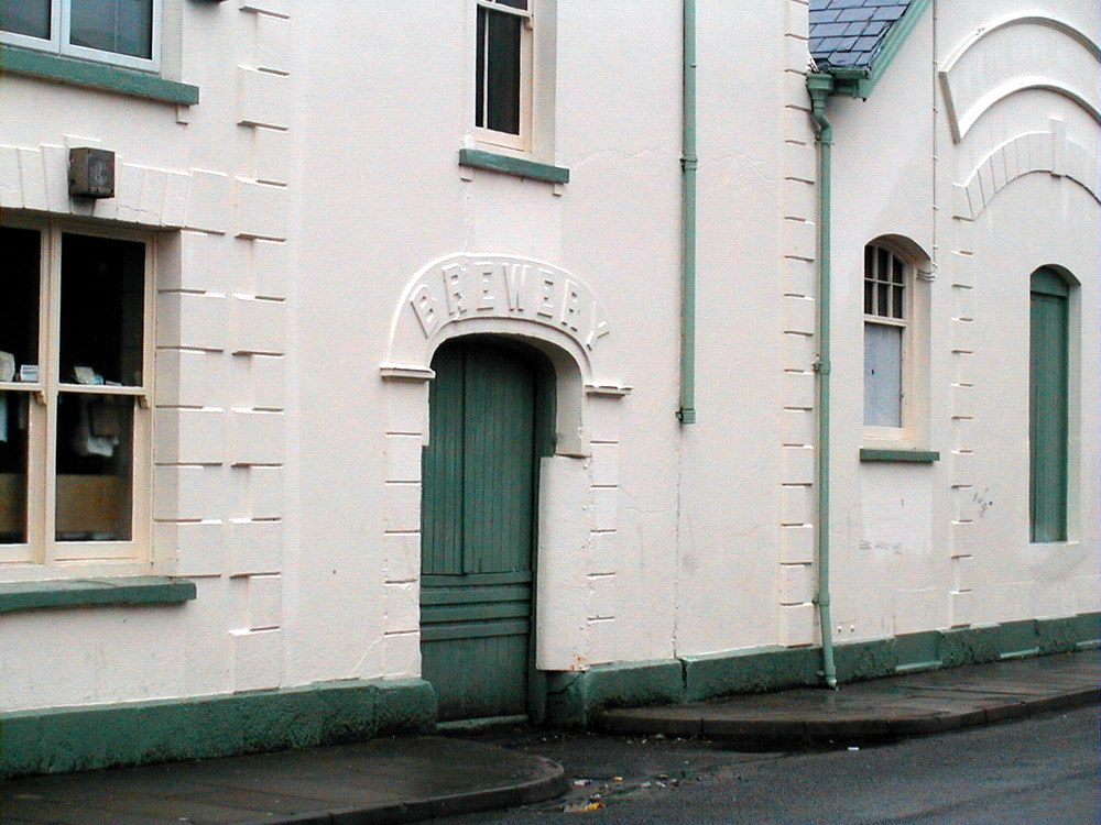
 |
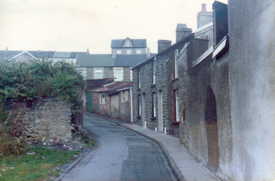
The Old Brewery Entrance - 2001 |
|
 |
| |
|
|
| |
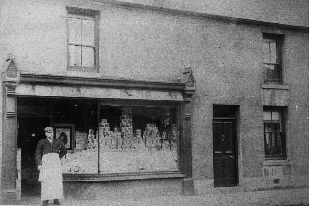
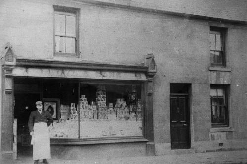
| J.D.Lloyd & Sons - Grocers -
No28 Brecon Road. |
|
 |
| |
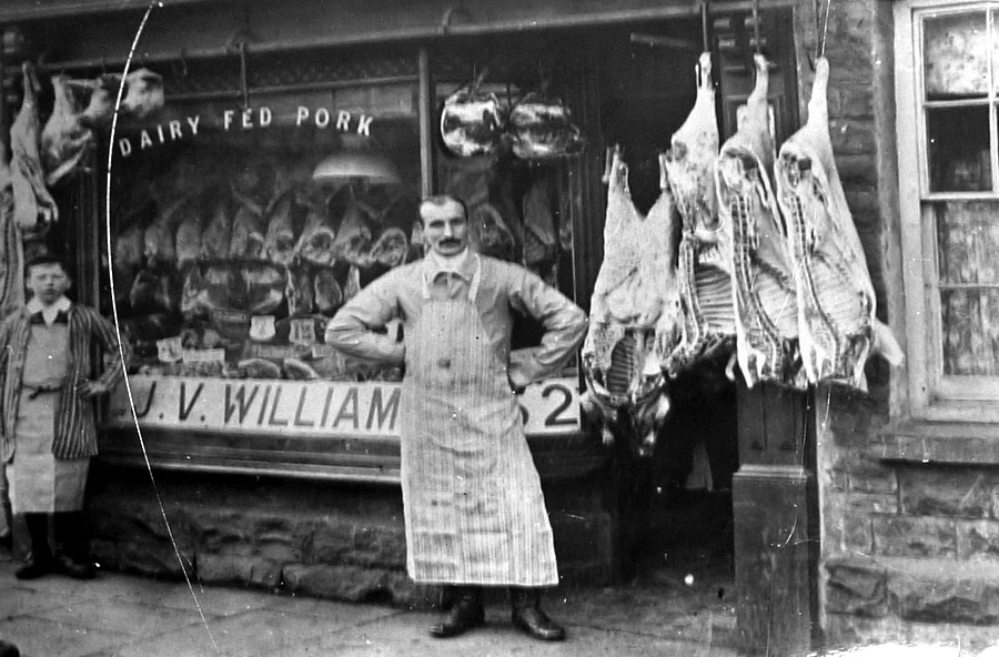
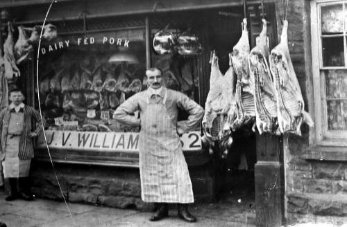
| J.V. Williams - Butcher - 52
Brecon Road |
|
 |
| |
|
|
|
Brecon Road Circa 1910.
(Postcard courtesy
of Mrs Gill Thomas, West Grove) |
|
 |
| |
| Brecon Road 1911
|
|
| |
|
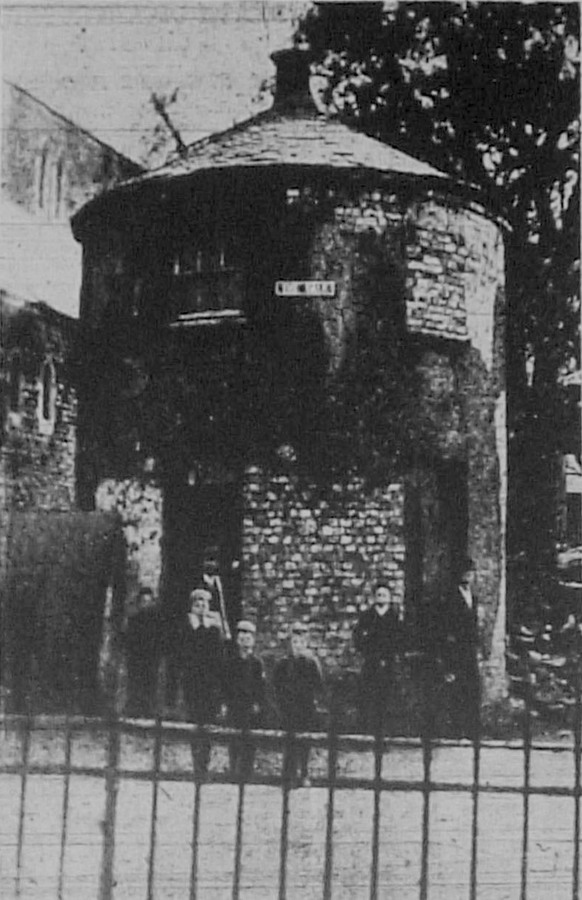
The Round House. - 1894.
At the junction with the Walk, this Round House was once a Lodge House for
Penydarren House, and
the area behind it was known by the Locals as "Homfray's Field" and later
as "Penydarren Park". It
was demolished not long after the Catholic Church was built. |
|
 |
| |
|
Garthnewydd House, Brecon Road, 1970
The YWCA (Young Women's Christian
Association) used to meet at Garthnewydd House. |
|
|
|
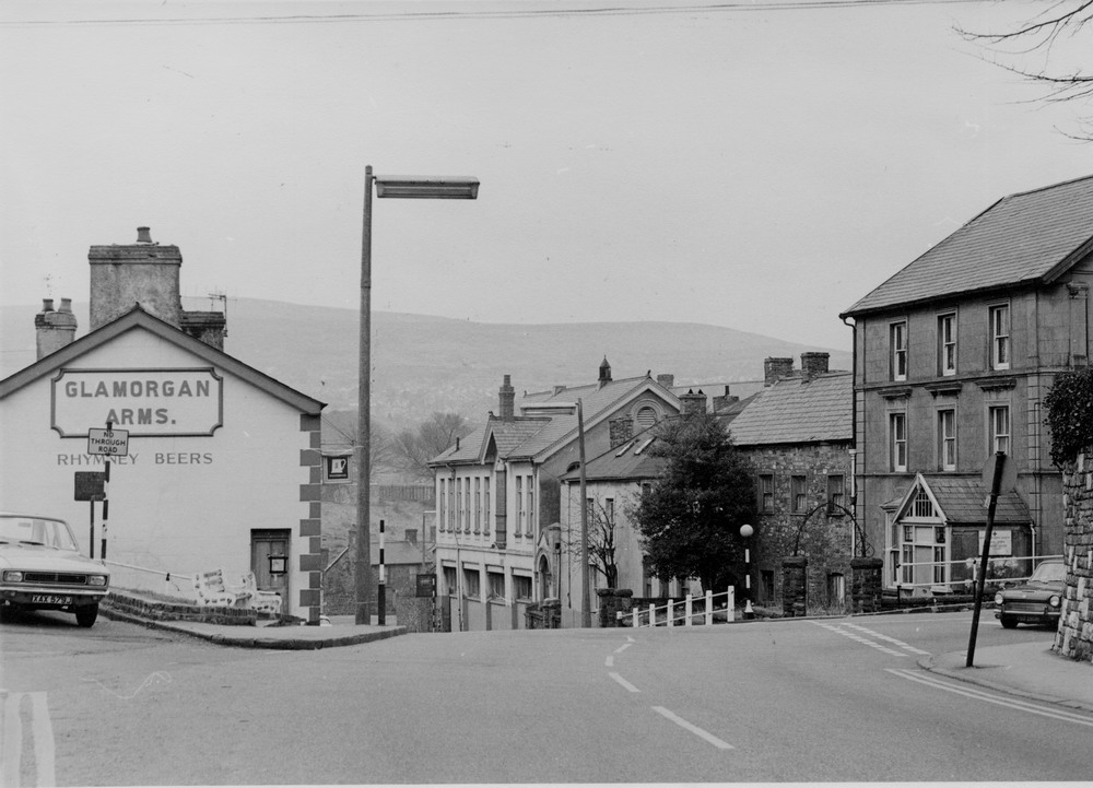
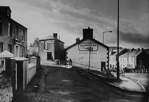
| The
Glamorgan Arms and Abermorlais Terrace |
|
 |
| |
| Bethesda
Street |
|
 |
| |
|
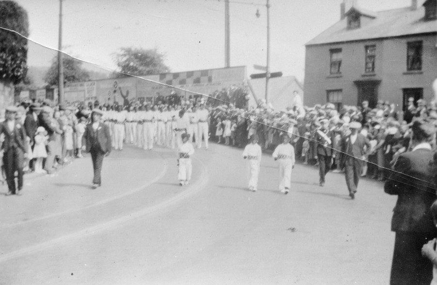
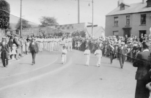
Parade at Newfoundland Terrace
- 1920's
(Photograph by Mrs
L. Snow courtesy of Anita Farrell) |
|
 |
|
|
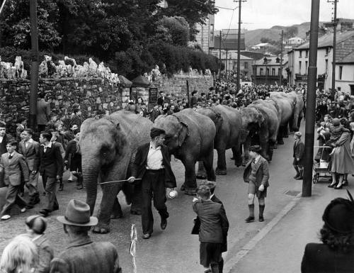
The Circus Travelled to
Merthyr by Train and Would Parade up to Cyfarthfa Park.
(Photograph
Courtesy of Clive Arthur -Spain, Clive is in the photograph as a little boy
in short trousers
that the Elephant
Man appears to be glaring at!) |
|
 |
| |
|
Do you have
any photographs or information relating to Brecon Road, Merthyr Tydfil?
If so,
please email us, by clicking the 'Contact Us' button. |
|
|
|
 |
|
 |


,MaryJohn,-,-,-,-,PatThomas,Colin-._PamJenkins.jpg)