![]()
![]()
![]()
![]()
![]()
![]()
|
Bedlinog |
||||||||||||||||||||||||||
|
Merthyr Tydfil |
||||||||||||||||||||||||||
|
<Click on the photograph to enlarge> |
||||||||||||||||||||||||||
|
||||||||||||||||||||||||||
|
||||||||||||||||||||||||||
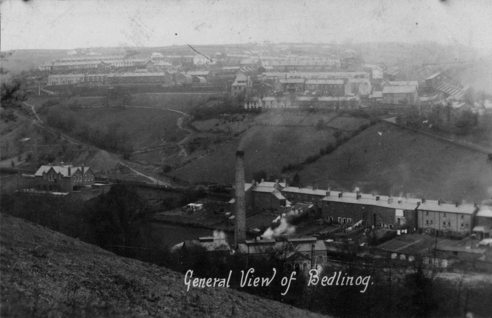
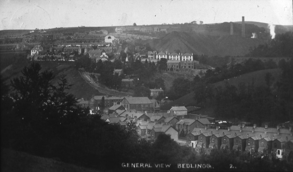
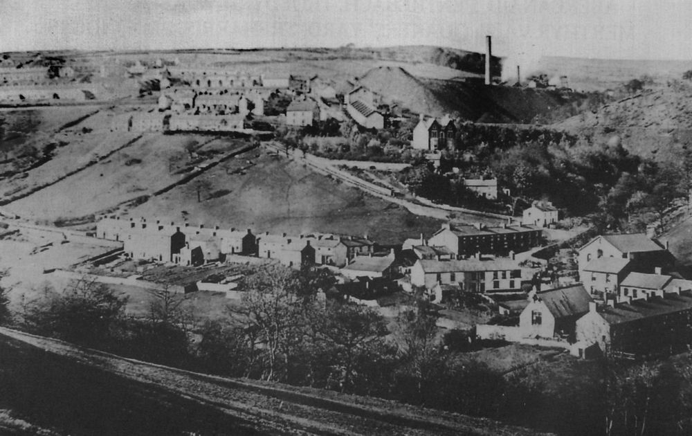
| General Views of Bedlinog | ||||||||||||||||||||||||||
|
|
||||||||||||||||||||||||||
|
|
||||||||||||||||||||||||||
|
|
||||||||||||||||||||||||||
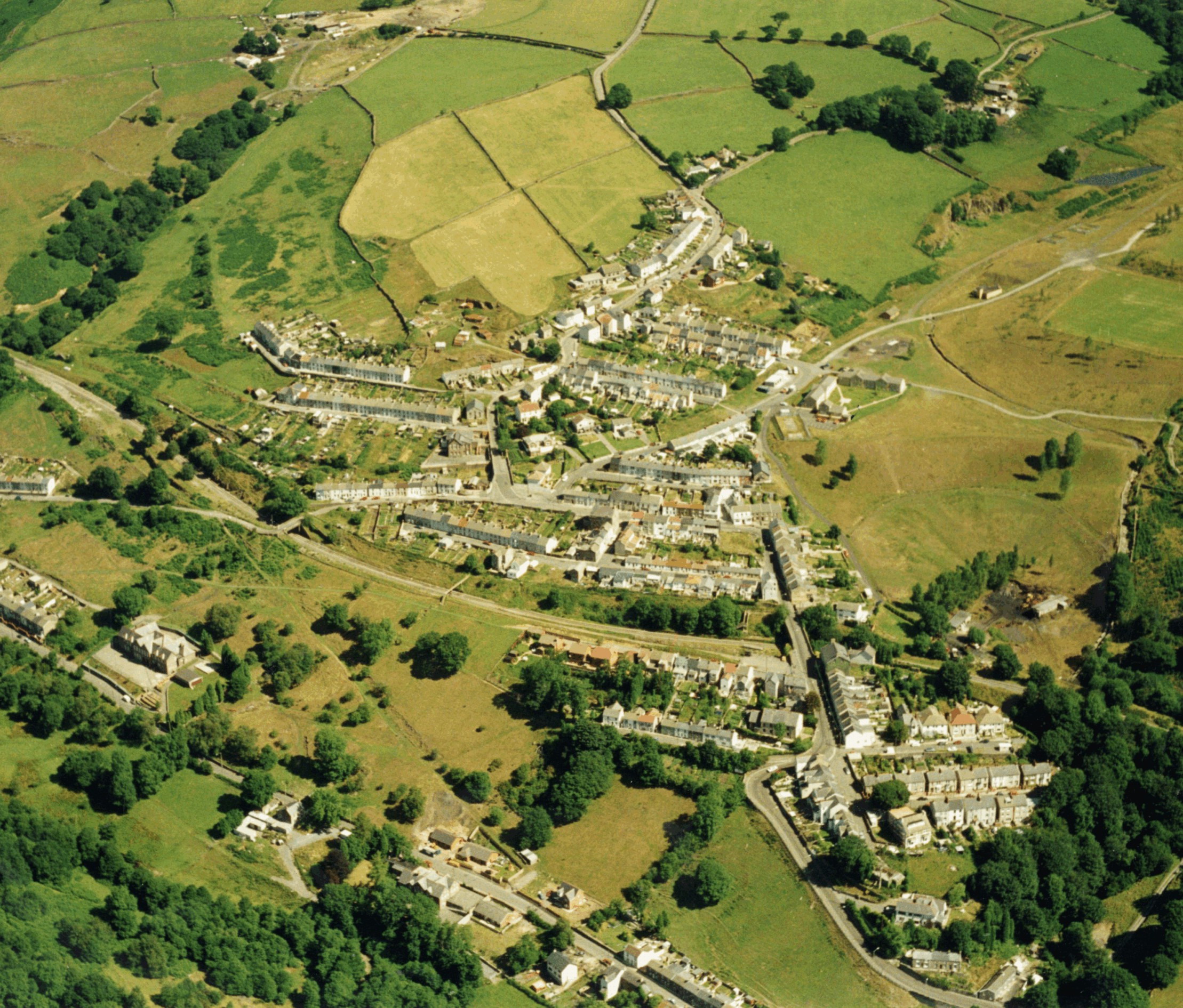
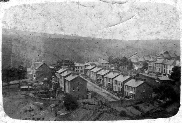
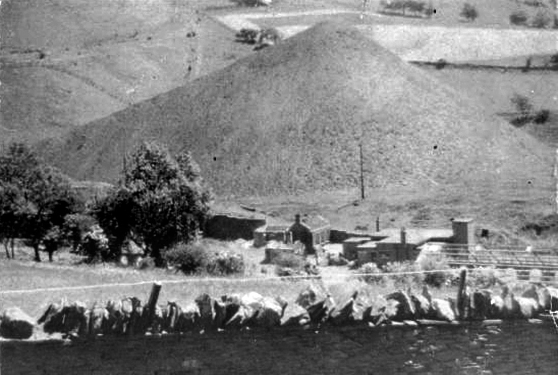
| Belinog - Aerial View | ||||||||||||||||||||||||||
|
|
||||||||||||||||||||||||||
|
|
||||||||||||||||||||||||||
|
Bedlinog - Woodland Place (Photograph courtesy of Liz Newcombe) |
||||||||||||||||||||||||||
|
|
||||||||||||||||||||||||||
|
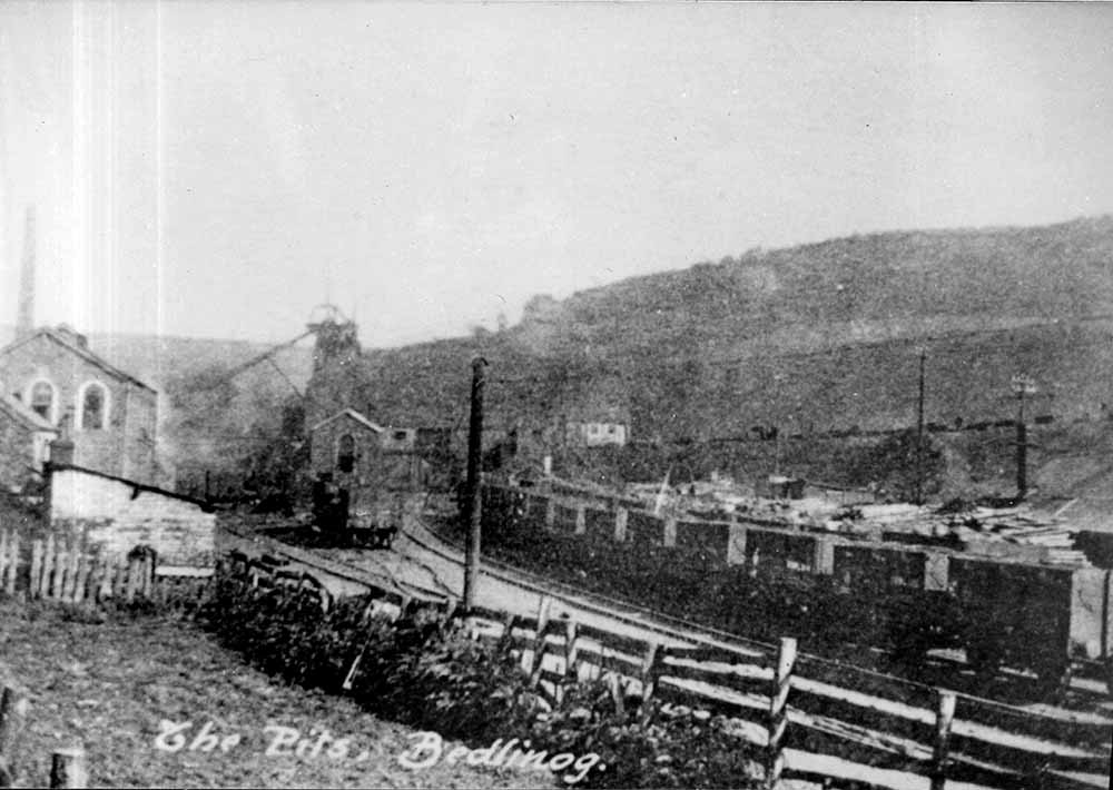
The Pits - Bedlinog Dowlais Iron Company. (Photograph courtesy of Judith Jones) |
||||||||||||||||||||||||||
|
||||||||||||||||||||||||||
|
|
||||||||||||||||||||||||||
|
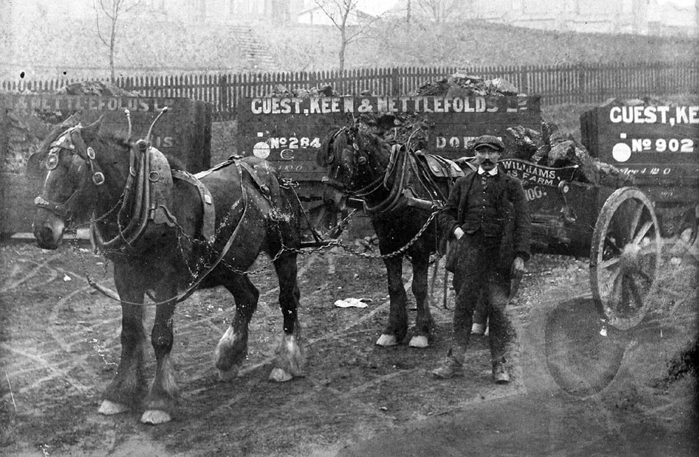
Guest, Keen & Nettlefolds Horses at N. Bedlinog Colliery (Pits) (Photograph Courtesy of Phillip Evans) |
||||||||||||||||||||||||||
|
|
||||||||||||||||||||||||||
|
|
||||||||||||||||||||||||||
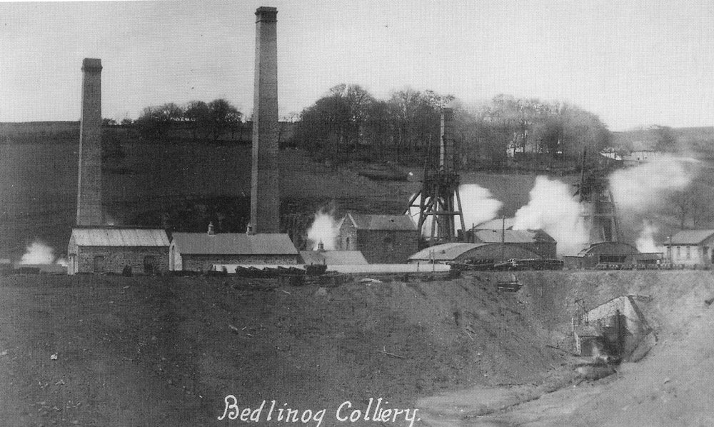
| Bedlinog Colliery (Pits) | ||||||||||||||||||||||||||
|
|
||||||||||||||||||||||||||
|
Bedlinog Colliery (Pits) after closing. (Photograph courtesy of Owen Jones) |
||||||||||||||||||||||||||
|
|
||||||||||||||||||||||||||
|
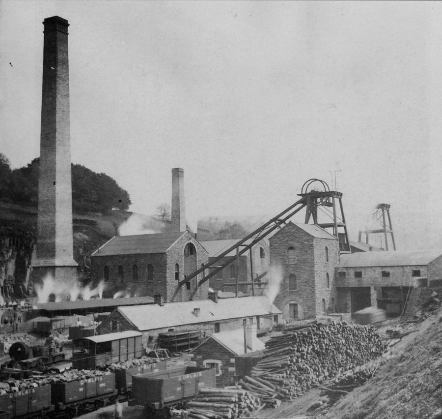
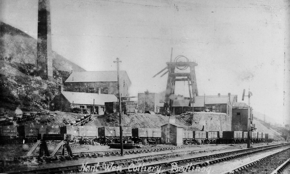
Nant Wen Colliery, Bedlinog. Sunk in the early 1870s to the depth of 85 yards by the Dowlais Iron Company. (Photograph Courtesy of Phillip Evans) |
||||||||||||||||||||||||||
|
|
||||||||||||||||||||||||||
|
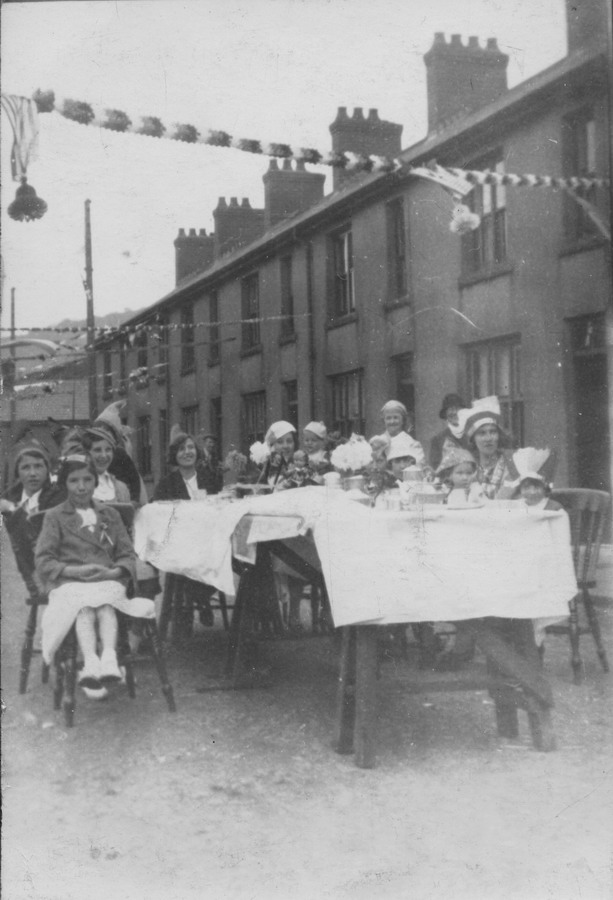
George Street, V.E. Day Party - 1945. (Postcard courtesy of Ann Jones) |
||||||||||||||||||||||||||
|
|
||||||||||||||||||||||||||
|
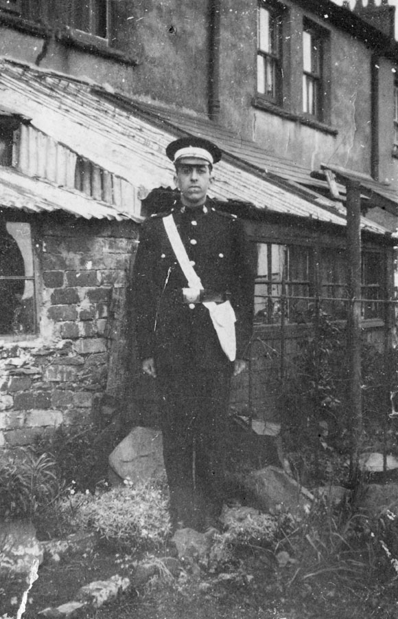
Wilfred Jones of 10, George Street (Postcard courtesy of Ann Jones) |
||||||||||||||||||||||||||
|
|
||||||||||||||||||||||||||
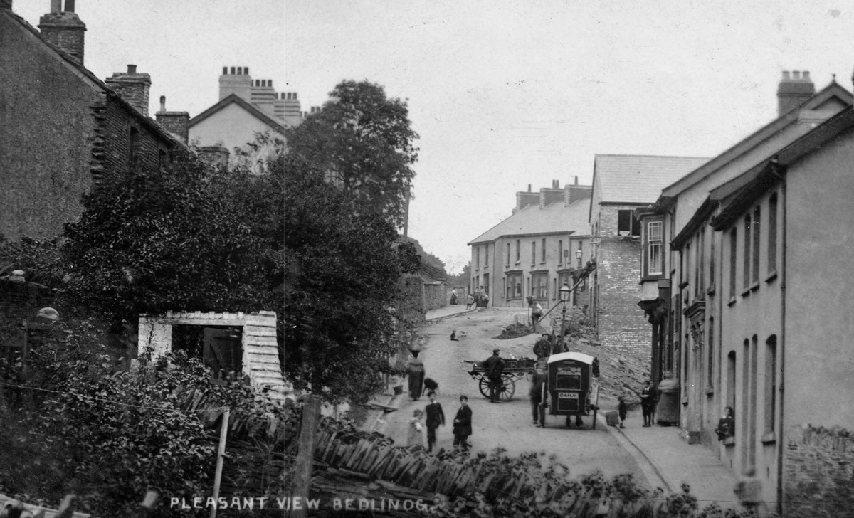
| Pleasant View - Bedlinog | ||||||||||||||||||||||||||
|
|
||||||||||||||||||||||||||
|
|
||||||||||||||||||||||||||
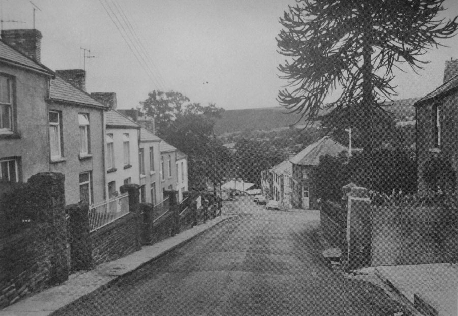
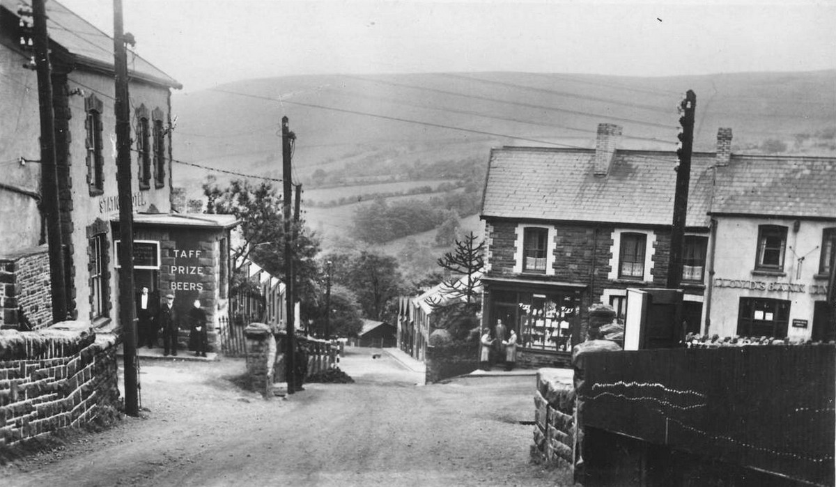
| Lower High Street in the 1970s. | ||||||||||||||||||||||||||
|
|
||||||||||||||||||||||||||
|
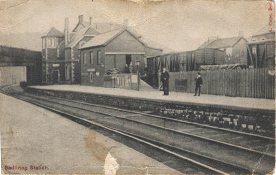
Bedlinog Station (Photograph Courtesy of Liz Newcombe) |
||||||||||||||||||||||||||
|
|
||||||||||||||||||||||||||
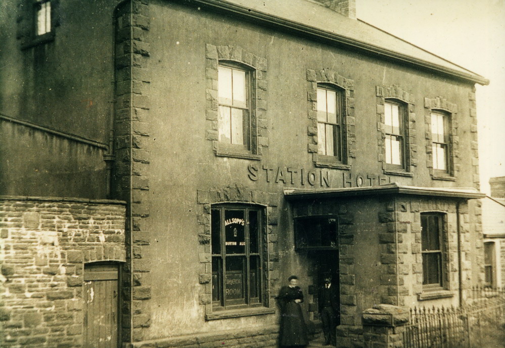
| Station Hotel - Bedlinog | ||||||||||||||||||||||||||
|
|
||||||||||||||||||||||||||
|
Bedlinog High Street |
||||||||||||||||||||||||||
|
|
||||||||||||||||||||||||||
|
|
||||||||||||||||||||||||||
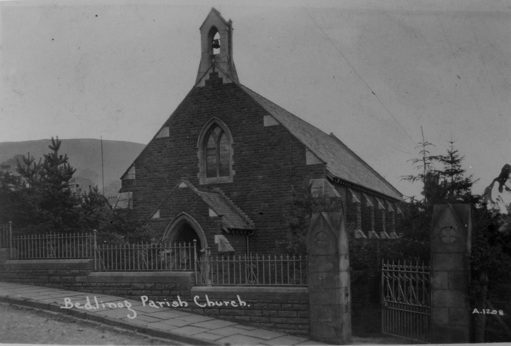
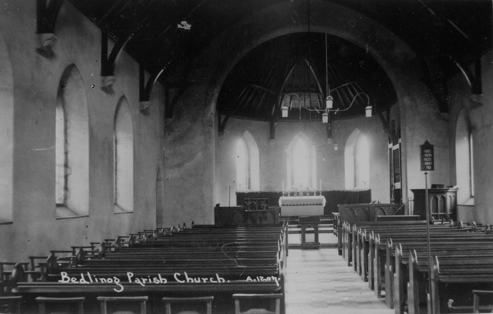
| St Caddoc's Bedlinog Parish Church - 1911 | ||||||||||||||||||||||||||
|
|
||||||||||||||||||||||||||
| St Caddoc's, Bedlinog Parish Church. 1911 | ||||||||||||||||||||||||||
|
|
||||||||||||||||||||||||||
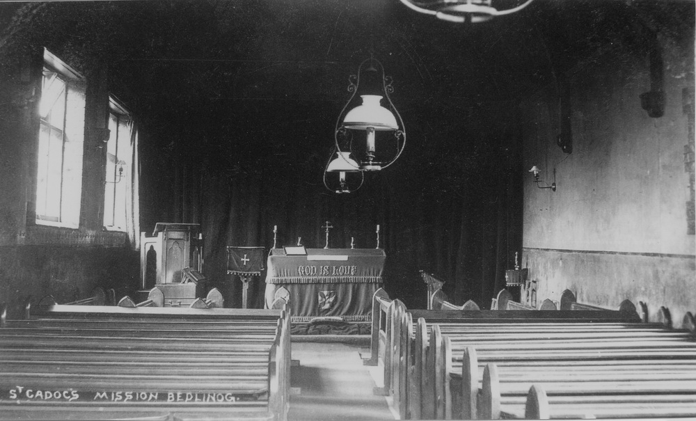
| St Cadoc's Mission Hall, Pre 1911 | ||||||||||||||||||||||||||
|
|
||||||||||||||||||||||||||
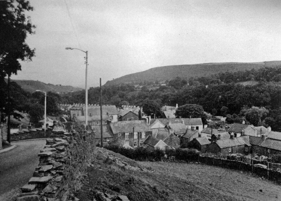
| Bedlinog 1970s. | ||||||||||||||||||||||||||
|
|
||||||||||||||||||||||||||
|
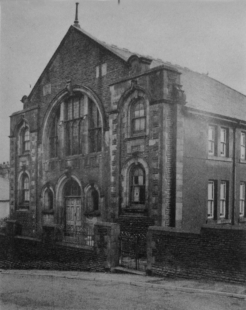
Goshen Chapel. (Photograph courtesy of Haydn Baynham) |
||||||||||||||||||||||||||
|
|
||||||||||||||||||||||||||
|
||||||||||||||||||||||||||
|
Go to:
|
||||||||||||||||||||||||||
|
|
||||||||||||||||||||||||||
|
Do you have any photographs or information relating to Bedlinog, Merthyr Tydfil? If so, please email us, by clicking the 'Contact Us' button. |
||||||||||||||||||||||||||
|
|
||||||||||||||||||||||||||
|
To the Map |
||||||||||||||||||||||||||
|
|
||||||||||||||||||||||||||