![]()
![]()
![]()
![]()
![]()
![]()
|
Building the Sliproad |
|||||
|
The Sliproad was constructed to allow traffic to by pass the narrow roads of Merthyr and Dowlais. Work commenced in 1948/49 and was completed in 1950/51. |
|||||
|
|||||
| Dowlais Top. This is where the slip road joins the A465 road from Dowlais to Abergavenny. On the other side of the bridge being built is the site of the now demolished MacDonalds restaurant. The railway under the bridge is the LNWR Merthyr to Abergavenny line. The Heads of the Valleys road was built mainly on the bed of this line on its way to Abergavenny. If you look down Dowlais you can just make out the bridge which took this railway through Penywern down the "Miler" tunnel in Pant and through Pontsarn to Cefn and eventually Merthyr. | |||||
|
|
|||||
|
Dowlais Top. The men you see in the foreground are laying stones to form the bed of the road. The stones are laid in a particular way and the technique is called 'Pitching'. We understand from an engineer who worked on the road that the whole 5 miles of pitching was carried out by two brothers from Dowlais. |
|||||
|
|
|||||
|
Just below Trecatti |
|||||
|
|||||
|
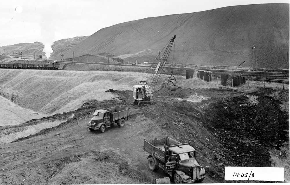
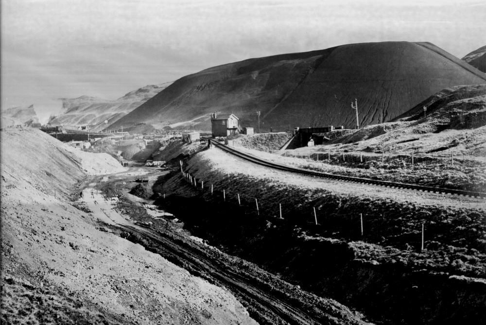
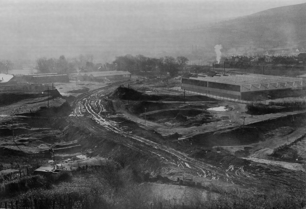
Just above the concrete bridges that were built to take the railway down the Bargoed Valley.The massive Old Coal Washery waste tip in the background. |
|||||
|
|
|||||
|
|
|||||
|
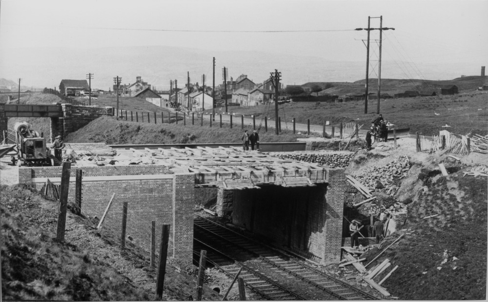
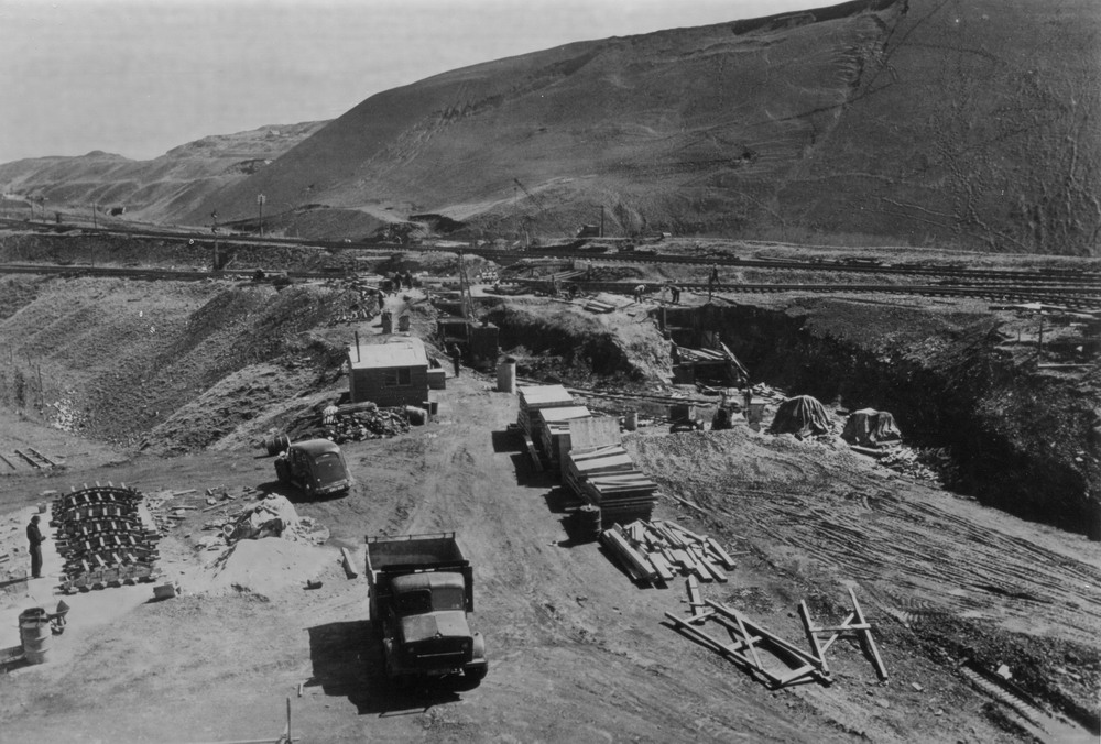
Preparing the groundwork before building the concrete bridges to take the railway lines. |
|||||
|
|
|||||
|
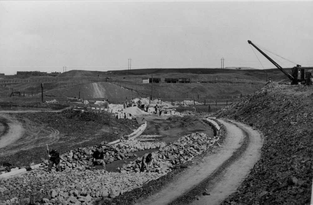
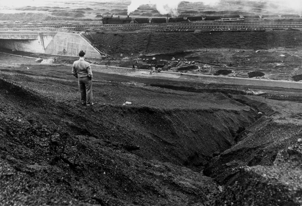
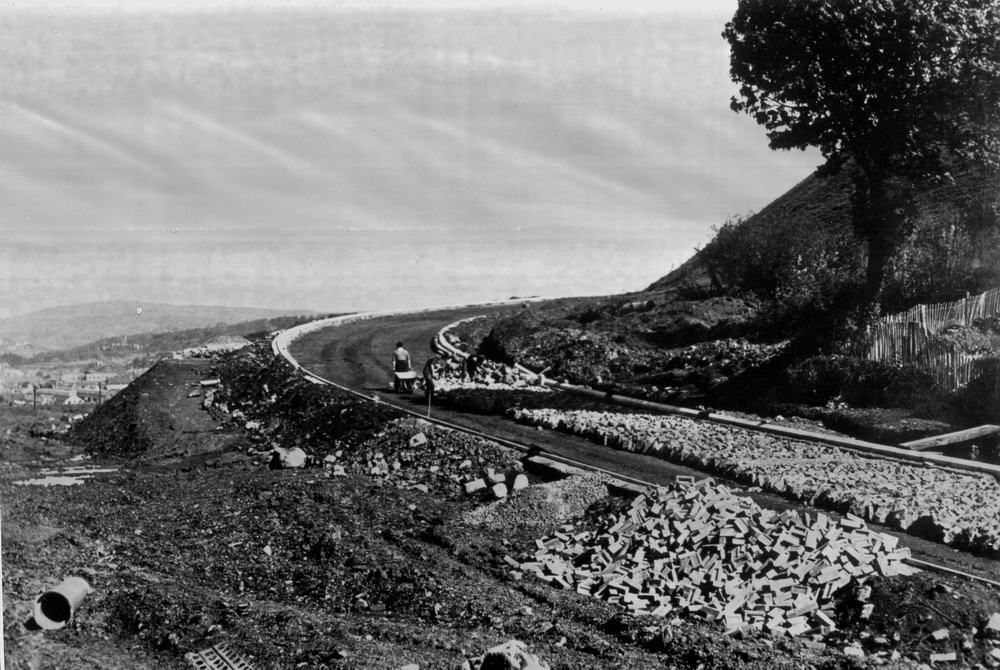
The bed of the slip road just below the Zig-Zag line which was used to take the finished goods out of the Goat Mill. |
|||||
|
|
|||||
|
A similar position to the one above. |
|||||
|
|
|||||
|
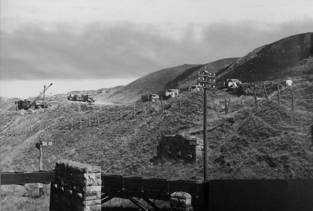
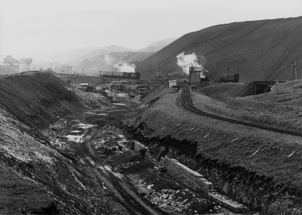
Looking from the huge black tip on to the road going under the now completed concrete bridge and a goods train on the zig-zag line. |
|||||
|
|
|||||
|
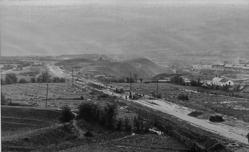
Picture taken from Boultons farm with Trebeddau farm to the right and Kier Hardie Estate in background. |
|||||
|
|
|||||
|
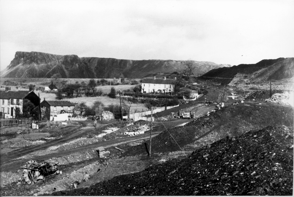
Mountain Hare, showing Mansfield Tce and the great WHITEY to the left, and Pwllyrhwyaid (Ducks pool) in the centre. This was considered to be the midpoint of the sliproad which is approx 5 miles in total length. |
|||||
|
|
|||||
|
This is the sweeping bend at the lower end of the sliproad directly above Bakers garage. Just over the edge of the road were cottages called Penyard Row. Again, the process of Pitching being carried out. |
|||||
|
|
|||||
|
The lower end of the sliproad. The factory on the right hand side of the picture was Kayser Bondor which employed several hundred women making ladies underwear. Hoover took the factory over when Kayser Bondor moved to Dowlais.This is now occupied by the retail park. |
|||||
|
|
|||||
|
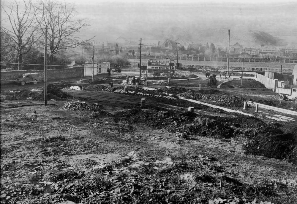
The very end of the sliproad. Pentrebach roundabout is being constructed. To the left ,behind the wall is Pentrebach House once the residence of Mr Anthony Hill, Ironmaster now a restaurant. |
|||||
|
|
|||||
|
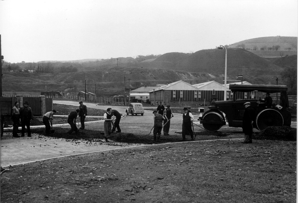
Tarmac being laid around the roundabout at Pentrebach. In the background is the Remploy factory which was taken over by Design & Manufacture when Remploy moved to the Cyfarthfa Estate. |
|||||
|
|
|||||
|
|
|||||
|
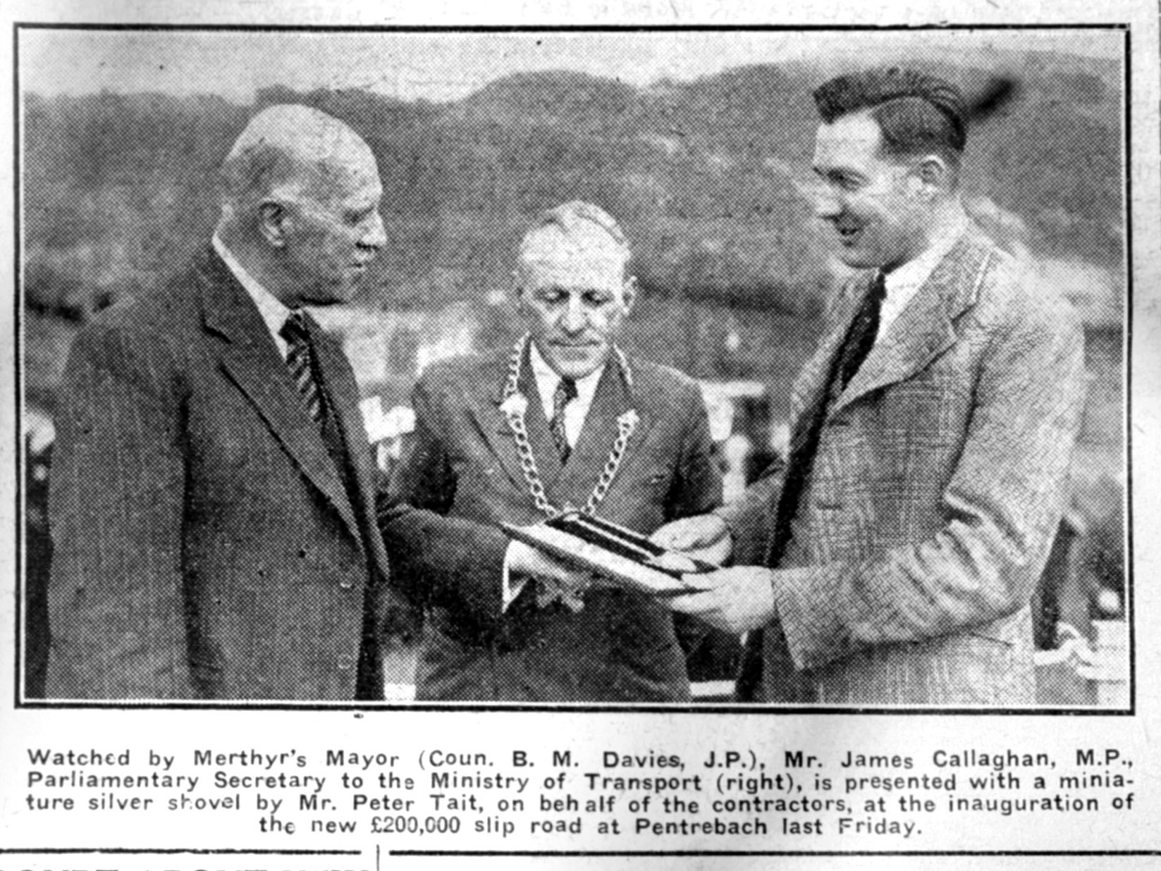
Inauguration of the New Slip Road - 25th June 1949 Mayor B.M. Davies J.P. meets James Callaghan M.P. (Later Prime Minister) (From the Merthyr Express) |
|||||
|
|
|||||
|
|||||
|
To the Map |
|||||
|
|
|||||